
Island & Nature on La Palma: Volcanoes, Laurel Forests and One of the Clearest Night Skies in the World
Ancient. Alive. Improbable. You step under the dense canopy of the laurel forest, and light fractures into a thousand shades of green on wet moss. Here, in the La Palma Biosphere Reserve, the earth breathes the spirit of the Tertiary: a Laurisilva laurel forest that survived the ice ages as a biological relic — nourished by the constant moisture of the north-east trade wind. And just a few kilometres to the west, a volcano spewed lava into the sea for three months in 2021.
Endemic Treasures and an Island in Motion
More than 1,000 plant species shape the island, including endemics such as the Tajinaste rojo — whose glowing red flower spikes transform the Roque de los Muchachos from May to June into a natural spectacle found only on La Palma. The Caldera de Taburiente National Park has been protected since 1954; the Tajogaite is Europe’s youngest volcano. Short-finned pilot whales live off the west coast all year round. And above it all towers the Roque de los Muchachos with its Starlight certificate: one of the clearest night skies in the world. La Palma is an island in motion — geologically, biologically, atmospherically.
Las Tricias: The Village of Dragon Trees on La Palma
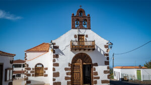
There are places on La Palma you see, and places you experience. Las Tricias belongs to the second category. This hamlet in the municipality of Garafía — a handful of houses, a restaurant, a few paths — offers one of the most powerful images on the entire island: hundreds of dragon trees (Dracaena draco), their umbrella-shaped crowns hanging over the Atlantic. The oldest are several hundred years old. You walk among them on the trail to the Cuevas de Buracas — and if you know the route, you understand why those who have seen this place rarely forget it.
Las Manchas: Life on the Edge of the Volcano
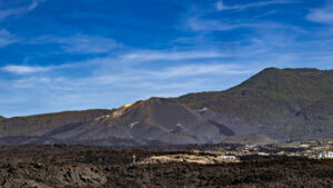
The name Las Manchas means “stains” or “patches” in Spanish — and rarely has a place name taken on such a literal meaning. Since the Tajogaite eruption on 19 September 2021, Las Manchas, a district of El Paso on the western side of La Palma, has been criss-crossed with black lava patches that have changed the village forever. Houses disappeared under metres of lava, fields were buried, roads dissolved. What remained is a place that lives in a uniquely intimate way with the volcanism La Palma has carried for millions of years.
Calima, Trade Wind Clouds and Snow: La Palma’s Weather Phenomena

The weather on La Palma follows no single script. The island is a weather laboratory: Atlantic trade winds meet volcanic peaks, African Saharan dust meets the humid Atlantic, and above the clouds shines a sun that, just a few kilometres further on, is hidden by fog. For travellers, this means: understand the weather, and you experience La Palma differently.
San Andrés: Picturesque Village Square and Historic Fishing Harbour
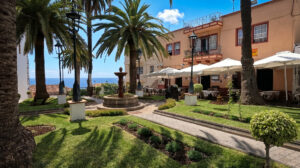
San Andrés is the older and smaller of the two settlements in the municipality of San Andrés y Sauces. Around the historic plaza with the Iglesia de San Andrés Apóstol, the stone fountain, and the beautifully preserved Canarian houses with their wooden balconies, you’ll find one of La Palma’s most beautiful village centres. Behind the historic facades, lush banana plantations already begin — they almost completely surround the village and give it its unmistakable character.
Los Cancajos: Beach, Snorkeling, and Evening Light on the East Coast
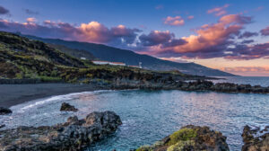
Los Cancajos is La Palma’s most developed beach resort on the east coast — and for many visitors, the first beach they encounter on the island. Just minutes from the airport, a fine black volcanic sand beach, crystal-clear water, and a well-kept promenade with restaurants and cafés await. Just offshore, a lava reef makes Los Cancajos one of La Palma’s most popular snorkelling and diving spots.
Franceses & Gallegos: La Palma’s Forgotten North Coast
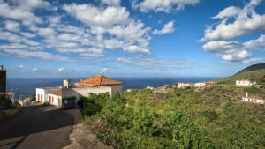
There are places on La Palma that lie far from the well-known tourist destinations. Franceses and Gallegos are among them. The two small hamlets on the wild north coast of the municipality of Garafía are connected by the historic Camino Real, now part of the GR-130 long-distance hiking trail. Long before roads reached these remote settlements, this royal road ran through the deep ravines of the north. Those who come here seek the original side of La Palma — either on foot or in a compact rental car.
El Tablado: The Village at the End of the Road
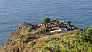
You turn off the road between Puntagorda and Barlovento and wind your way downhill, deeper and deeper into the northwest, until the road ends and a village begins that looks as though time forgot all about it. El Tablado perches on a narrow ridge in the municipality of Garafía — spectacularly set between two of La Palma’s most formidable ravines.
Tajuya: Closest to the Tajogaite Volcano
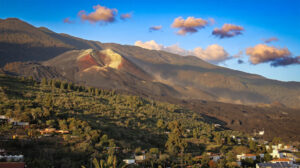
Tajuya is a peaceful neighborhood of El Paso that was barely known to anyone outside La Palma before September 19, 2021. That changed overnight with the eruption of the Tajogaite volcano on the western flank of the Cumbre Vieja — just a few kilometres from the village.
Argual and Tazacorte: The Colonial Heritage of the Aridane Valley
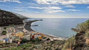
The Aridane Valley is considered the green and economic heart of La Palma. Yet the history of this prosperity does not begin in the modern centre of Los Llanos de Aridane, but in the small neighbourhood of Argual and the neighbouring town of Tazacorte.
The Churches of Santa Cruz: Mudéjar, Flemish Masters, and Canarian Art
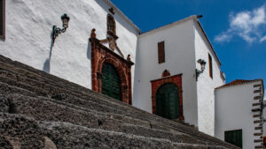
In the 16th century, Santa Cruz de La Palma was one of the wealthiest port cities in the Spanish Empire. Merchants and citizens invested the riches from Atlantic trade in church buildings that remain among the most significant religious structures in the Canary Islands.
The Castles of Santa Cruz: Witnesses of the Pirate Age
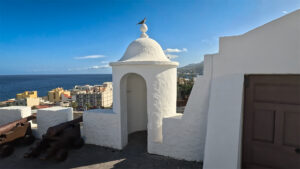
That a small Atlantic island needed multiple fortifications is explained by its eventful past: in the 16th century, Santa Cruz de La Palma was one of the most important ports in Atlantic trade. Goods passed through the harbour between Europe and the New World — and with wealth came the greed of foreign seafarers.
Calle O’Daly: The Shopping Street with an Irish Name
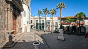
Anyone strolling through the historic old town of Santa Cruz de La Palma will come across a street name that sounds unusual for a Canary Island: Calle O’Daly. In everyday life, many Palmeros still refer to it as Calle Real – the traditional royal road and main shopping street of the capital.
Balcones Típicos: La Palma’s Most Famous Wooden Balconies
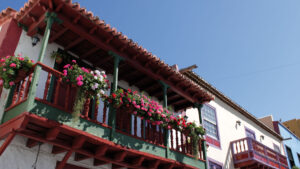
There is one image that represents La Palma on almost every travel brochure: artfully carved wooden balconies spanning multiple floors, colourful façades, and behind them the deep blue Atlantic. This iconic motif was born on the Avenida Marítima of Santa Cruz de La Palma — and is today one of the most recognisable views in the Canary Islands.
Plaza de España Santa Cruz: The Renaissance Heart of the Capital
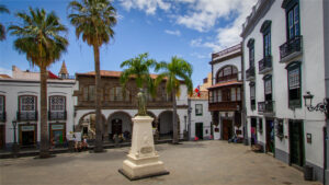
Some plazas you enter once and immediately understand: this was the historical and political heart of an entire region. Plaza de España in Santa Cruz de La Palma is exactly that kind of place. The square impresses not with its size but with its extraordinary concentration of historic buildings. It is considered one of the most beautiful and harmonious Renaissance ensembles in the Canary Islands.
Puntallana: The Quiet Municipality Between Laurel Forest and Coast
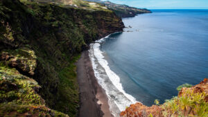
Puntallana is one of La Palma’s most underrated municipalities. Although it sits just north of Santa Cruz de La Palma and is easily reached via the LP-1, it remains largely untouched by major tourist traffic. This community of around 2,500 residents packs some of the island’s finest contrasts into a small area: a spectacular cliff coast with black volcanic sand, historic architecture in the village centre, and the mystical world of the Canarian laurel forest.
San Andrés y Sauces: Northeast, Laurel Forest, and the Blue Pool
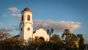
San Andrés y Sauces is one of La Palma’s greenest municipalities. The two villages of San Andrés and Los Sauces lie in the humid northeast of the island and together form the cultural and scenic heart of the region. Lush banana plantations, centuries-old laurel forests, and a spectacular cliff coast define the landscape. With around 4,000 residents, the municipality has preserved its authentic character and is an ideal base for exploring La Palma’s evergreen north.
Barlovento: Green, Peaceful, and Still Undiscovered
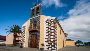
Barlovento is situated in the remote northeast of La Palma — and that is precisely what gives the municipality its special charm. Here the damp trade wind clouds build up against the mountain slopes, laurel forests cover wide stretches of the landscape and the rugged coastline reveals the wild side of the island. The name Barlovento means “windward” or “wind side” and aptly describes the climatic conditions. With around 2,000 inhabitants, the municipality is one of the quietest regions of La Palma and an ideal base for nature lovers, hikers and independent travellers.
Breña Alta: The Green Neighbour of Santa Cruz
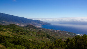
Breña Alta is one of La Palma’s municipalities that many visitors initially overlook — yet it combines nature, tradition, and a superb location in a particularly compelling way. The municipality extends from the green slopes above Santa Cruz de La Palma up into the pine forests of the Cumbre. Although Breña Alta has no coastline of its own, its roughly 7,000 residents make it one of the island’s lively and authentic regions.
Fuencaliente: At the Southern Tip, Where Wine and Salt Are Made
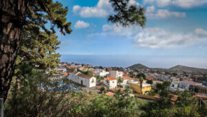
Anyone who travels La Palma from north to south ends up in Fuencaliente — literally. The island’s southern tip is one of the geologically youngest landscapes in the archipelago. Here the Teneguía volcano created new land during its 1971 eruption: glowing lava flowed into the Atlantic and expanded the island by several hectares. On this young volcanic soil, some of the Canary Islands’ finest wines now thrive, while high-quality sea salt is harvested along the coast at the Salinas de Fuencaliente.
Villa de Mazo: Where Flower Carpets Tell History
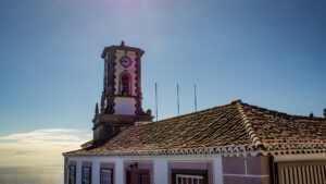
Once a year, at Corpus Christi, the residents of Villa de Mazo transform their streets into a fleeting work of art unlike any other. Colourful flower petals, volcanic sand, salt crystals, lapilli, and other natural materials are crafted over days of painstaking effort into intricate carpets and stunning motifs. What appears to visitors as a unique spectacle is for the Mazeros a living tradition and an expression of community spirit. For generations, the flower carpets have been created in friendly competition between the different districts — turning Villa de Mazo into a living open-air art school every year.
Tijarafe: Village Above the Pirate Cove
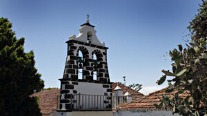
Due to its climatically favoured hillside location and countless hours of sunshine, Tijarafe is considered the premier destination for independent travellers on La Palma. Go-lapalma.com offers its largest island-wide portfolio here: from modern designer villas with heated infinity pools to solar-powered fincas in complete seclusion and traditionally restored country houses, discerning travellers can find the perfect accommodation far from the standard hotel scene.
Puntagorda: The Village That Turns Pink in Winter
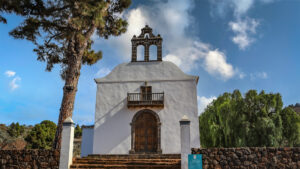
The Mercadillo de Puntagorda takes place on Saturdays (3:00 pm to 7:00 pm) and Sundays (11:00 am to 3:00 pm) in a modern market hall right at the forest edge. It is considered by locals and visitors alike to be the best farmers’ market on La Palma. Local producers offer freshly harvested fruit and vegetables, honey, handicrafts, and island wines.
Garafía: Where La Palma Has Not Yet Been Discovered
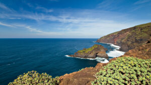
Well into the second half of the 20th century, Garafía was reachable only via difficult roads. The winding routes through the north of the island kept the municipality a secluded corner of La Palma for a long time. This geographic isolation was a challenge for its residents — but a stroke of luck for the landscape and culture.
Puerto Naos: Where the Sun Lingers Longest on La Palma
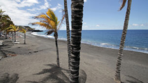
As of May 2026, Puerto Naos is largely accessible. The CO₂ traffic-light system is permanently in operation: Green = free access · Yellow = increased caution · Red = closed. Always observe on-site signage. Status: May 2026 (subject to change).
El Paso: The Gateway Between Two Worlds
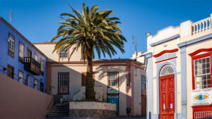
Access restrictions remain in place for certain areas of the lava field due to possible gas emissions. Up-to-date information can be obtained at the visitor centre or from the municipality of El Paso.
Tazacorte: Where the Bananas Taste Best
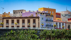
Among traditionally decorated colourful houses, winding alleys, and quiet squares, Tazacorte still retains much of its historic charm and social fabric. Alongside the magnificent, freshly whitewashed manor houses of the former sugar and later banana estate owners — draped in violet bougainvillea climbing up the walls — more modest workers’ houses stand close together, an architectural mirror of the town’s history. Those seeking authentic western La Palma — without the bustle of Los Llanos or the tourist remnants of Puerto Naos — come here.
Los Llanos de Aridane: The Largest City Almost Nobody Knows
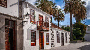
Los Llanos de Aridane is La Palma’s underestimated centre — vibrant, delicious, and ideally located. Anyone spending a week on the island should make this their base. Not because it is the most spectacular place, but because from here everything spectacular is within reach.
Santa Cruz de La Palma: The Capital That Never Lost Its Splendor
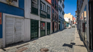
Founded on May 3, 1493 by Alonso Fernández de Lugo, Santa Cruz de La Palma quickly grew into one of the most important Atlantic trading ports of the 16th century. The layout of the old town still reflects that era: Calle O’Daly recalls the Irish merchants who settled here, Calle Van Dalle the Dutch traders who followed. The city was rich, cosmopolitan, and self-confident — and much of that character has survived to the present day.
La Palma: 14 Municipalities, 82,000 Residents, One Island
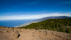
The 14 municipalities are: Barlovento, Breña Alta, Breña Baja, Fuencaliente, Garafía, Los Llanos de Aridane, El Paso, Puntagorda, Puntallana, San Andrés y Sauces, Santa Cruz de La Palma, Tazacorte, Tijarafe, and Villa de Mazo.
The Indianos: La Palma’s Wealthy Returnees
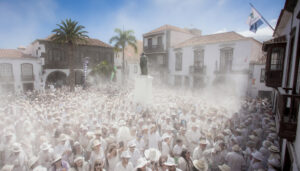
The most famous commemoration of the Indianos is the Día de los Indianos on Carnival Monday in Santa Cruz de La Palma. On that day, the capital transforms into a sea of white. Participants dress in historic white suits, wear straw hats, and evoke the returning emigrants with cigars, music, and a Caribbean atmosphere.
The Conquest of La Palma 1493: The End of Benahoare
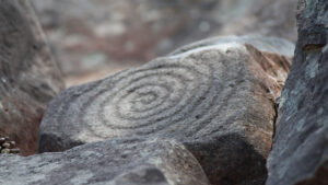
The conquest of La Palma in 1492/93 was not merely a military campaign — it was the collision of two entirely different worlds. With Tanausú’s defeat, the era of Benahoare came to an end — yet the memory of the native people lives on in the landscapes, place names, and traditions of the island to this day.
The Benahoaritas: La Palma’s First Society
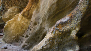
Benahoare — that was the name the indigenous people of La Palma gave their homeland. The name is usually translated as “My Home” or “My Homeland.” Long before European seafarers crossed the Atlantic, a distinct culture with its own traditions, beliefs, and ways of life already existed on the island.
History of La Palma: From the Benahoaritas to Tajogaite
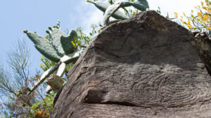
The best-known ruler of the Benahoaritas was Tanausú, leader of the kingdom of Aceró in what is now the Caldera de Taburiente. After his capture, he is said to have refused all food during the crossing to Spain and died at sea. He remains to this day a symbol of the resistance of the indigenous people.
Astronomy on La Palma: Under the Best Skies in the World
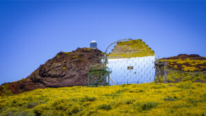
There are very few places on Earth where the night sky appears so clear and unspoiled. The Roque de los Muchachos on La Palma — at 2,426 metres the highest point on the island — sits mostly above the inversion layer of the trade wind clouds and, thanks to its exceptionally stable atmosphere, offers ideal conditions for astronomy.
Las Nieves: Laurel Forests and the Island’s Sanctuary
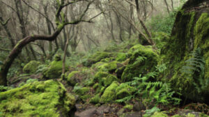
The name Las Nieves (“the snow”) greets visitors to La Palma in two very different contexts: on the one hand it refers to the island’s most important sanctuary above Santa Cruz de La Palma, and on the other to the expansive Parque Natural de Las Nieves in the lush northeast of the island. Both bear the name of La Palma’s patron saint — the Virgen de las Nieves.
Cumbre Vieja Nature Reserve: La Palma’s Living Volcanic Ridge
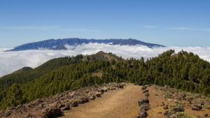
The Cumbre Vieja is not a traditional nature reserve, preserving an unchanged landscape. Rather, it is an active volcanic system. The eruption of the Tajogaite in 2021 permanently altered parts of the protected area. Since then, you can observe how lichens, mosses, and first pioneer plants are slowly reclaiming the cooled lava fields. The nature reserve impressively shows how new life develops step by step after a volcanic eruption.
La Palma Biosphere Reserve: The Entire Island Under UNESCO Protection
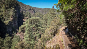
In 1983, the 511-hectare area of El Canal y Los Tilos near San Andrés y Sauces was designated the first Biosphere Reserve in the Canary Islands. The lush laurel forest with its Marcos y Cordero springs, the Barranco del Agua, and a unique fauna and flora provided the impetus. In 2002, the designation was extended to the entire island — a step that brought La Palma international recognition and shaped the island’s nature tourism.
Whales and Dolphins off La Palma: Atlantic Wildlife Right at the Shore
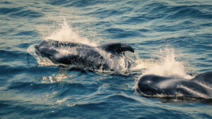
The Canary Islands are among the best whale-watching regions in Europe. La Palma holds a special position: off the steeply dropping west coast, the Atlantic already reaches depths of more than 1,000 metres just a few kilometres from shore. This extraordinary underwater landscape provides ideal living conditions for numerous whale and dolphin species. Short-finned pilot whales (Globicephala macrorhynchus) are year-round residents of the waters around the island. Also regularly spotted are bottlenose dolphins (Tursiops truncatus) and common dolphins (Delphinus delphis). Seasonally, larger whale species such as fin whales and, with luck, blue whales also pass by La Palma.
La Palma’s Lizards: Fast, Shy, and Everywhere
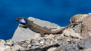
You’re standing on a lava ridge, a warm wind against your face — and suddenly something darts across the rock. Lightning fast. Soundless. Perfectly camouflaged. Welcome to the wild side of La Palma. The island has a reputation for being relatively quiet in terms of terrestrial wildlife. But look closely, and you’ll find real nature — and no creature is more commonly encountered than the lizard.
Birdwatching on La Palma: Endemic Species in the Laurel Forest
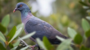
While La Palma might not be a classic birding hotspot like Fuerteventura or Tenerife, nature lovers will find something far more special here: rare bird species and endemic subspecies closely tied to the ancient laurel forests of the Canary Islands. A walk through Los Tilos or the Cubo de la Galga in the early morning hours quickly becomes an unforgettable experience for birdwatchers and nature photographers.
The Wildlife of La Palma: Small, Endemic, and Overlooked
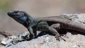
La Palma is no safari destination. Those looking for lions or elephants won’t find them here. But those who look carefully — on rocks, in bushes, in the laurel forest, beneath the water’s surface — discover a fauna that overwhelms with its uniqueness: endemic lizards with blue throats. Pigeons whose ancestors have survived for millions of years in the laurel forests of the Canary Islands. Geckos that move silently up walls. And off the coast, whales and dolphins that have the fortune to live in some of the cleanest waters in Europe.
Avocados on La Palma: The Green Gold of the West Coast
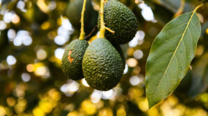
In recent years, a new shade of green has spread across the hillsides of La Palma’s west coast: avocado trees. As demand for European avocados grows, La Palma — with its mild Atlantic climate, fertile volcanic soil, and well-developed irrigation infrastructure — has established itself as one of the most promising growing locations north of Africa.
Wine Growing on La Palma: Malvasía, Volcanic Ash, and a Comeback
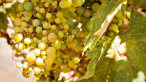
Back in the 16th and 17th centuries, the royal courts of England drank Malmsey — the famous Malvasía wine from La Palma. Even William Shakespeare mentions “Malmsey” — the English name for the famous Malvasía wine — in several of his works. This was no coincidence: Santa Cruz de La Palma was then one of the most important trading ports of the Atlantic, and the wine from the island’s volcanic landscapes was considered a prized luxury. Later, European tastes changed and viticulture fell into a long crisis. Only with the introduction of the protected designation of origin D.O. La Palma in 1994 did an impressive comeback begin, making the island once again one of the most exciting wine regions in the Canary Islands.
Banana Farming on La Palma: The Sweet Backbone of the West Coast
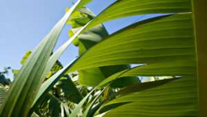
Travelling west on La Palma, you see them everywhere: broad green leaves lined up in dense plantations, wrapped in bright blue protective sheaths from which golden-yellow fruit clusters emerge. The banana — called Plátano in the Canary Islands — is La Palma’s most important export product and the defining landscape element of the west coast. Without it, the Aridane Valley would be economically poorer and the west coast’s scenery entirely different.
La Palma’s Plant World: A Quarter of All Canary Island Endemics Found Here
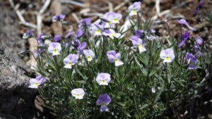
La Palma is not called La Isla Verde — the Green Island — without reason. Around 2,000 plant species grow on this small volcanic island. Among them are numerous Canary Island endemics, of which around 40 species are found exclusively on La Palma. The island owes this botanical uniqueness to its geographical location, its dramatic vertical relief, and the confluence of moist trade wind clouds and a dry westerly climate.
La Palma’s Spurge Plants: Survival as an Art Form
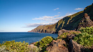
First-time visitors travelling along La Palma’s coast often notice peculiar plants by the roadside: upright, multi-branched plants with green rods that have no leaves and resemble giant candelabras in shape. These are spurge plants — euphorbias — and they are among the great adaptation masters of the dry, salty coastal climate of the Canary Islands. While they are easily mistaken for cacti, they are botanically distinct: cacti come from the Americas; euphorbias are of African origin. But under similar selective pressure, they have developed similar forms — an instructive example of convergent evolution.
Tajinaste on La Palma: The Flowering Spectacle That Surpasses Tenerife
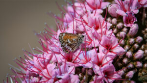
When people hear the word Tajinaste, they think of Tenerife — of the brilliant red flower spikes that define the high mountain landscape of Mount Teide in spring. But La Palma, the Isla Bonita, surpasses its larger neighbour in one decisive way: the island is home to several endemic Tajinaste species found nowhere else on Earth. This makes La Palma a globally unique hotspot for this fascinating plant genus of the borage family (Boraginaceae).
The Dragon Tree: La Palma’s Oldest Living Natural Heritage
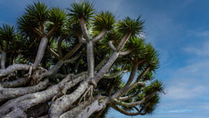
Some call it the dragon tree because its resin runs red as blood. Some say it’s because when you cut off a branch — like a dragon — new shoots always grow back. The truth is: nobody really knows. But the name Dracaena draco has accompanied this tree for centuries. The dragon tree can live longer than many human-built structures and political empires of Europe, and on La Palma it stands as one of the most impressive symbols of the island’s extraordinary natural history.
The Canarian Pine: Fire, Clouds, and the Water of La Palma
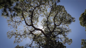
No tree shapes La Palma’s landscape more than the Canarian pine — Pinus canariensis. It covers large parts of the island’s mountain regions, grows at elevations above 2,000 metres, and has developed extraordinary traits through evolution: it survives fire, filters moisture from the trade wind clouds, and helps return atmospheric water to the soil. Without it, La Palma would be a different, drier island.
The Laurel Forest: La Palma’s Living Natural Heritage from the Tertiary
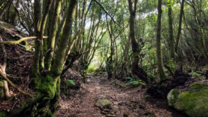
About 20 million years ago, a primeval laurel forest of bay trees and related species covered large parts of the northern hemisphere: North Africa, southern Europe, and the Canary Islands. When the climate turned colder and drier during the ice ages, this forest disappeared from the European and North African mainland. In the Canary Islands it survived — sheltered by mild Atlantic temperatures and watered by the humid trade wind clouds.
La Palma’s Flora: Why the Island Is Truly Green
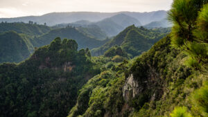
La Palma isn’t called La Isla Verde—the Green Island—by coincidence. No other place in the Canary Islands archipelago has such a diverse plant world in such a small area. The island owes this botanical uniqueness to its exceptional combination of extreme steepness, a humid trade wind climate in the east, and a dry sunny coast in the west. Within just a few kilometres, habitats arise that on the mainland are often thousands of kilometres apart.
The Calima: When the Sahara Visits La Palma
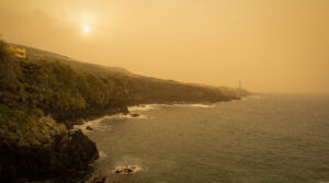
You feel it before you see it. The air grows drier, the light shifts — a muted orange-brown instead of the usual Atlantic blue. Then the horizon hangs in a milky haze, the sun looks as if seen through parchment, and a fine reddish dust coats every surface. Welcome to the Calima — the weather phenomenon that reaches La Palma several times a year, plunging the island into a completely different atmosphere for a few days.
The Trade Wind Clouds: How the Wind Divides La Palma into Two Worlds
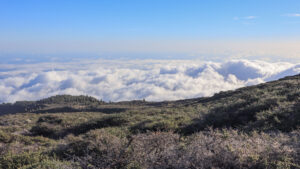
The northeast trade wind is La Palma’s invisible director. It comes from the Atlantic, carries moisture, and meets the island’s central mountain range. What happens next shapes the face of the island: the clouds pile up against the eastern slopes, release their moisture, nourish the laurel forests, and leave the western side dry. Two climate worlds on an island of 708 square kilometres — the trade wind is their creator.
Climate Zones of La Palma: From Beach to Summit in 30 Kilometers
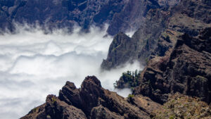
One of La Palma’s most fascinating characteristics is that you can travel through five completely different climate zones within just 30 kilometres horizontally. From the black lava beach at sea level to the Roque de los Muchachos at 2,426 metres, you find annual temperatures, vegetation, and ecosystems that on other islands would be separated by thousands of kilometres.
Climate on La Palma: The Divided Island and the Eternal Spring
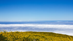
One might think La Palma has one climate — but it has two. The central mountain range divides the island into a humid eastern side and a dry western side. In the east, the north-east trade winds bank up against the mountains, releasing their moisture as mist and light rain, nurturing lush laurel forests and evergreen vegetation. In the west, very little rain falls — the clouds have already emptied over the mountains — and instead, the sun shines almost constantly. This is not a natural curiosity but a fundamental characteristic of the island that shapes every travel plan.
The Barrancos of La Palma: Where the Island Reveals Its Depths
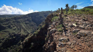
La Palma is an island of superlatives — the steepest volcanic island in the world, the deepest erosion caldera, the highest point in the Canaries relative to its land area. But its most striking geological feature may be its most understated: the barrancos. These deep, narrow ravines that cut through the island’s volcanic layers like deep gashes in the terrain define La Palma’s landscape like nothing else. Seen from above, the island looks like a hand with spread fingers — each finger a barranco running from the ridge down to the sea.
The Coastal Landscape of La Palma: Black, Steep, and Unforgettable
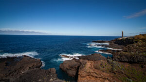
La Palma is the steepest volcanic island in the world — and nowhere is that more apparent than at the coast. Where other islands slope gently into the sea, La Palma’s cliffs plunge almost vertically into the Atlantic. Black lava rock, shaped by millions of years of surf, forms a coastline that could hardly be more rugged or dramatic. No soft sand invites you to linger, no shallow water to wade through. The coast here is a spectacle — not a beach resort.
Roque de los Muchachos: The Roof of the Island and the Silence Above the Clouds
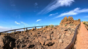
Standing on Roque de los Muchachos for the first time — at 2,426 metres, above the clouds, with the Atlantic stretching to the horizon in every direction — words fail you. That is no cliché. La Palma’s highest summit is one of those places that cannot be described, because any description falls far short of the reality. To the left, the Caldera de Taburiente drops nearly 2,000 metres almost vertically. To the right, the white observatory domes. Below, a layer of cloud like a cotton blanket, from which another peak occasionally emerges.
Cumbre Nueva: The Ridge Connecting Two Worlds
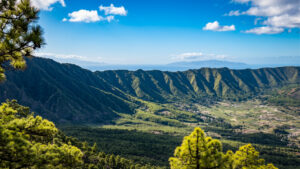
The Cumbre Nueva often stands in the shadow of the better-known Caldera de Taburiente and the volcanically active Cumbre Vieja — yet geologically it ranks among La Palma’s key regions. This densely forested mountain ridge connects the massive rim zone of the Caldera de Taburiente in the north with the Cumbre Vieja in the south, forming the central transition between these two very different landscapes.
The Cumbre Vieja: La Palma’s Youngest and Most Active Volcanic Ridge
The Cumbre Vieja — literally the “old ridge” — is actually the youngest part of La Palma. While the northern part of the island, with the Caldera de Taburiente, is several million years old, many of the Cumbre Vieja’s volcanic cones formed only in the past few centuries. Along the elongated mountain ridge lie numerous cinder cones, eight of which have erupted in historic times — most recently Tajogaite in 2021. This makes the Cumbre Vieja La Palma’s most active volcanic region and one of the most active volcanic landscapes in the Canary Islands, its high plateau offering views all the way to the summit ridge of the Caldera de Taburiente.
Caldera de Taburiente: Not a Volcanic Crater, but an Erosion Wonder
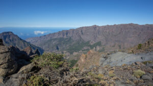
Standing at the edge of the Caldera de Taburiente for the first time — best at La Cumbrecita, where the forest opens to suddenly reveal the entire basin — you face a landscape mystery. A massive, bowl-shaped amphitheater about eight kilometers in diameter. Cliff walls dropping almost 2,000 metres to the valley floor in places. Pine forests on the slopes, a silver-shimmering stream in the valley, waterfalls in the gorges. All around rises the caldera’s massive rim, broken only by the Barranco de las Angustias — the sole natural drainage outlet.
The Tajogaite: 85 Days That Changed La Palma
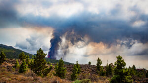
September 19, 2021, 3:12 pm. On the western flank of the Cumbre Vieja, above the Aridane plain, the earth opened. An eruption fissure tore the ground apart; lava flowed sluggishly at first, then with increasing force. Within hours, the lava flows began moving down the slopes toward Los Llanos and El Paso. The evacuations began.
Volcanism on La Palma: The Island That Never Stops Growing
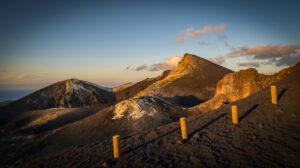
This activity poses very little risk to visitors — eruptions are predictable and have been monitored for decades by a dense sensor network. But it is part of the island’s identity: La Palma is still growing. Still changing. And those who visit it are visiting a place that, in geological time, is still very young.
Geology of La Palma: The Steepest Volcanic Island in the World
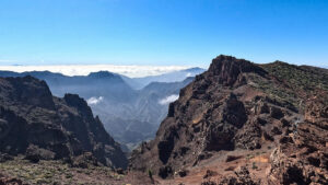
La Palma is, at around 2 million years old, the second youngest of the Canary Islands — after El Hierro. But in one superlative it stands unmatched: La Palma is the steepest volcanic island in the world. With a total height of over 6,000 metres from the ocean floor to the summit ridge, and a base area of just 708 square kilometers, its steepness is virtually unmatched anywhere on Earth. In places, La Palma rises more than 2,400 metres in less than 10 kilometers as the crow flies — from the Atlantic to Roque de los Muchachos. This striking topography makes the island one of the most dramatic volcanic landscapes on Earth.
Geography of La Palma: One Island, Two Climate Worlds, One Summit
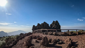
The highest point is Roque de los Muchachos (2,426 m), which rises only around 8 kilometers as the crow flies from the ocean. This extreme steepness makes La Palma one of the steepest volcanic islands in the world. The island rises over 6,000 metres in total from the ocean floor to its summit. Hardly any other volcanic island achieves such great elevation differences over such a short distance. This extraordinary relief shapes landscape, climate, and vegetation in equal measure.
La Palma Nature: The Green Island of the Atlantic
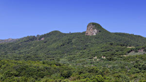
La Palma has not a single wide sandy beach, no shallow lagoons, and no Teide. What La Palma has is something different: the Caldera de Taburiente National Park — one of the largest erosion calderas in the world. Ancient Laurisilva laurel forests. A volcano that erupted as recently as 2021. And a night sky so clear it holds Starlight Reserve certification. Nature here is not a backdrop. It is the main attraction.
La Bombilla: The Village That Survived the Lava
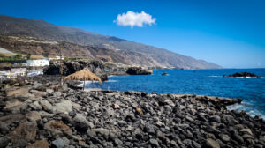
Even years after the eruption ended, La Bombilla remains subject to severe access restrictions due to ongoing CO₂ emissions. Access is regulated by authorities and — depending on current hazard levels — is only possible under special safety conditions.
Caldera de Taburiente National Park: Hiking Through La Palma’s Green Heart
The Caldera de Taburiente National Park has been La Palma’s green heart since 1954 — and one of the few protected areas in Europe where visitors can still experience true wilderness: no paved paths, no fences, no infrastructure beyond a few basic trail markers and the official campsite Playa de Taburiente.