
Excursions on La Palma: Volcanoes, Sea Caves and the Clearest Night Sky in Europe
Deep. Dark. Unexpected. You stand at the entrance of Cueva Bonita, the bioluminescence reflected in the lava walls, and realise: La Palma’s excursion destinations are not obligatory rainy-day programmes. They are the true heart of the island — places you don’t anticipate until you’re standing right in front of them.
More Sights per Square Kilometre than Any Other Canary Island
The Tajogaite lava field is the most dramatic new excursion destination in the Canaries – created by the historic volcanic eruption of 2021, which can now be experienced up close on officially guided tours. The Caldera de Taburiente has been a national park since 1954: an erosion crater up to 1,800 metres deep, where hidden waterfalls plunge down steep lava walls. The Observatorio del Roque de los Muchachos at 2,396 metres altitude houses some of the largest telescopes on Earth. The Cueva Bonita on the north-west coast can only be reached by boat and, in calm seas, glows in a blue-green you will never forget. And the Salinas de Fuencaliente produce pink sea salt right at the foot of two extinct volcanoes. La Palma is a destination that effortlessly provides material for several visits.
Surfing & Water Sports on La Palma
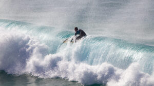
La Palma is known among surfers as the Hawaii of the Atlantic – which sounds enticing, but also serves as a warning. The waves here are powerful, the spots are exposed, and the infrastructure is sparse. Waves break over lava reefs, surf conditions are forceful and unpredictable, and getting in and out over steep coastlines requires experience. For advanced riders, La Palma is an exceptional destination. For beginners, there are better places.
La Cumbrecita – Where the View Plunges into the Depths
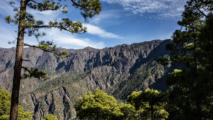
Sometimes all it takes is one bend in the road. You drive up the narrow forest track, the pine forest grows denser, the air cooler, the light thinner — and then, as you round the final bend before the car park, the landscape opens up dramatically. The Caldera de Taburiente suddenly lies at your feet: endlessly deep, green and grey, wrapped in a silence you didn’t expect. This is La Cumbrecita.
Wine Tasting on La Palma – Volcanic Soil in the Glass

Wine grown on volcanic ash. That sounds like a marketing promise – but on La Palma it’s simply reality. The island produces some of the most distinctive wines in the Canary Islands: mineral, full of character, and shaped by a terroir found nowhere else in the world.
Caldera de Taburiente – Where La Palma Reveals Its Ancient Core
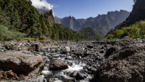
There are places on La Palma that make you feel as though you’re seeing the island in its purest form — raw, ancient, and wrapped in a silence that feels like reverence. The Caldera de Taburiente, at the very heart of the island, is one such place. Anyone who has stood on its crater rim and looked down into the more than 1,700-metre-deep basin carries those images for a long time.
Diving on La Palma – A Volcanic World Beneath the Waves
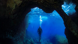
Everything La Palma offers above the water – volcanic shapes, lava formations, dramatic cliffs – it offers below the surface too. Dive here and you’re diving through a volcanic underwater world: lava tubes, basalt arches, vertical walls dropping away to a thousand metres – and, since 2021, fresh newly formed lava reefs from the Tajogaite eruption, currently being colonised by marine life.
Driving Around La Palma – Three Routes, Three Worlds
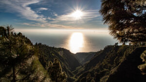
La Palma is 47 kilometres long and 29 kilometres wide – but anyone who wants to explore the island fully by car will quickly find a whole day can easily disappear. Not because of the distances, but because of the roads: hairpin bends, narrow passes and countless stopping points that throw any schedule out the window. This is what makes La Palma the ideal island for drivers – provided you are prepared to drive slowly and stop often.
Camping on La Palma – Pitching a Tent Between Volcano and Laurel Forest
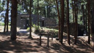
Wild camping is strictly prohibited on La Palma – the island is almost entirely protected as a nature reserve. Anyone wanting to camp needs an official campsite or a permit. That sounds like bureaucracy – and it is, but it’s manageable. And the reward is considerable: campsites on La Palma have locations that are hard to beat.
Stargazing on La Palma – Europe’s Darkest Nights

Step outside on a clear La Palma night and look up, and you’ll see the Milky Way in all its glory. Not the faint smudge you might catch in the countryside back home, but a brilliant, shimmering band of thousands of stars visible to the naked eye. That’s no accident: since 2002, La Palma has held the world’s first official Starlight Reserve status, awarded jointly by UNESCO and the Instituto de Astrofísica de Canarias – a title built on a law that protects the night sky the way other laws protect water or forests.
Ron Aldea – La Palma’s Only Sugarcane Rum

In Puerto Espíndola, a small fishing harbour on the northeastern coast of La Palma, the Aldea family has been distilling rum since 1936. Not from molasses – from freshly pressed sugarcane juice, harvested right here on the island.
Fishing on La Palma 2026 – From Shore to Deep Sea

La Palma has a lot to offer anglers: a deep coastline that drops to 1,000 metres within just 3 kilometres of the shore, rich Atlantic waters and a tradition of fishing that goes back centuries.
Paragliding on La Palma – Hawaii of the Skies
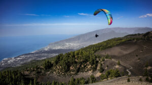
Among paraglider pilots, La Palma has been legendary for decades. They call it the Hawaii of the skies – for good reason: stable trade winds, thermal updrafts from volcanic terrain and landing strips right on the beach.
Mountain Biking on La Palma – Extreme Altitude, Extreme Descents
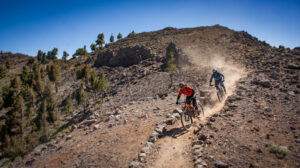
Anyone exploring La Palma by mountain bike should accept one fact before setting out: there are no flat routes on this island. From sea level to 2,426 metres – the entire island is one continuous climb, and if you want to go up, you either pedal or you push. At the top, you’re rewarded with descents that few other terrains in Europe can match.
Whale Watching on La Palma – A Third of All Whale Species at the Door
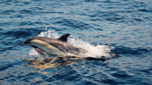
The waters around La Palma are among the most species-rich marine mammal habitats in the eastern Atlantic. Roughly a third of all known whale and dolphin species worldwide have already been recorded in Canarian waters – a richness that comes down to the combination of warm surface waters, deep underwater canyons close to shore, and a constant supply of food.
Rock Climbing on La Palma – Basalt, Rock Pillars and Gorge Walls
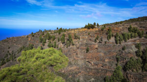
La Palma isn’t a mass-tourism climbing destination. The routes are lightly developed, guidebooks are scarce, and the scene is small and local. If that’s exactly what you’re after – original routes on sharp basalt, no queues at the base, and views you won’t find on any other European crag – you’ll find it here.
Canyoning on La Palma – Into the Belly of the Island
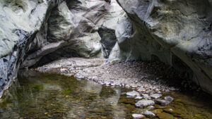
La Palma is an island of gorges. More than thirty deep barrancos cut through the volcanic rock – from the central ridge down to the ocean. Canyoning here means descending into the heart of the island.
Kayaking & SUP on La Palma – The Coast from the Water
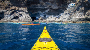
La Palma has 167 kilometres of coastline – and most of it is inaccessible by land. Kayaking and stand-up paddleboarding open up sea caves, hidden coves and cliff faces that no road reaches.
Banana Plantations on La Palma – Understanding the Plátano Canario
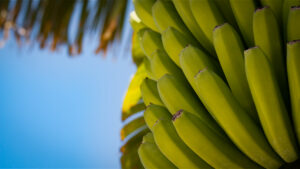
Driving through the Aridane Valley means driving through a forest of banana plants. Plantations stretching up the slopes from sea level to 400 metres – no other crop shapes this landscape quite like the banana.
Horse Riding on La Palma – Through Pine Forests and Volcanic Ash
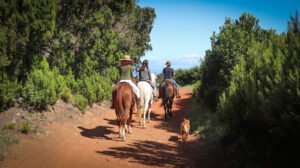
La Palma is considered a small paradise for riders. The southern half of the island offers tours through pine forests, across volcanic ash fields and along coastal paths with views of the Caldera.
Lava Cave Tours on La Palma – Through the Interior of the Volcano
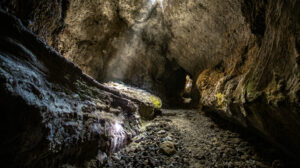
When lava flows on La Palma, a fascinating natural process takes place: the outer surface of the stream cools and hardens upon contact with the air, while the molten magma beneath continues to flow. Once the eruption subsides and the liquid lava drains away, it leaves behind a hollow tunnel—a lava tube. These natural underground passages, some stretching for hundreds of metres and tall enough to stand in, offer a rare glimpse into the inner mechanics of a volcano, frozen in time.
Cueva Bonita – The Beautiful Cave
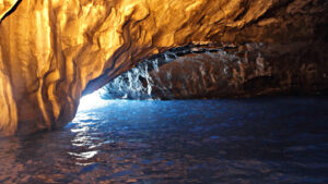
Six kilometres north of Puerto de Tazacorte, where the steep coast of the Barranco del Jurado meets the sea, a grotto opens up in the black basalt rock. It has two entrances, but only one is reachable by boat. Sail inside, and you’ll understand at once why it’s called la Cueva Bonita – the beautiful cave.
Museo Naval – The Santa María at the End of the Alameda
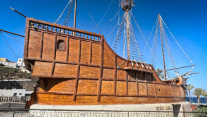
At the end of the Plaza Alameda, where the old town meets the harbour, a ship sits on dry land. It is a full-scale replica of the Santa María – Columbus’s flagship – and inside it is the Museo Naval of Santa Cruz de La Palma.
MAB – Where the Benahoaritas Come to Life
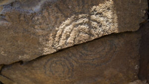
Anyone visiting the petroglyphs of La Zarza, the pottery of Mazo or the Belmaco cave and wanting to understand more – anyone looking for context for all the stone and buried remains left behind by La Palma’s original inhabitants – should start at the MAB. The Museo Arqueológico Benahoarita in Los Llanos de Aridane is the most modern and complete museum on La Palma’s prehistory: not a cabinet of display cases, but a reconstructed way of life.
Balcones Típicos – La Palma’s Wooden Landmarks
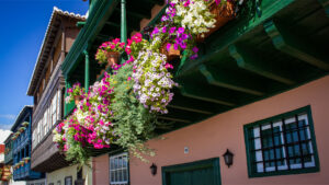
Along the Avenida Marítima in Santa Cruz de La Palma stand the most famous facades in the Canary Islands: a row of historic colonial houses with elaborately carved wooden balconies – the Balcones Típicos.
Miradores – Seeing La Palma from Above
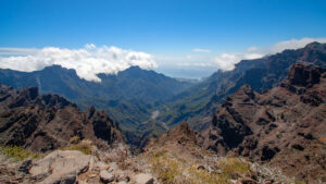
La Palma is an island of viewpoints. Scattered across the island, from the coast to the 2,426-meter summit, you’ll find lookout points that offer breathtaking panoramas. Some are right by the roadside, while others require a short hike.
Puntagorda – When La Palma Turns White in February
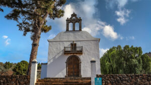
At the end of January, beginning of February, when the coastal towns still look brown and dusty, the almond trees blossom in Puntagorda. Thousands of trees on the terraces and slopes above the sea open their white and pale-pink blossoms all at once – a change of colour that transforms the northwest coast of La Palma in an instant. The spectacle alone makes the journey worthwhile.
El Paso – Silk, Crafts and the Gateway to the Caldera
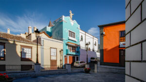
El Paso is located exactly where the coastal plain meets the mountains – a town between two worlds. On one side the lush Aridane Valley, on the other the steep slopes rising toward the Caldera de Taburiente.
Los Llanos de Aridane – The Most Vibrant City on La Palma
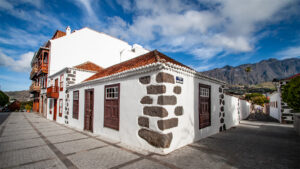
Los Llanos de Aridane long ago overtook the capital, Santa Cruz de La Palma, in population and is today the island’s largest town. What at first sounds like a modern administrative centre holds a pleasant surprise: a well-preserved old town with Canarian manor houses, one of the island’s liveliest tapas bar scenes – and, at its heart, a Plaza de España that radiates a calm beneath its mighty laurel trees you wouldn’t expect from a city.
Cubo de la Galga – In the Oldest Forest on the Island
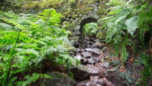
There are forests on La Palma that you enter and immediately know: something here is different. The Cubo de la Galga in the northeast of the island is such a forest. The air is heavy with moisture, the trunks old and moss-covered, the light fighting its way through a canopy built up over decades. Anyone who walks the PR LP 5.1 circular route moves through one of the best-preserved laurel forests on La Palma – a piece of nature that seems to have remarkably stopped time.
Castillo de Santa Catalina – The Star Fortress at the Harbour
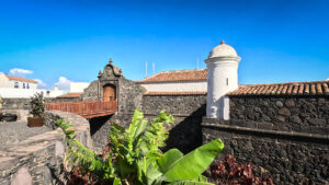
On the Avenida Marítima, where the old town houses meet the harbour, stands the Castillo de Santa Catalina. Designed in 1585 on the orders of Philip II by Italian military architect Leonardo Torriani, it is a classic example of a Renaissance fortress: the star-shaped floor plan with projecting bastions allows complete flanking coverage of the walls – no attacker should be able to approach unobserved.
Castillo de La Virgen – Where La Palma Defended Itself Against the Pirates
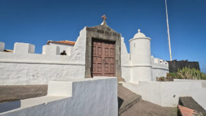
In the 16th century, Santa Cruz de La Palma was one of the most important ports of the Spanish Empire. Wealth attracted pirates. Francis Drake, the Dutch privateer Pieter van der Does – the coast of La Palma was a coveted target. The answer was stone and cannon: the Castillo de La Virgen, built at the end of the Plaza Alameda on a rocky spur east of the city wall.
Roque de los Muchachos Observatory: Visiting Guide & Tips
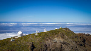
At 2,426 metres above sea level, above the clouds, they stand like silent sentinels: the domes of the Observatorio del Roque de los Muchachos (ORM), one of the world’s most important astrophysical research facilities. More than 20 telescopes from over 20 nations are installed here. The centrepiece is the Gran Telescopio Canarias (GTC) – with a primary mirror of 10.4 metres, the largest single-mirror telescope on Earth.
Museo Casa Roja – Embroidery, Flower Carpets and a Magnificent Manor House
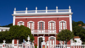
In Mazo, there is one house you simply cannot pass by. The Casa Roja – the Red House – stands at the edge of the village with deep red walls, wooden balconies and a garden that tells stories of another era.
Tajogaite – Where La Palma Still Steams
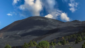
On 19 September 2021, the earth opened a fissure on the Cumbre Vieja. What followed were 85 days of fire, lava, and ash — the first volcanic eruption on La Palma since 1971, and the first the whole world followed in real time. Since then, this volcano has been called Tajogaite — and the lava field it left behind is one of the most fascinating and moving natural spectacles in the Canary Islands.
Maroparque – Where Animals Get a Second Chance
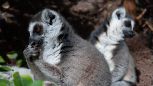
High up in Breña Alta, on a steep slope overlooking La Palma’s east coast, lies Maroparque—a facility unlike any other on the island. It is not a zoo – it is a rescue station for confiscated and injured animals.
La Zarza and La Zarcita – The Message of the First Palmeros
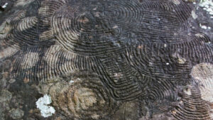
Deep in the laurel forest belt of the north, at around 1,000 metres in altitude, the most impressive traces of La Palma’s indigenous people lie hidden in a forest often shrouded in mist. La Zarza y La Zarcita are the most significant archaeological sites in the entire Canary Islands — places where the history of the Benahoaritas, the island’s original inhabitants, is quite literally carved in stone.
Barranco Fagundo – Where the North Plunges into the Deep
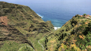
There are gorges on La Palma that you look at from above. And then there is the Barranco Fagundo. You don’t just look at this gorge – you fall with it. A steep zigzag path corkscrews down from El Tablado into the interior of the rock, past exposed rock layers that shimmer in yellow, red and ochre, past vegetation squeezing into every crevice, and past a streambed far below that carries water from the wild north down to the sea.
Barranco de las Angustias – The Gorge That Catches Everything
The name alone says it all: this is no casual stroll. Barranco de las Angustias – the gorge of death agonies – is the only natural outlet of the Caldera de Taburiente: a narrow, shadow-filled incision in the western edge of the island, through which the Río Taburiente carries its water to the sea. Those who hike here walk into the interior of La Palma – through rocks that close in overhead, across water, through light that barely filters through.
Santa Cruz de La Palma – The Most Beautiful Old Town in the Canary Islands
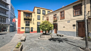
On 3 May 1493, the Spanish conquistador Alonso Fernández de Lugo founded Santa Cruz de La Palma. What grew from this early settlement is today considered one of the best-preserved Renaissance old towns in the Canary Islands – and arguably the most charming capital in the Canaries.
Marcos y Cordero – Through Thirteen Tunnels to the Island’s Springs
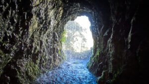
It begins with a tunnel. You step into cool darkness, drops fall from the ceiling, the light at the far end seems far away – and then you’re inside, in the middle of one of the strangest and most beautiful excursions La Palma has to offer. Marcos y Cordero is not a viewpoint, not a museum, not a sight in the classic sense. It is a path through the interior of the mountain, along ancient water channels, through thirteen tunnels blasted into the rock – leading to the seven springs that have watered the green north of La Palma for centuries.
Los Tilos – Where La Palma’s Primeval Forest Breathes
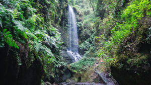
There are moments on La Palma when you forget you’re in the middle of the Atlantic. In Los Tilos, such a moment is guaranteed. The path into the Barranco del Agua leads into a forest that feels older than any memory – a laurel forest so dense and humid you’d expect to find it in the tropics rather than on a small volcanic island in the Atlantic. The ferns reach head height. The air smells of damp moss. The greenery practically glows.
Museo del Plátano – Europe’s Only Banana Museum
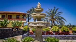
Driving through the Aridane Valley on La Palma, you pass through an endless expanse of banana plants. Plantations as far as the eye can see – a sea of green leaves and blue protective bags around the fruit. The banana is not decoration, it is an economic foundation: around 60,000 tonnes of Plátano Canario leave La Palma each year heading for the mainland. What lies behind this system – history, botany, technology, water – is explained by the Museo del Plátano in Tazacorte, Europe’s only museum dedicated exclusively to this subject.
Fuencaliente – Where La Palma Meets the Sea at Its Southernmost Point
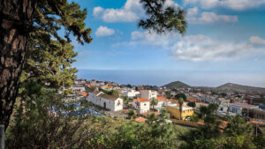
Right at the very bottom, at the island’s outermost tip, they stand side by side like silent sentinels: the old and the new lighthouse of Fuencaliente. The older one is half-swallowed by the lava of the 1971 eruption of Volcán Teneguia — a stone witness that this island is still breathing. Anyone who comes to Fuencaliente arrives at a place where the forces of the earth feel especially close.
Roque de los Muchachos – Above the Clouds, at the Edge of the Caldera
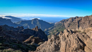
You drive up the serpentines of the LP-4 and just as you begin to wonder if the road will ever end, it delivers you to a world above the clouds. The pine forest recedes, the clouds suddenly lie beneath you, and then you are at 2,426 metres – the highest point on La Palma, at the Roque de los Muchachos, where the air is so clear you feel you could reach out and touch Tenerife.
Villa de Mazo – Pottery, Indigenous Heritage, and Flower Carpets
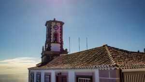
Villa de Mazo lies on the south-east coast of La Palma, between the capital Santa Cruz and the volcanic tip of Fuencaliente. The municipality is modest in size and unassuming, yet culturally one of the richest places on the island: here, one of the Canaries’ oldest pre-Spanish pottery traditions lives on, here you’ll find the oldest known petroglyphs in the Canary Islands, as well as La Palma’s most elaborate Corpus Christi festival.