Volcanoes on La Palma – An Island Still Growing
La Palma is one of the most volcanically active islands in the Canary Islands and is home to one of Europe’s most dynamic volcanic systems. What on other islands has long since become fossilised history – cooled craters, ancient lava fields, and extinct vents – is a living reality on La Palma. The last eruption was less than five years ago. The island continues to grow, and future eruptions form part of its natural long-term development.
The Island’s Formation – 3 Million Years of History
La Palma’s story began around 3 to 4 million years ago on the ocean floor. There, at a depth of roughly 4,000 metres, an underwater volcano slowly built upward through countless eruptions. Only around 1.7 to 2 million years ago did the island finally break through the sea surface – a phase geologists call the subaerial stage.
What is visible today – the island’s highest peak at 2,426 metres – represents only the upper portion of a vast volcanic edifice that rises more than 6,000 metres from the Atlantic floor.
After El Hierro, La Palma is the second youngest of the seven main Canary Islands. At the same time, it is one of the steepest volcanic islands on Earth: across just 708 square kilometres, the terrain rises from sea level to 2,426 metres – a geological profile that is exceptional worldwide.
The Two Geological Zones of La Palma
Geologically, the island divides clearly into two distinct zones.
The North – the Caldera de Taburiente
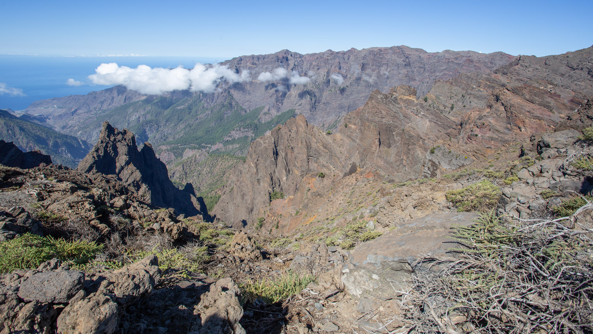
The north forms the older part of La Palma. This is where the impressive Caldera de Taburiente is found – long mistakenly interpreted as a giant volcanic crater. Today we know that it was formed by massive flank collapses, volcanic processes, and millions of years of erosion. The rock in this area reaches an age of up to two million years, making it the oldest exposed rock on the island.
The South – the Active Cumbre Vieja
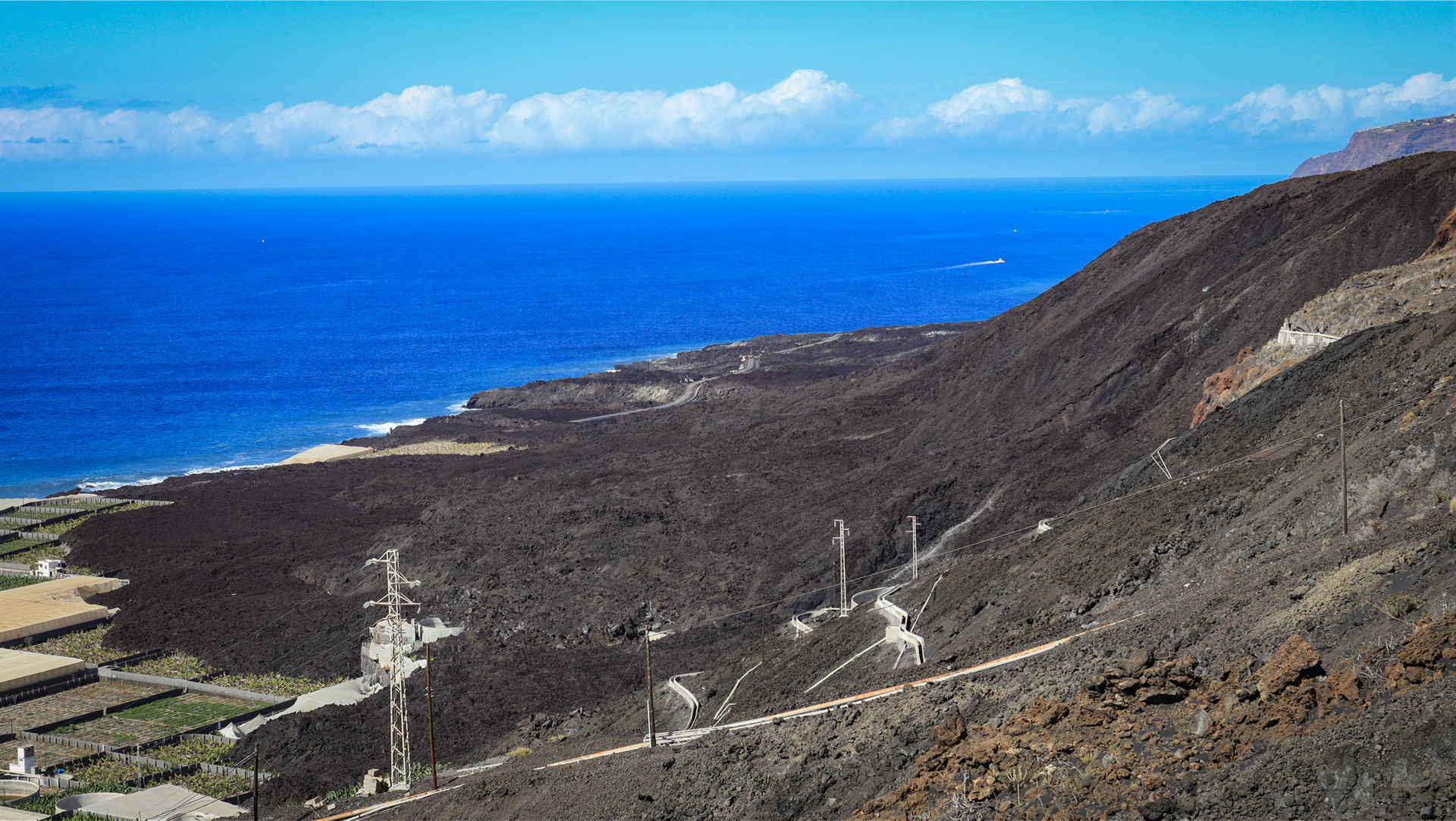
The Cumbre Vieja presents an entirely different picture. This elongated volcanic ridge forms the island’s active backbone. All historically documented eruptions on La Palma have occurred along this volcanic axis. Today the Instituto Geográfico Nacional (IGN) and the Instituto Volcanológico de Canarias (INVOLCAN) monitor the region around the clock with a dense network of seismometers, GPS stations, and gas sensors.
Historical Eruptions on La Palma
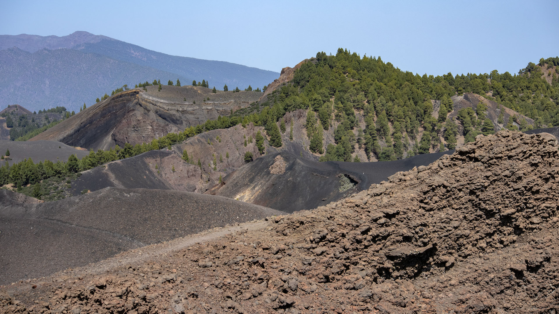
Eight volcanic eruptions have been documented on La Palma since the 15th century – all along the active Cumbre Vieja:
- 1470 – Montaña Quemada (Tacande)
- 1585 – Tajuya
- 1646 – Volcán Martín
- 1677 – Volcán San Antonio
- 1712 – Volcán El Charco
- 1949 – San Juan (Duraznero, Llano del Banco and Hoyo Negro)
- 1971 – Volcán Teneguía
- 2021 – Volcán Tajogaite
Statistically, a volcanic eruption occurs on La Palma roughly every 40 to 50 years. These are mostly effusive eruptions: lava flows relatively calmly rather than exploding outward. Even so, lava flows can cover large areas and cause considerable damage.
The Tajogaite Eruption 2021
On 19 September 2021, an eruption fissure opened near El Paraíso. What followed was the longest and most thoroughly documented volcanic eruption in the island’s recorded history. The eruption lasted 85 days, 5 hours, and 8 minutes.
During this time:
- around 1,219 hectares of land were covered by lava,
- more than 3,000 buildings were destroyed or severely damaged,
- two new lava deltas (fajanas) were created on the coastline,
- around 49 hectares of new land were added to the Atlantic coast.
The volcanic cone that formed was later officially named Tajogaite. The name comes from the language of the Benahoaritas, the indigenous people of La Palma, and means roughly ‘split mountain’.
Geological Features
Pillow Lava in the Barranco de las Angustias
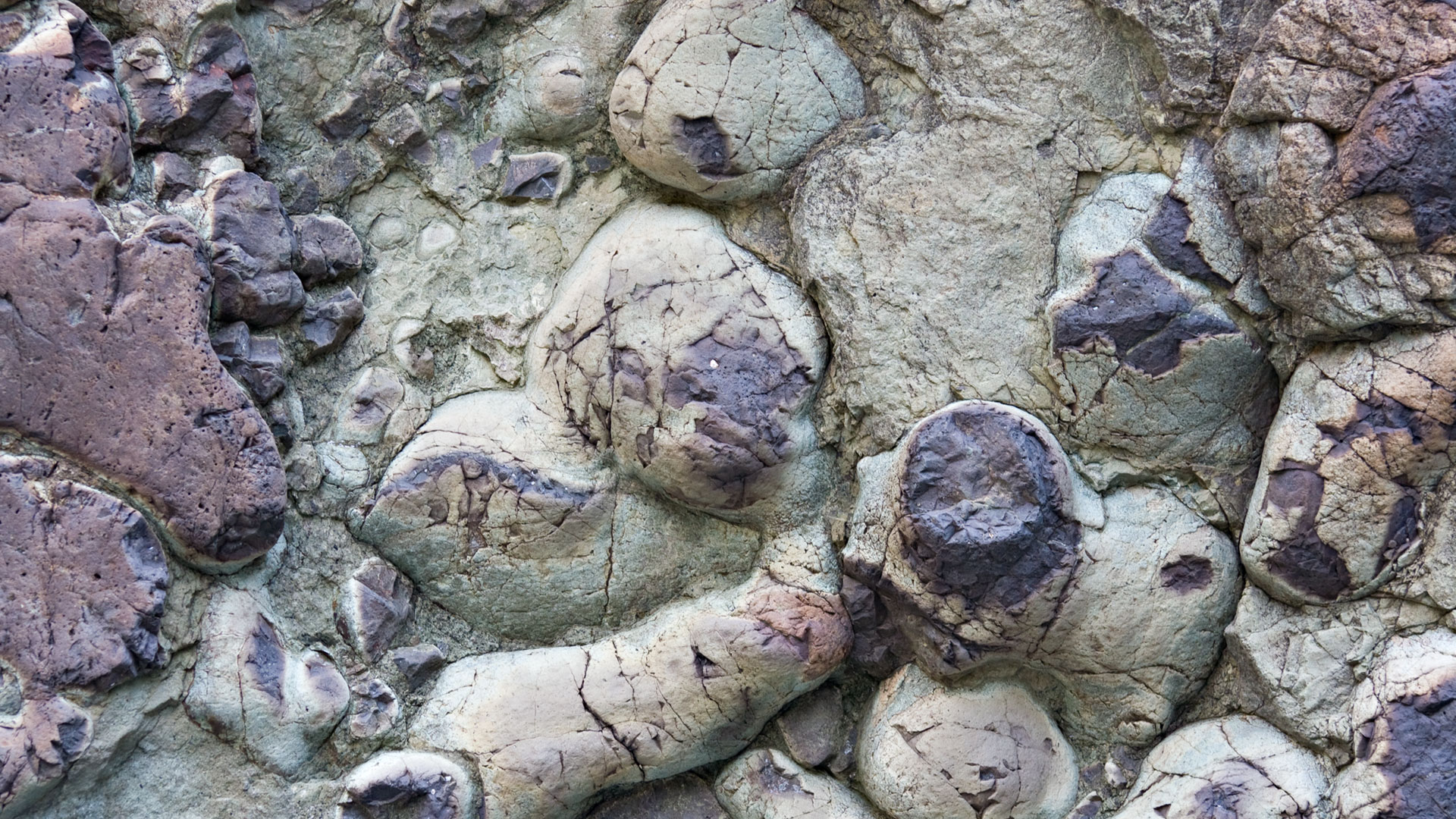
The Barranco de las Angustias is one of the best places to observe pillow lavas. These rounded basalt formations were created millions of years ago when lava erupted beneath the sea surface and solidified instantly in the cold water. Later, as the island built upward, these rock layers were lifted and are now exposed in the ravine.
The Lava Tube Network
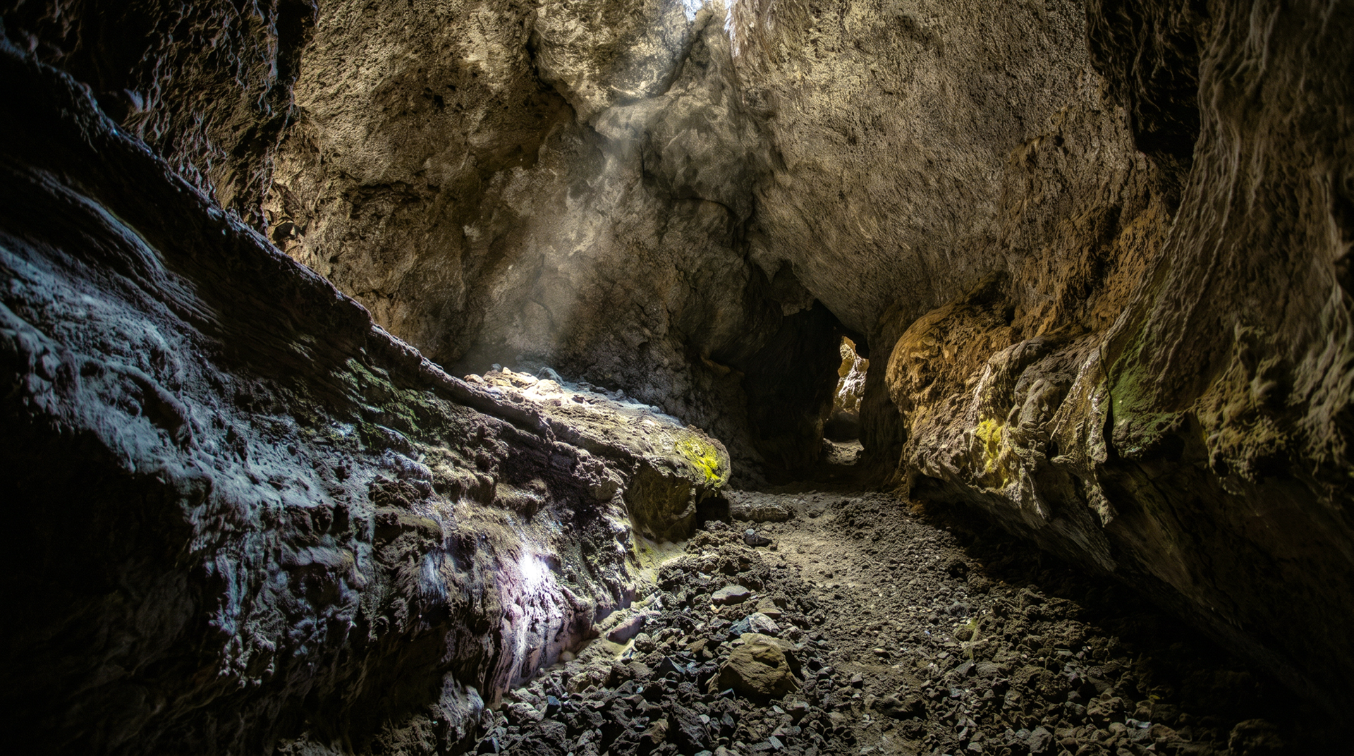
Beneath La Palma’s surface runs an extensive network of natural lava tubes. These form when the outer surface of a lava flow solidifies while liquid lava continues to flow within. After the lava drains, a tunnel-like cavity remains. The best-known accessible lava tube is the Cueva de las Palomas near Las Manchas, which formed during the 1949 eruption.
Current Monitoring – How Safe Is La Palma?
Since the 2021 eruption, the monitoring infrastructure has been massively expanded. The Instituto Geográfico Nacional (IGN) and the Instituto Volcanológico de Canarias (INVOLCAN) monitor La Palma around the clock.
Seismometers register the smallest micro-earthquakes, GPS stations measure ground uplift to the millimetre, and gas sensors monitor CO₂ output. Any future eruption will provide weeks or months of advance warning, ensuring a safe and orderly evacuation. For visitors in the island’s open zones, the risk is therefore practically zero.
Volcano Tourism – the Most Interesting Excursions
Tajogaite: An absolute must-see. The best overview is from the Mirador de Las Hoyas or the trail between Tajuya and Jedey. Entering the restricted zone around the new crater is strictly prohibited and may only be done as part of certified guided tours.
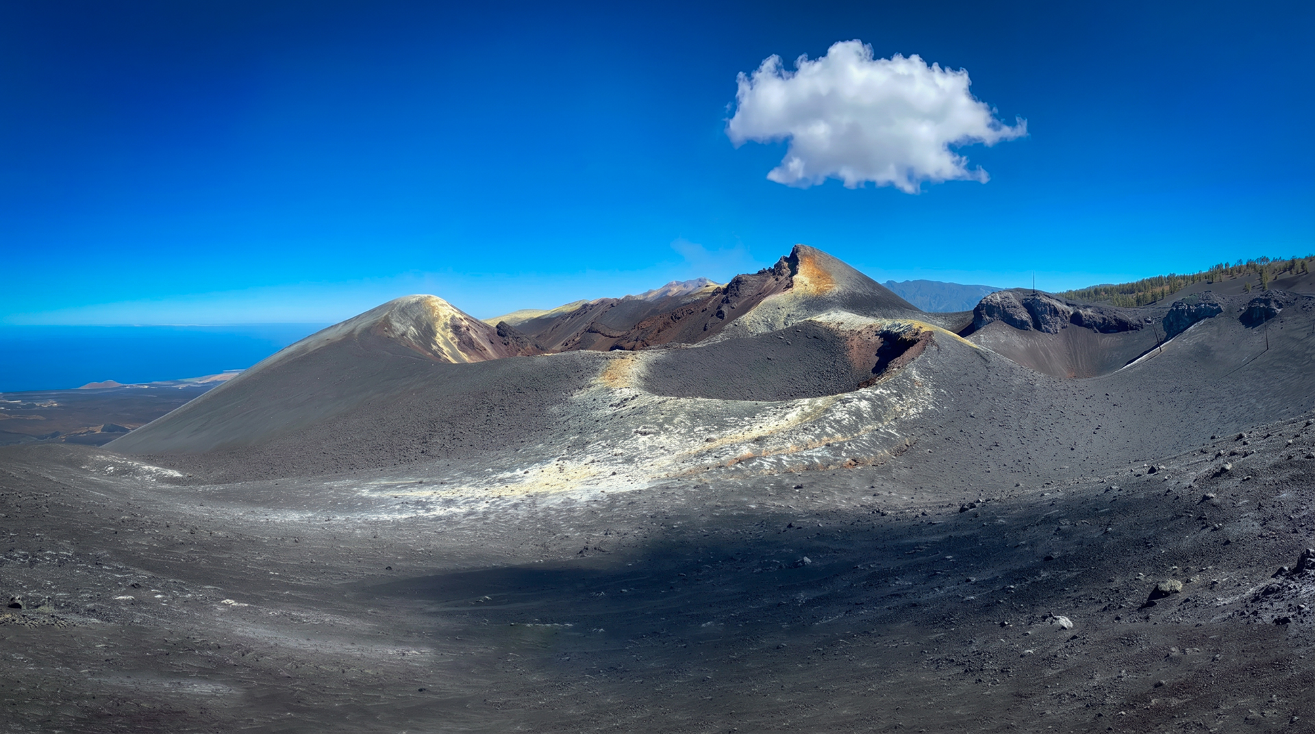
Volcán San Antonio & Teneguía: In the south of the island (Fuencaliente), the San Antonio Volcano visitor centre (entry approx. €5–6) allows visitors to walk along the crater rim. Directly below it is the Teneguía, which erupted in 1971 and can be climbed freely.
Caños de Fuego: The modern visitor centre near Las Manchas offers exhibitions, an elevated walkway over the 1949 lava field, and guided tours into the spectacular lava tube Cueva de las Palomas.
Hiking Tip: Ruta de los Volcanes
This ridge walk crosses the Cumbre Vieja and offers spectacular views of old and new craters.
Note: The route is roughly 17 kilometres long and runs mostly over loose lava sand with no shade. Good fitness, sturdy walking boots, windproof clothing, and at least 2 to 3 litres of water per person are absolutely essential.
Frequently Asked Questions (FAQ)
Is La Palma safe to visit after the 2021 eruption?
When will the next eruption happen on La Palma?
Can you climb the Tajogaite independently?
Why is the volcano called Tajogaite and not Cumbre Vieja?
Which volcanoes can you visit on La Palma?
This article is based on the on-the-ground knowledge of the Gequo editorial team – publishers of the Reisezeit hiking guides and operators of Sunhikes.com. Last updated: May 2026