
PR-LP 3: Hiking trail from Pico de la Nieve to Santa Cruz de La Palma
The PR-LP 3 is one of the most extreme descent routes in La Palma: 13.6 km, 196 m ascent, 2,395 m descent, moderate, 4:30–5:30 hours. From the 2,234 m high Pico de la Nieve, the path leads through forest areas almost at sea level to the island’s capital Santa Cruz de La Palma – a complete vertical cross-section through La Palma’s climatic zones.
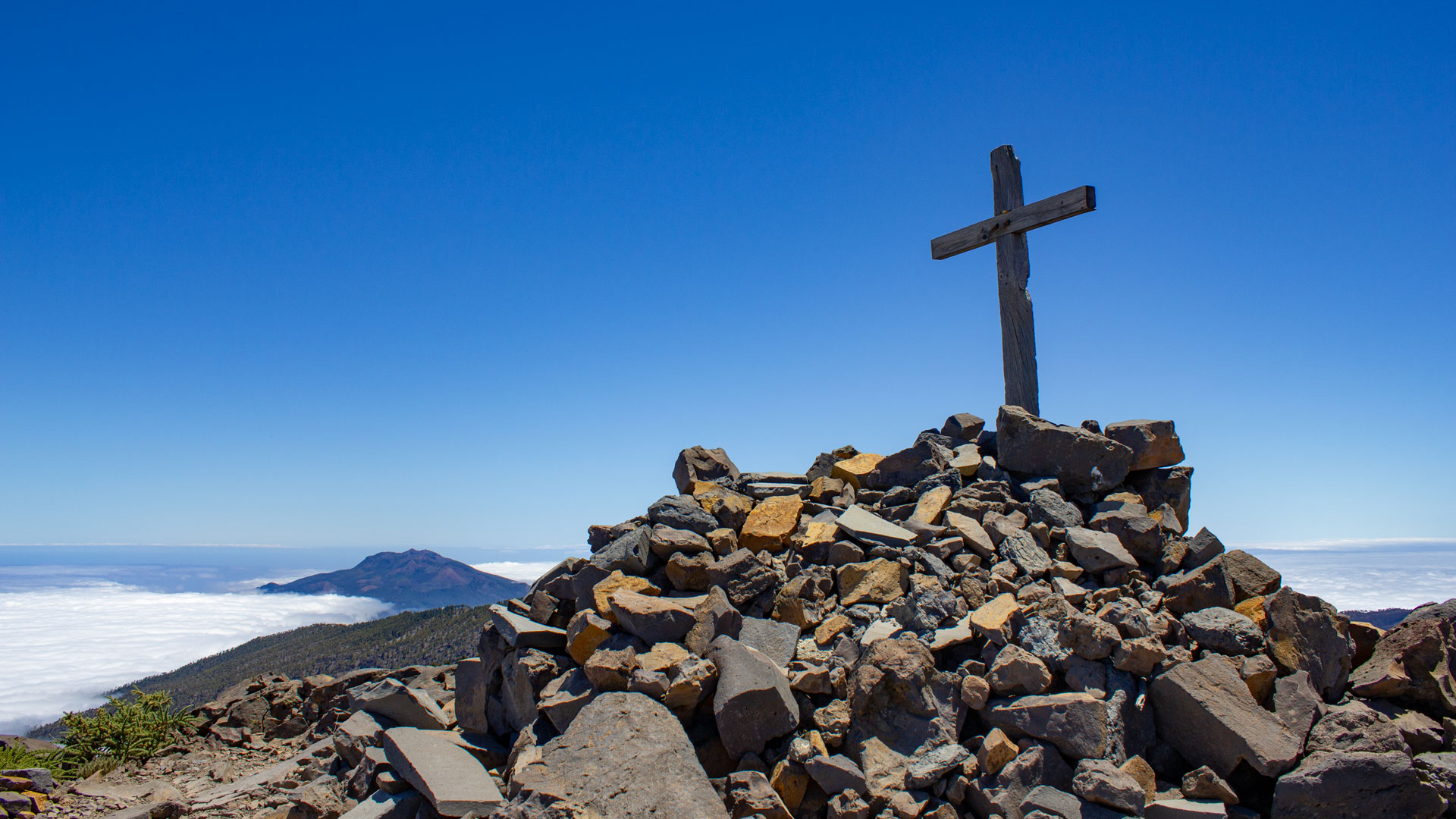
The tour starts with a magnificent view over the erosion crater of the Caldera de Taburiente and the mountain range of the national park. On a clear day: Tenerife appears on the horizon. After the high mountain section, you pass through Canarian pine forest, followed by cloud belt areas, tree heath and laurel forest. Finally, the old town of Santa Cruz – the Plaza la Alameda, the replica of Santa María and the cafés of the capital.
Starting point: Pico de la Nieve, LP-4 (Pista Pico de la Nieve junction). End point: Plaza la Alameda, Santa Cruz de La Palma. Return: Bus line 100 from Santa Cruz back to LP-4.
Route facts at a glance
| Route Type | One-way (Pico de la Nieve → Santa Cruz de La Palma) |
|---|---|
| Distance | 13.6 km |
| Elevation | 196 m ascent / 2,395 m descent |
| Highest Point | 2,224 m (Pico de la Nieve approx. 2,239 m) |
| Lowest Point | 25 m (Santa Cruz, almost at sea level) |
| Duration | 4:30–5:30 hours |
| Difficulty | moderate (easy to follow, 2,395 m descent, good basic fitness required) |
| Starting Point | LP-4, junction for Pista Pico de la Nieve |
| End Point | Plaza la Alameda, Santa Cruz de La Palma |
| Trail Marking | PR LP 3 (yellow-white) |
| Protected Area | Caldera de Taburiente National Park (upper section) |
| Equipment | Water, sturdy footwear, windproof jacket (for the summit), sunscreen (for the coast) |
Directions and logistics
Starting point: LP-4, Pista Pico de la Nieve junction. If you want to climb to the summit (recommended for the full panoramic view): approx. 1:15 hour ascent from LP-4, then descent to Santa Cruz. Park your car at LP-4, then take bus line 100 from Santa Cruz back to LP-4. Alternatively: A second car in Santa Cruz.
The route in detail
Pico de la Nieve to the first LP-4 crossing
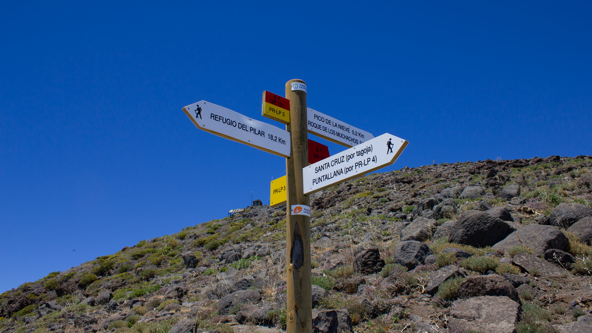
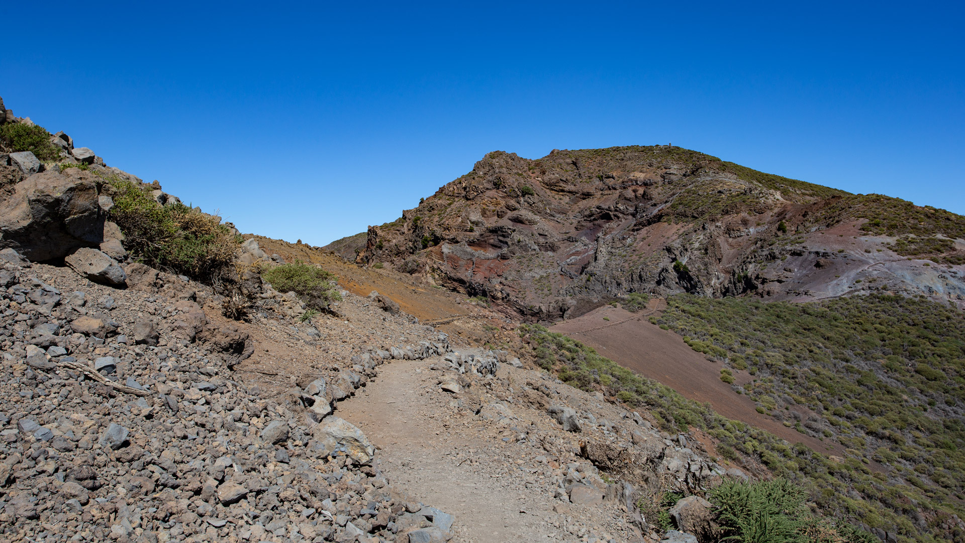
From the summit of Pico de la Nieve (2,239 m): magnificent view over the erosion crater of the Caldera de Taburiente and the summit chain. The route soon emerges from high mountain vegetation into the Canary Islands pine forest. After 2.4 km, you reach the first LP-4 crossing at Pista Pico de la Nieve at the Pista Pico de la Nieve. where the PR LP 4 also branches off towards Puntallana to Puntallana. PR LP 3 crosses the road and continues downhill.
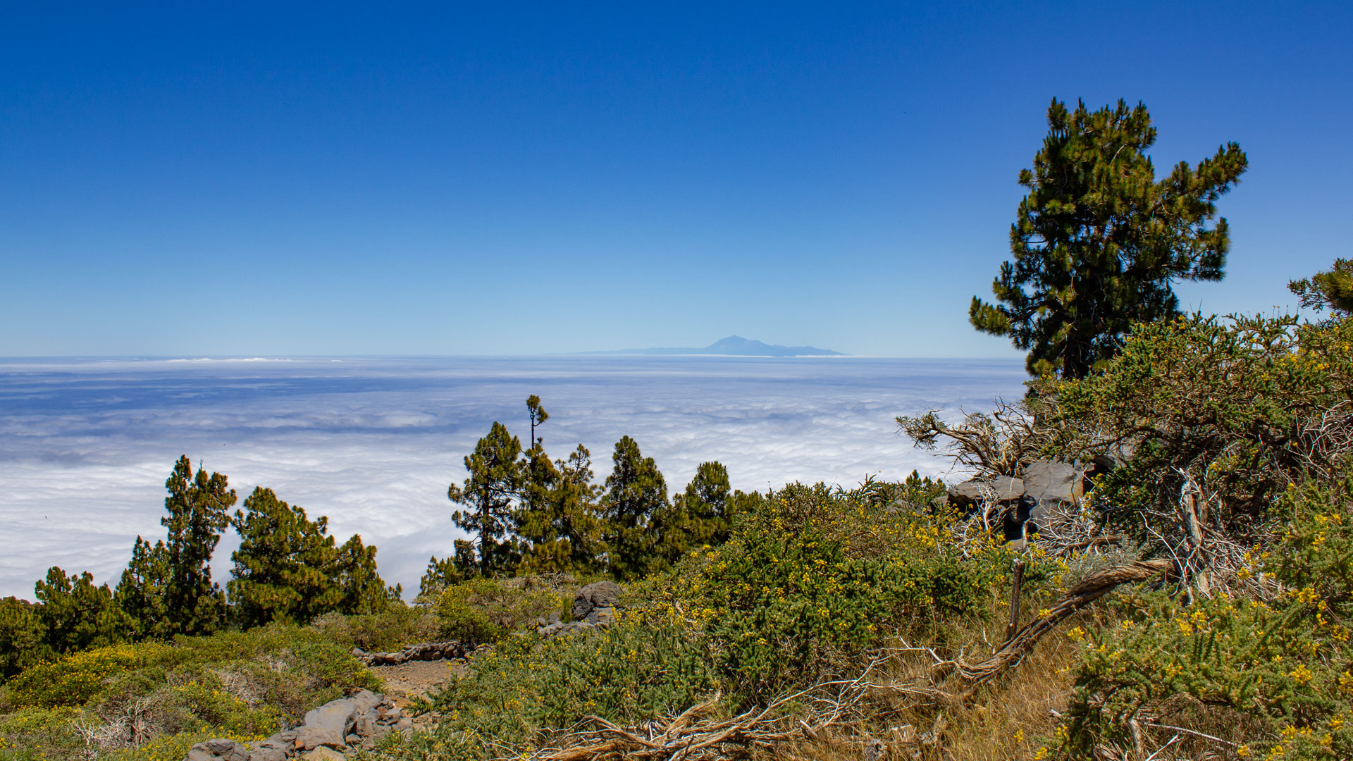
Pine forest, cloudscapes and laurel forest
At the 4 km mark, there is a second LP-4 crossing (follow the road for around 100 m before rejoining the trail). Again and again views along the side of the island and of the Atlantic. If conditions are good: Tenerife with the Teide. The tour passes through the cloud storage areas – you can feel the transition from dry pine forest to wetter heather-laurel forest due to the change in temperature and humidity.
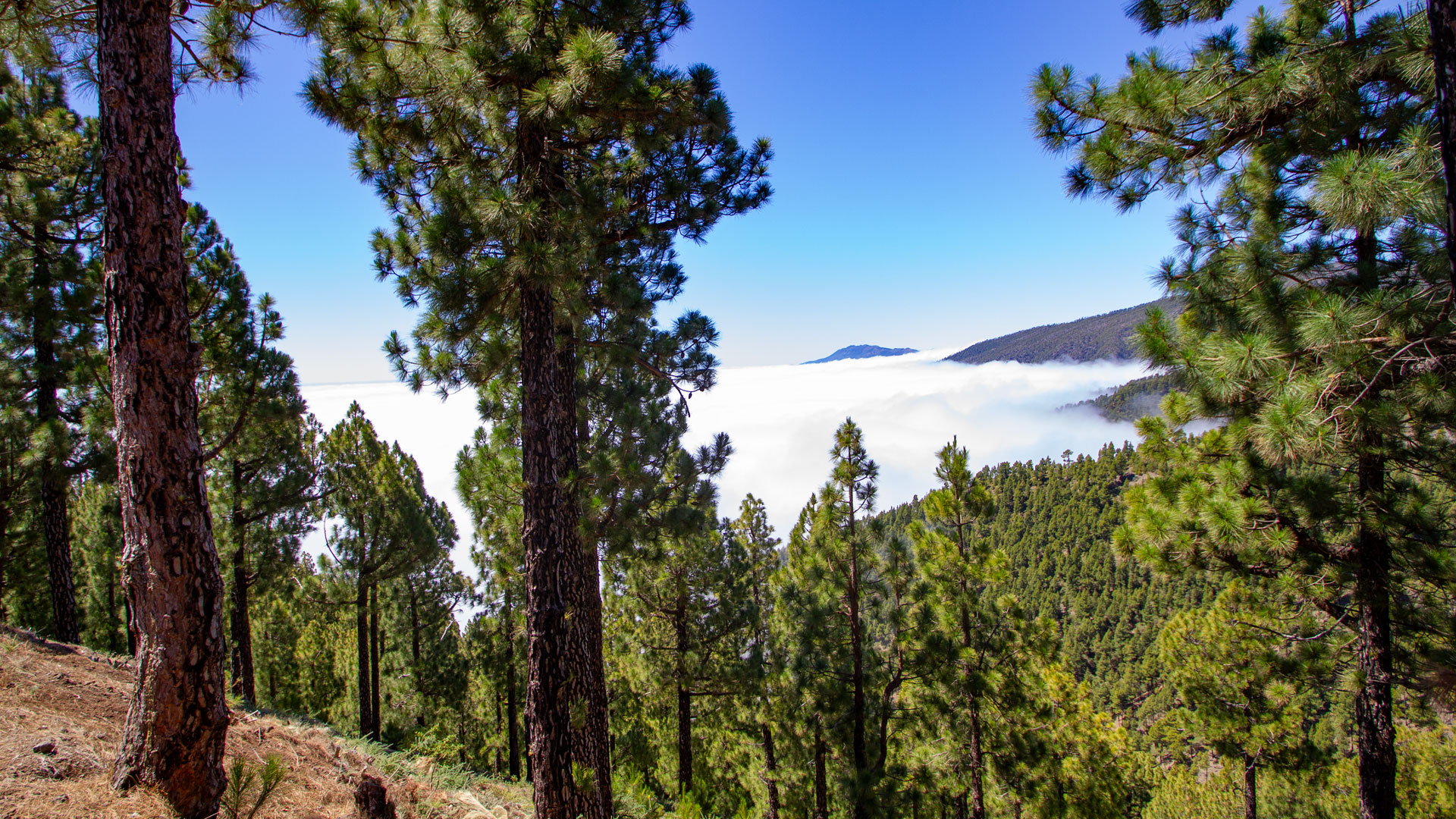
Last kilometers and arrival in Santa Cruz
At approx. 7.3 km: turn left at PR LP 3.1 (ignore). Continue through Barranco del Carmen Dorador. LP-401 crossing at km 10.4. Through Barranco del Carmen in Los Alamos. The final stretch follows tarmac roads to Plaza la Alameda in the centre of Santa Cruz de La Palma to Plaza la Alameda in the centre of Santa Cruz de La Palma. At the destination: replica of Santa María, old town, cafés – the contrast to the high mountains is hardly greater.
A 2,395 m descent: what it means for your knees
The PR LP 3 is moderate in terms of technical difficulty, but physically demanding – not through the climb, but through the long descent. 2,395 meters downhill over 13.6 km mean continuous strain on the knee joints for 4-5 hours. Using walking poles is not a sign of weakness; it is a smart choice for this hike. If you walk without sticks, you should consider knee pads or bandages.
Experience with long descents shows: speed is crucial. Walking downhill too fast places immense strain on your knees. If you walk slowly and evenly, with your knees slightly bent, you will arrive at the bottom with your knee joints intact. Trekking poles reduce the impact on your knees by around 30% — a significant difference over 13.6 km.
Passing through vertical climate zones
The PR LP 3 crosses four vegetation levels over 13.6 km and 2,395 m above sea level: high mountain vegetation (2,200 m), Canarian pine forest (1,800-1,200 m), heath-laurel transition zone (1,200–600 m), and coastal areas lined with banana plantations and Canarian succulents (below 200 m). No other hiking trail on La Palma shows these four zones so completely in a single descent.
Best time to visit
| Season | Character | Note |
|---|---|---|
| Spring (March–May) | Tajinastes in bloom at the top; mild temperatures on the coast | Botanically best time |
| Summer (June–August) | Cool above, hot below | Early start; lots of water |
| Autumn (Sept-Nov) | Best distant view of Tenerife | Most popular season |
| Winter (Dec-Feb) | Frost possible above | Wind protection, layer system |
Combinable tours
| Tour | Data | Character |
|---|---|---|
| Caldera high-altitude hiking trail Pico de la Nieve → Roque | 20.5 km, difficult | Instead of descent: ridge hike northwards |
| GR-130 Stage 1: Santa Cruz – Puntallana | 11.4 km, moderate | Arrival in Santa Cruz, next day coast |
| Los Brecitos → Playa de Taburiente | 5.2 km, moderate | Other national park route from the LP-4 |
GPS track and 3D route planner
GPS track helpful for the multiple LP 4 intersections and the PR LP 3.1 junction. With the free 3D route planner, the descent can be lengthened or shortened individually – directly in the browser, without an app.
To the route page on Sunhikes: PR LP 3 Pico de la Nieve – Santa Cruz
3D route planner from Sunhikes – customize and combine routes
Practical Tips
Emergency call 112. Hiking poles strongly recommended (2,395 m descent). Early start for optimal views from the summit. Bus line 100 from Santa Cruz back to LP-4 for the return journey. Cafés in Santa Cruz as a conclusion.
Note: National Park
The upper part runs in the Caldera de Taburiente National Park (since 1954). Stay on marked trails, take your rubbish with you.
Frequently asked questions
Why do most hikers start from the LP-4 rather than the summit?
The climb to Pico de la Nieve as an addition
If you don’t just want to enjoy the descent, start with a climb to Pico de la Nieve (approx. 1:15 h from the LP-4) and then go downhill to Santa Cruz. Including the peak adds a true summit experience, making the descent all the more dramatic: you start at the highest viewpoint that La Palma offers (off the Roque de los Muchachos) and end in the capital by the sea. No other hiking trail in La Palma offers this vertical cross-section so completely.
The Pico de la Nieve (2,239 m) has a wooden cross on the summit – visible from afar on the ridge path. The view from the summit includes: Caldera de Taburiente (west and north), Cumbre Vieja with the volcanoes (south), east coast and Atlantic Ocean (east). On a clear day: Tenerife, La Gomera, El Hierro visible at the same time. The summit detour before the long descent to Santa Cruz is worth the extra 1:15 hour.
Arriving in Santa Cruz
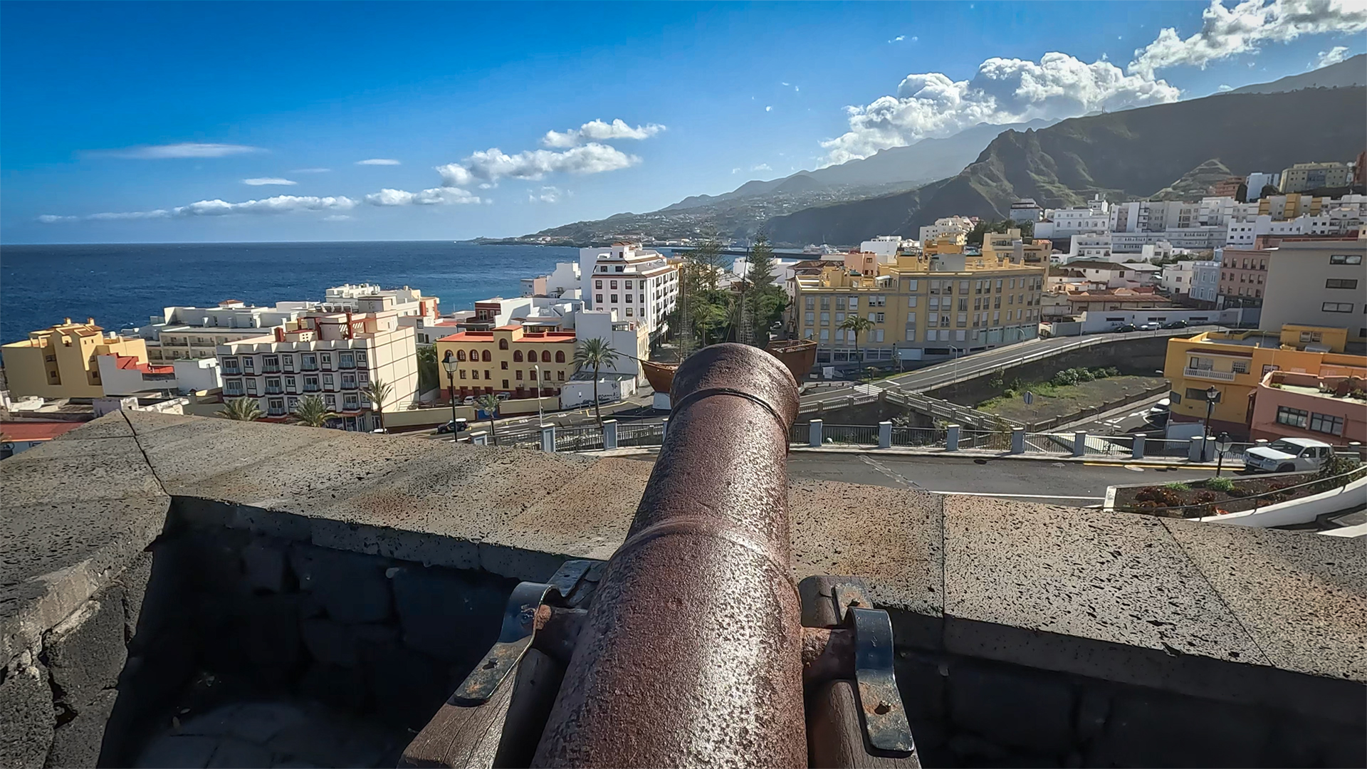
Arriving at Plaza la Alameda in Santa Cruz after 4:30-5:30 hours of descent through all climate zones of La Palma is a strange experience: you have the summit, the pine forest, the laurel forest, the gorges and the banana zones behind you – and suddenly you are walking along the cobbled streets of the old town, surrounded by colonial architecture, cafés and the sound of the Atlantic a few hundred meters further. The replica of the Santa María at the harbour is the first unexpected motif after a long day of hiking.
Another option for the PR LP 3: You don’t walk the full length, but only to the LP-401 intersection at km 10.4 and then take a bus back. That’s about 10 km of descent from the high mountain zone to the middle altitudes – with the significant change of vegetation and without the long final asphalt section into the city. This is a sensible division for hikers who want to experience the change in climate without having to go to the end.
The path leads into Plaza la Alameda — not the better-known Plaza de España. It’s about a 5-minute walk from Alameda to O’Daly and Plaza de España. Anyone who has completed the PR LP 3 does this short section of the old town as a natural continuation of the day: from the hiking trail directly into the old town – the most beautiful transition that La Palma has in store for a long day of hiking.
The PR LP 3 is accessible all year round – a rarity among La Palma’s long hiking trails. In winter, the Pico de la Nieve summit area can have snow, but the route is snow-free from 1,800 m and is always easy to walk on the paths further down. Anyone who hikes in winter enjoys crystal-clear views after rain, with Tenerife sharply defined: Tenerife particularly sharp, sometimes Gran Canaria on the horizon. The cold above (windbreak!), the warmth below (Santa Cruz has 20°C all year round): This is the vertical temperature gradient in La Palma that you physically experience on this route.
This article is based on the on-the-ground knowledge of the Gequo editorial team – publishers of the Reisezeit hiking guides and operators of Sunhikes.com. Last updated: May 2026


