
Hike Mirador El Time to Puerto de Tazacorte
The hiking trail from Mirador El Time to Puerto de Tazacorte is one of the most visited and best-known hiking trails in La Palma – the only trail on the island to be awarded the Sendero Azul environmental award for exemplary environmental management. 3 km, 510 m descent, moderate, approx. 1:00–1:30 h downhill (ascent approx. 1:30 h).
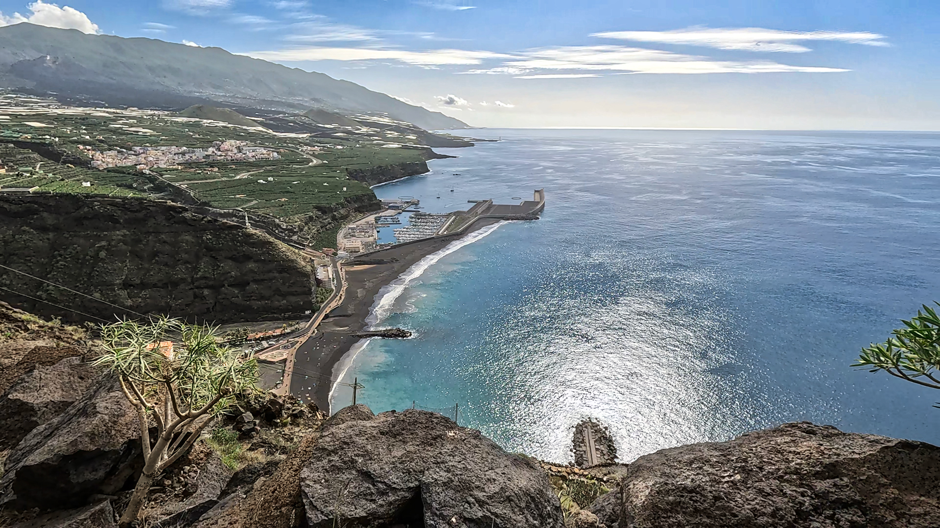
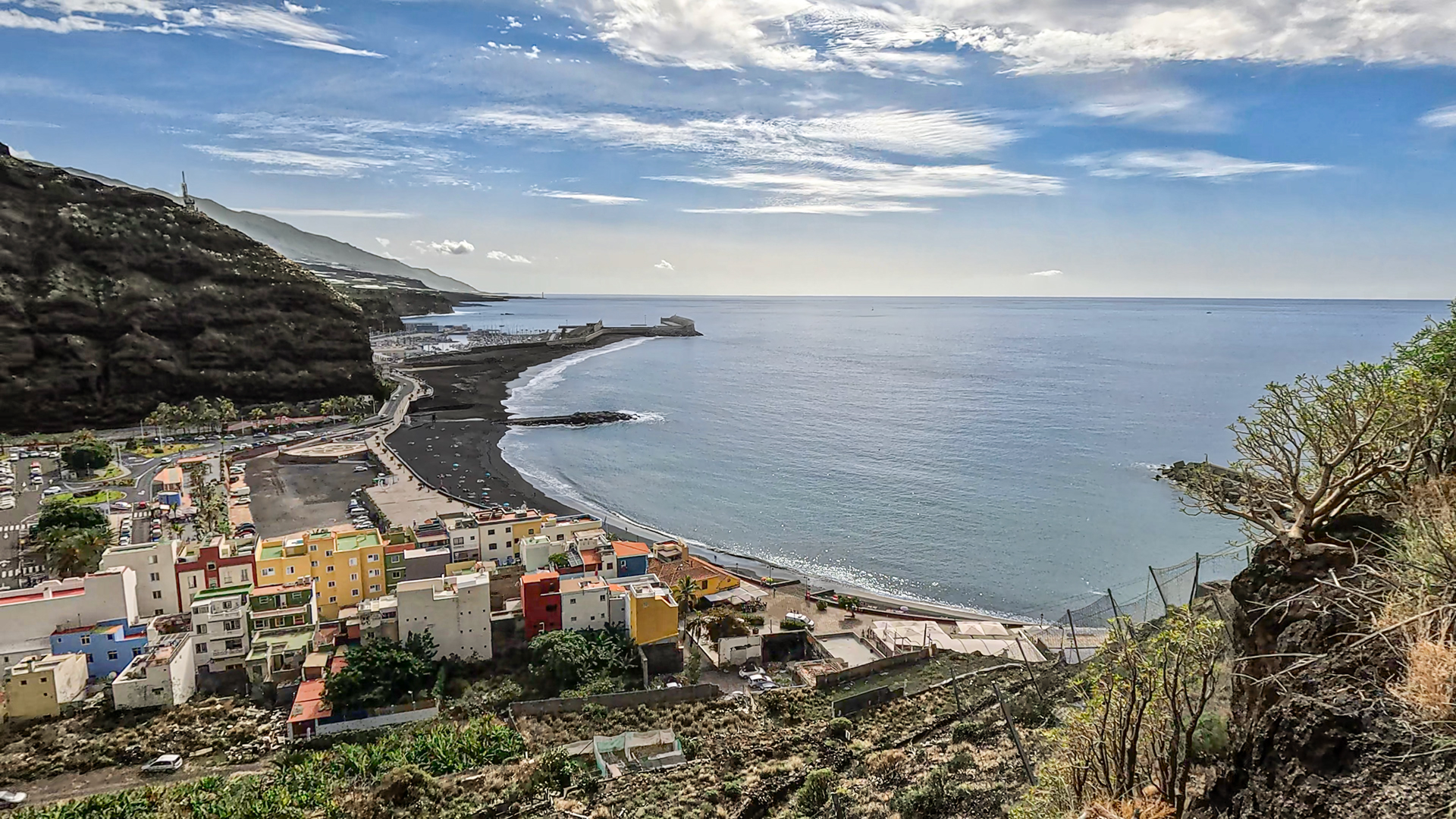
The trail begins at Mirador El Time at 513 m – with one of the widest panoramic views on the west coast: the Aridane Valley, the Tajogaite lava flows, Puerto de Tazacorte and the coastline to Tijarafe. The historic path leads in steep bends through rock faces and banana plantations down to the harbour.
The Mirador El Time is located on the LP-1, south of Tijarafe, and can also be reached by bus. The path is part of the GR-131 El Bastón and is therefore officially the start of the long climb to Roque de los Muchachos.
Route facts at a glance
| Route Type | One-way (Mirador El Time → Puerto de Tazacorte) / out-and-back possible |
|---|---|
| Distance | 3 km |
| Elevation | 510 m descent (downhill) / 510 m ascent (return) |
| Highest Point | 513 m (Mirador El Time) |
| Lowest Point | 0 m (Puerto de Tazacorte, sea level) |
| Duration | 1:00–1:30 h (downhill) / approx. 1:30 h (ascent) |
| Difficulty | moderate (sure-footedness required, short but steep) |
| Starting Point | Mirador El Time, LP-1 south of Tijarafe |
| Trail Marking | GR-131 (red-white) |
| Award | Sendero Azul — environmental award |
| Equipment | Sturdy footwear, water, sun protection |
Directions and logistics
Mirador El Time: LP-1 south of Tijarafe. Car park at the Mirador with restaurant/café. Accessible by bus. Puerto de Tazacorte: West coast, easily accessible by bus. Return from Puerto de Tazacorte: Bus (10 before the hour) or taxi back to the Mirador. Alternatively: Park your car in Puerto Tazacorte, take a taxi up to Mirador El Time, then hike downhill.
The route in detail
Mirador El Time to rock serpentines
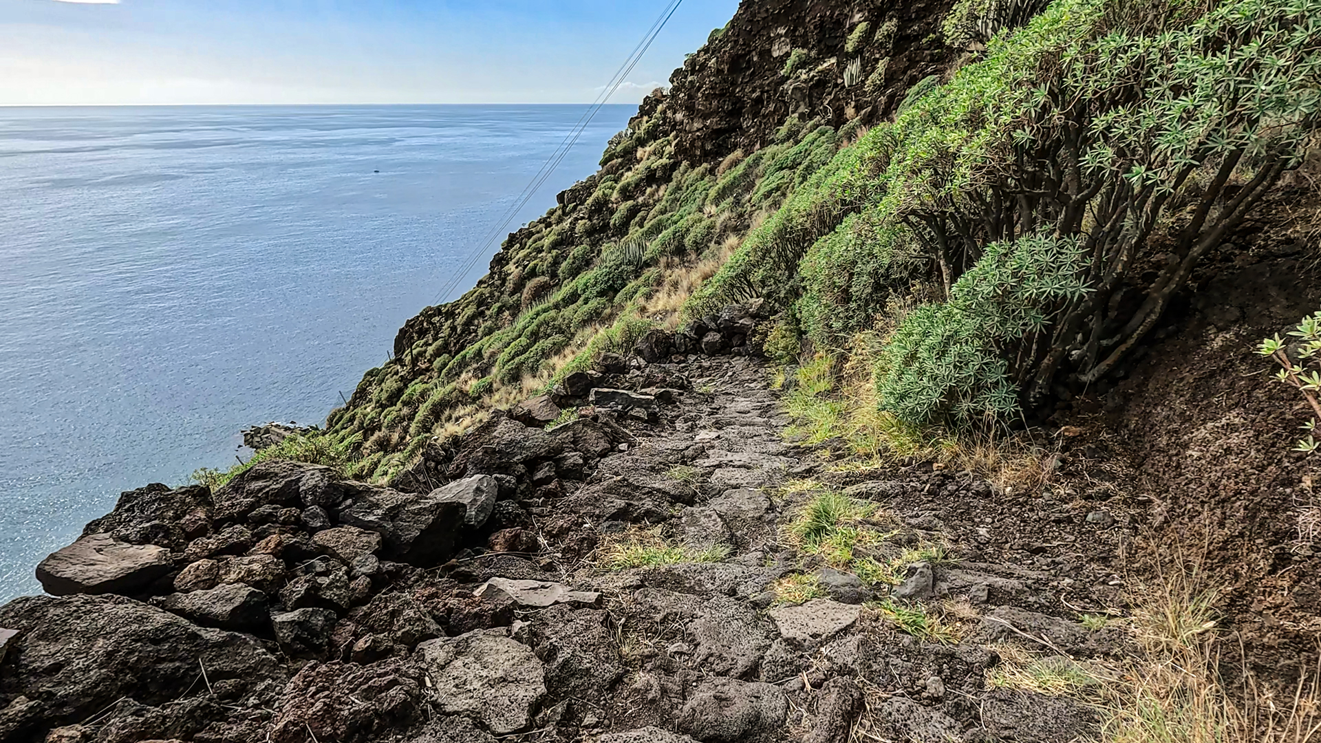
From Mirador El Time follow the GR-131 (red-white) downhill. First on asphalt, with a wonderful view over the coast to the northwest. Then you briefly leave the asphalt to get to the next asphalt road. This leads through banana plantations and gardens to a plaza. Past villas with beautifully landscaped gardens. Behind the last house: an old path paved with natural stone.
Switchbacks to Puerto de Tazacorte
Now the classic serpentines that you often see in photos of the Mirador begin: short, steep bends through the steep slope above the harbour. From here: first view of the harbour. Continue downhill in serpentines – no getting lost as there are no other paths on this steep slope. Finally, Puerto de Tazacorte: the small fishing port with black beaches, restaurants and direct access to the Atlantic.
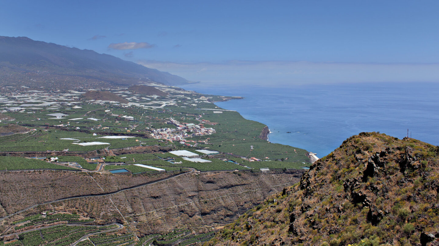
Mirador El Time: the panoramic viewpoint
The Mirador El Time is one of the most spectacular viewpoints in La Palma: From here you can simultaneously see the entire Aridane Valley (La Palma’s most fertile plain with banana plantations stretching to the horizon), the lava flows of Tajogaite 2021 (deep black, directly in front of the valley), Puerto de Tazacorte at the foot of the cliff and the coastline all the way to Tijarafe. The café/restaurant at the Mirador offers snacks and cakes – ideal before the descent or after the ascent.
The name El Time comes from the old Canarian word tyme – the old name for the high plateau above the harbour. The Mirador was set up at the point where the old ridge road to Tijarafe begins. For the last five centuries, this route has been the main connection between the port of Tazacorte and the north of the island. There are also dwellings of the indigenous people of Benahoritas along the way – the path is older than Spanish colonization.
Sendero Azul: Environmental Award
The El Time – Puerto de Tazacorte hiking trail is the only hiking trail on La Palma that carries the Sendero Azul seal for exemplary environmental management – and has now received it six times in a row. The award recognizes the cooperation of the municipalities of Tijarafe and Tazacorte in cleaning, maintenance and protection against landslides.
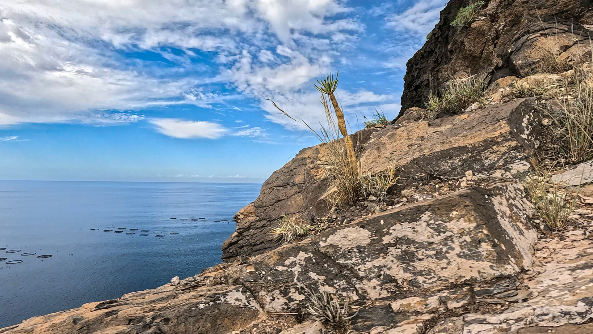
The high ethnographic value of the path — historical use over centuries, Benahorita sites, agricultural terraces — contributes to the award. The Sendero Azul is the Canary Islands equivalent of the Blue Flag for beaches: a quality and environmental seal that is not earned permanently, but annually.
Puerto de Tazacorte: the destination
Puerto de Tazacorte is the only natural harbour on the west coast of La Palma. Black lava rocks, small fishing port, restaurants right on the water. The port of Tazacorte was historically the most important trading point on the west side – sugar, bananas and wine were shipped here. Today: boat tours, diving centre and starting point for whale watching trips. After the descent: stop at one of the fish restaurants at the harbour, then swim on the black beach.
Best travel time
| Season | Character | Note |
|---|---|---|
| All year round | West coast sunny and warm | One of the few ideal paths all year round |
| Summer (June-Aug) | Hottest section at the harbour | Early morning or evening for the climb |
| Autumn (Sept-Nov) | Tajogaite lava fields in the best light | Strongest contrasts between lava and green |
| Winter (Dec–Feb) | Warm; West coast less rain | Ideal winter hike |
Accommodation: Tazacorte — Clariso
Holiday homes in Tazacorte on clariso.eu — Holiday homes Tazacorte. Villa Veni is located in Las Norias — perfect location for the evening before and morning start of this hike.
Tazacorte has the second largest Clariso offering in La Palma after Tijarafe – and is the ideal base location for all west coast tours. Villa Veni is located on the edge of the black lava flow in Las Norias: you literally sleep next to the Tajogaite lava field and Puerto de Tazacorte is a 10-minute drive away. For the El Time hike: Park the car at the harbour, take a taxi up, hike downhill. Done.
Combinable tours
| Tour | Data | Character |
|---|---|---|
| GR-131 Stage 1: Puerto de Tazacorte → Roque de los Muchachos | 27 km, difficult | The big one El Bastón ascent stage |
| GR-130 Stage 5: Tijarafe – Los Llanos | 13 km, difficult | Following stage from Tijarafe (plateau above El Time) |
| El Jesús cultural hike Tijarafe | 9.4 km, moderate | Cultural highlight in the neighboring community |
GPS track and 3D route planner
The path is well marked and hard to miss. With the free 3D route planner, the El-Time descent can be combined with the GR-131 for the big ascent stage to Roque – directly in the browser, without an app.
3D route planner from Sunhikes – customize and combine routes
Practical Tips
Emergency call 112. Café/restaurant at Mirador El Time: plan before the descent or after the ascent. Buses back from Puerto de Tazacorte run at 10 minutes past the hour. Fish restaurants at the harbour at the end of the tour.
Frequently asked questions
What is the Sendero Azul?
Can you hike the trail uphill?
The Aridane Valley: La Palma’s most fertile plain
From Mirador El Time you can see the Aridane Valley in its entirety: a flat, fertile plain at about 330 m altitude, surrounded by mountains on three sides and the Atlantic Ocean to the west. The valley was formed by historic lava flows and is now covered with banana plantations – the largest banana growing area in the Canary Islands. The white plastic-sheeted greenhouses shimmer in the sun.
Right in front of the valley: the black lava flows of Tajogaite 2021. The contrast between the green valley and the fresh black lava fields is one of the most powerful images you can see from a viewpoint on La Palma. From Mirador El Time you can see both: the fertility of the valley and the destruction of the lava – side by side, without transition.
Puerto de Tazacorte: History and Present
Puerto de Tazacorte is the finest natural harbour on the west coast of La Palma – a small bay protected by lava rocks with black sand. Historically, it was the west side’s main trading point for sugar, wine and bananas. Today: fishing boats next to diving boats, restaurants with fresh fish and seafood, starting point for whale watching tours. The traditional townscape remains, preserving its authentic character.
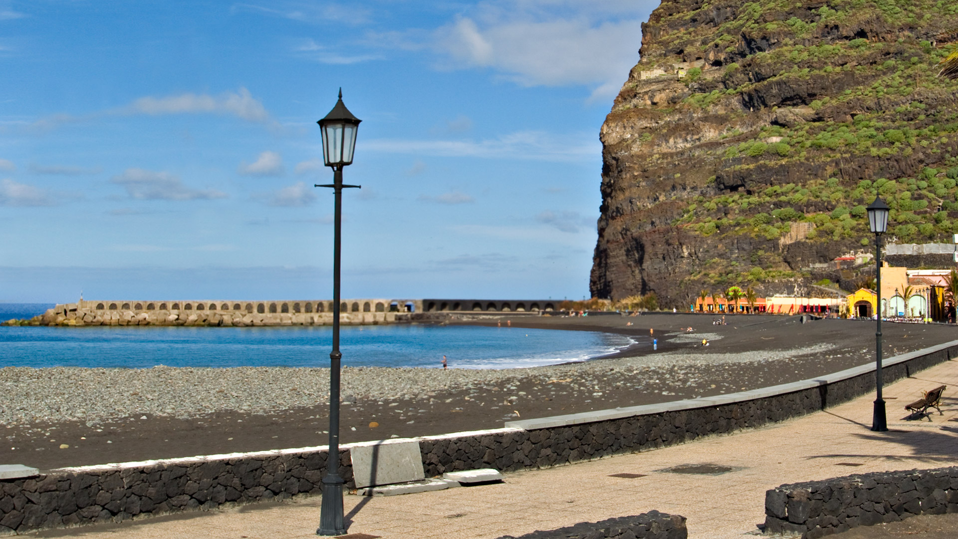
The GR-131 El Bastón starts here at the sign at the foot of the cliff and climbs up to the Roque de los Muchachos (2,426 m). Anyone who stands in Puerto de Tazacorte and sees the sign also sees the task before them: 2,426 meters uphill, all of La Palma’s climate zones in one day. The El Time Trail is the first section of this epic tour.
For hikers planning the GR-131-Stage 1 (Puerto Tazacorte – Roque de los Muchachos): The El Time trail is the first hour of this epic tour. Anyone who walks the El Time trail independently (descent) will already know the route for the big climb – which makes planning easier. The difference: on the big climb you go through and continue, on the El Time path you turn around at the harbour. Both times: the same path, two different experiences.
This article is based on the on-the-ground knowledge of the Gequo editorial team – publishers of the Reisezeit hiking guides and operators of Sunhikes.com. Last updated: May 2026


