
Hike Llano de las Moscas to Pico Nambroque
Pico Nambroque (1,922 m) is the second-highest peak in the Cumbre Vieja – and the most unusual. While most neighboring volcanoes consist mainly of scoria, Nambroque is based on a massive basalt structure and has rocky phonolite domes. At the summit, deep lava and degassing vents lead directly into the interior of the mountain. The hike from Llano de las Moscas on the SL-LP 125 is 9 km, 454 m, moderate, 3:00–3:30 hours.
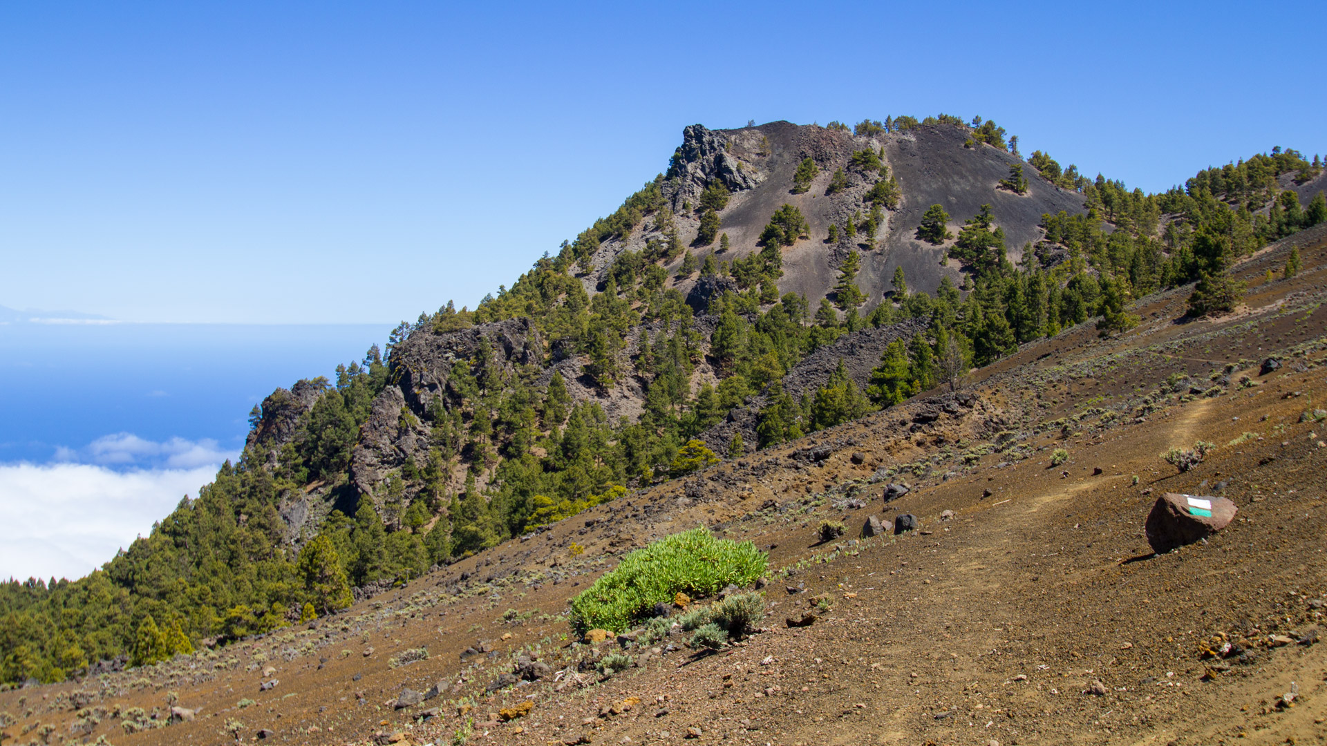
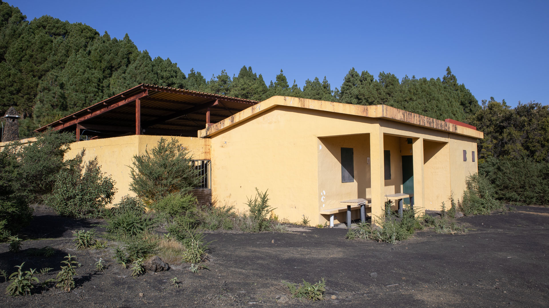
The starting point is the unmanaged refuge Refugio de las Moscas. According to Sunhikes, a 4×4 vehicle is required to get there – the Pista de Cabrito from the LP-301 between km 8 and 9 is very difficult to drive in places. If you don’t have an off-road vehicle, park at the intersection with the PR-LP 16 (approx. 1.4 km before the hut) and walk the last 1.4 km.
The route offers wonderful insights into the volcanism of the Cumbre Vieja and fantastic views over the island of La Palma. Crowd level: low — one of the quietest summit trails in the natural park.
Route details at a glance
| Route type | Out and back |
|---|---|
| Distance | 9.0 km |
| Altitude | 454 m ascent / 450 m descent |
| Highest point | 1,908 m (summit Nambroque: 1,922 m) |
| Lowest point | 1,501 m (Refugio de las Moscas) |
| Duration | 3:00-3:30 hours |
| Difficulty | moderate (sure-footed, easy to follow) |
| Starting point | Refugio de las Moscas – Directions Pista de Cabrito, LP-301 km 8-9 – 4×4 recommended |
| Trail marking | SL-LP 125 (green and white) |
| Protection status | Cumbre Vieja Natural Park |
| Equipment | Rations, water, sturdy footwear, sunscreen, waterproofs, windproof layer |
Directions
From the LP-301 (Cumbre road) turn onto the Pista de Cabrito between km 8 and 9 – at the junction there is a planted traffic island, the first few meters are still asphalted. After a small gorge and a basalt wall, the track runs parallel to the mountainside. After about 2.6 km: intersection with a small stone hut (left). This is where the PR-LP 16 meets the slopes. If you don’t have a 4×4, park here and walk the last 1.4 km along the hiking trail to the hut. The road via the first slope that branches off to the right uphill leads to the Refugio de las Moscas in 1.9 km.
The route in detail
Refugio de las Moscas to Hoyo Negro (km 0–5)
From the Refugio de las Moscas on the SL-LP 125 (green-white) uphill through sparse pine forest. The path winds upwards in numerous curves. Along the way: views extending down the east coast to the capital Santa Cruz, views of the red volcanic cone of Montaña Calero. At a crossroads with a cairn, turn left uphill to Nambroque.
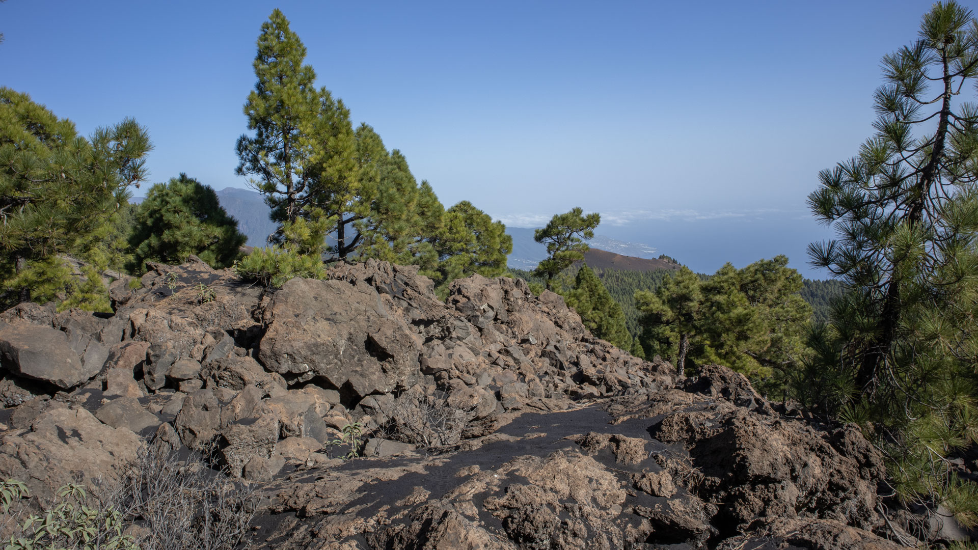
On a basalt wall, the path leads over a small natural stone staircase through the rock and then winds along the back of the rock formation, supported by small walls. Below right: deep erosion gully in loose volcanic rock. First views of the Cumbre Vieja. Then: cross the gully onto an open mountain slope covered in dark brown lapilli. Diagonally uphill. Above: intersection with GR-131. Then continue on the Ruta de los Volcanes towards Hoyo Negro.
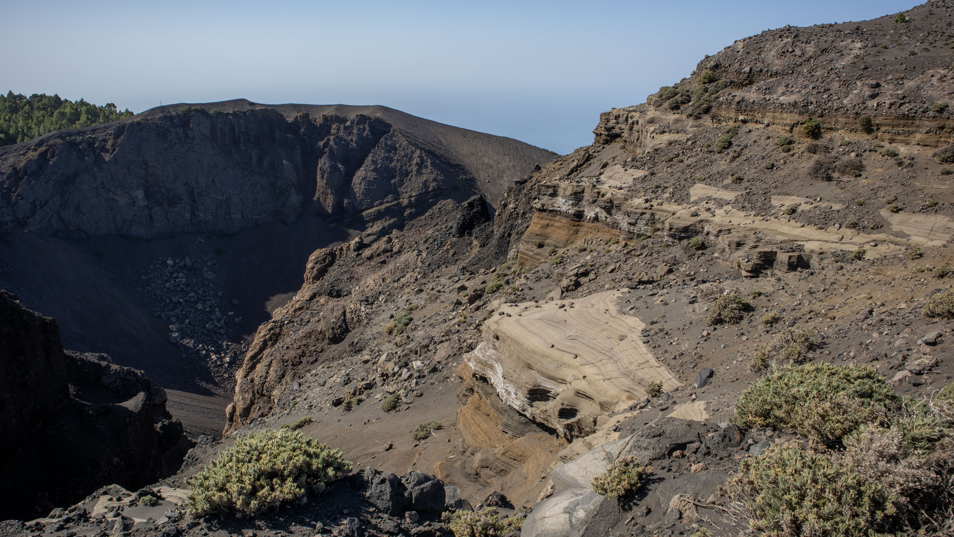
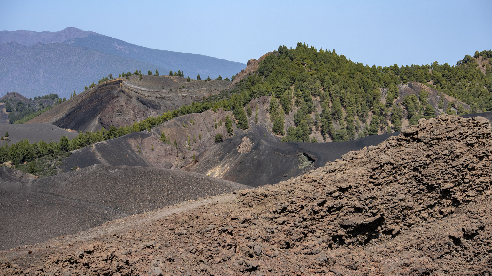
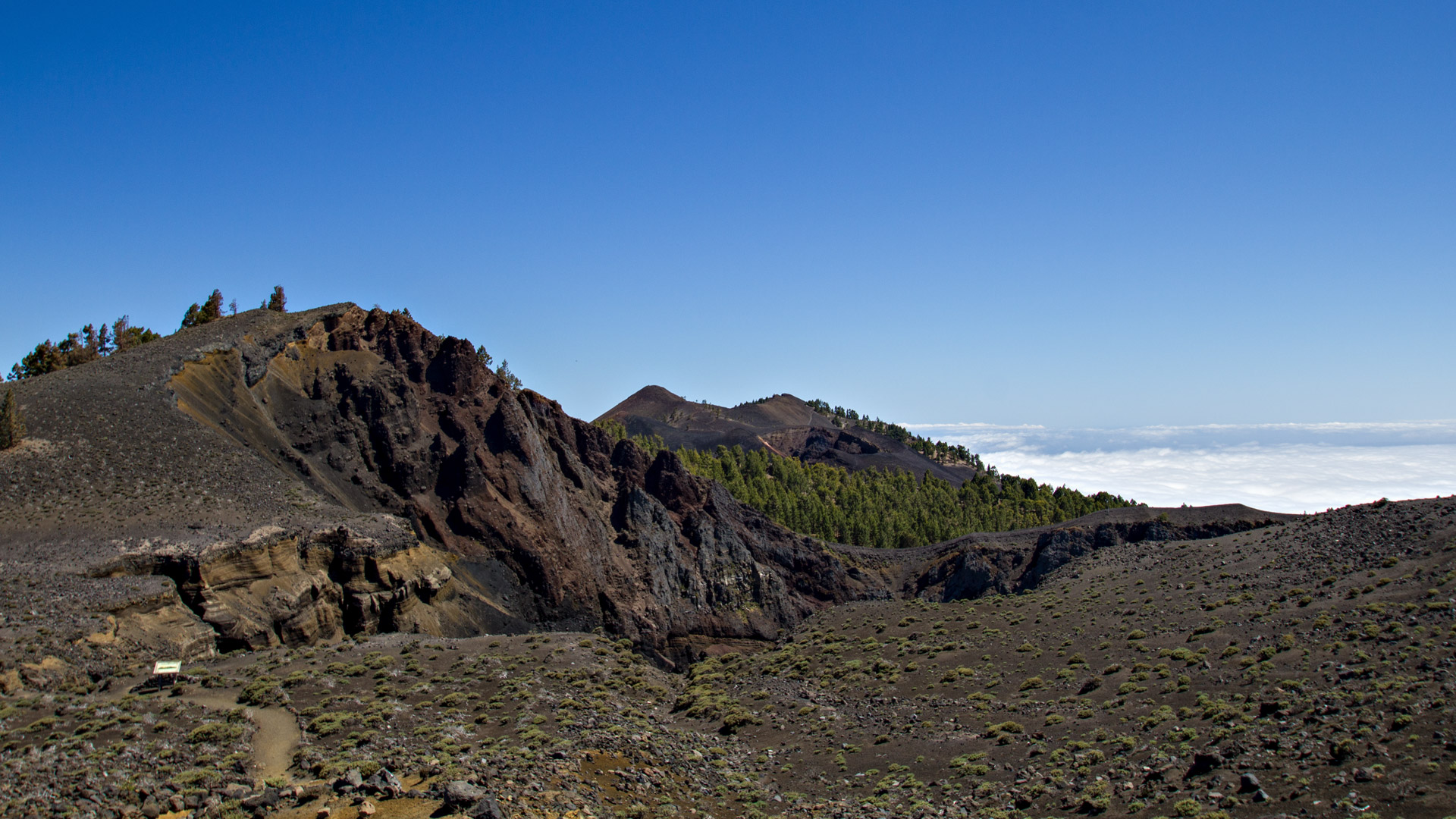
At Hoyo Negro: the deep, dark explosion crater of Nambroque on its western flank. Impressive rock layers in different shades of brown. View south over the Montaña del Fraile with the Duraznero crater to the peaks of Deseada.
Climb to the summit of Pico Nambroque (km 5-9)
Left above the crater continue south. After a short climb: pine forest. Then follow the path that branches off to the left to Nambroque. On the way to the summit: a small crater, then a round vent about a meter in diameter – an old lava and degassing vent from the volcano. Continue through a depression and over a steep, slippery path to the crater rim. On the way there is a narrow crevice in the rock that forms an opening to the main crater.
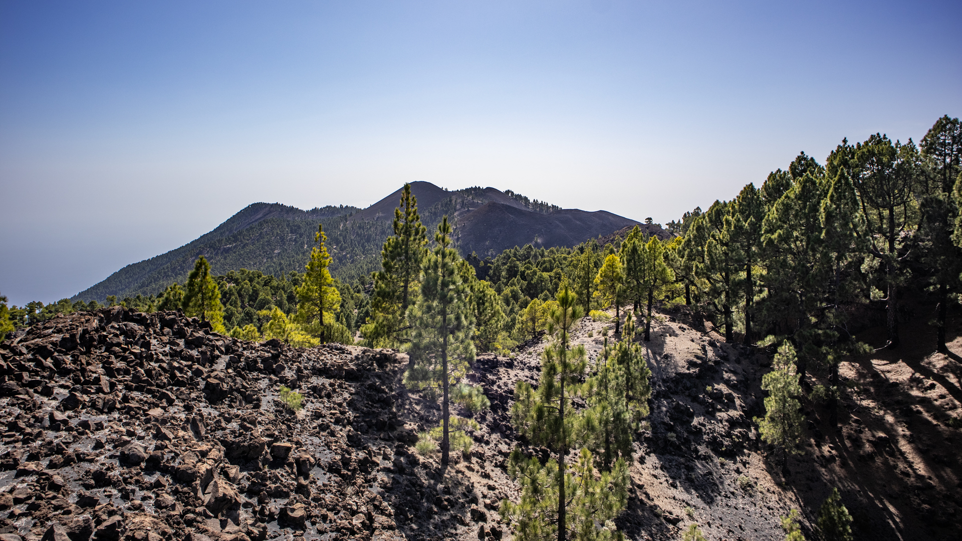
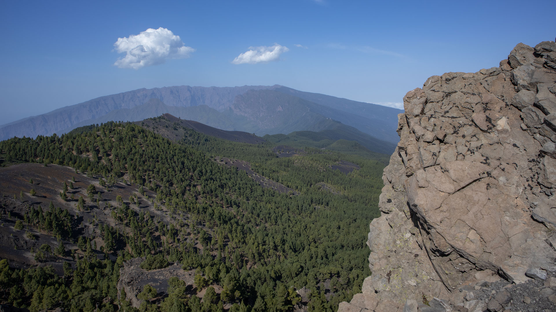
At the summit of Pico Nambroque (1,922 m): spectacular panoramic view over the ridge of the Cumbre Vieja to the summit chain of the Caldera de Taburiente. In the south: the highest peaks of the volcano route. The impressive phonolith domes rise prominently in front of the summit. Between the bright rocky cliffs: view of the east coast of La Palma. Return on the same path. At the cairn triangle, a shortcut via the forest track is possible.
Phonolite domes: what makes Nambroque unique
The Pico Nambroque is the only mountain in the Cumbre Vieja with rocky features in the form of phonolite domes. Phonolite – also called Klingstein – is a light, fine-grained volcanic rock that arises from slowly rising, silicate-rich lava. It differs fundamentally from the dark red and black scoria cones of the neighboring volcanoes. The bright cliffs of Nambroque peak are visible from afar, giving the mountain its distinctive silhouette.
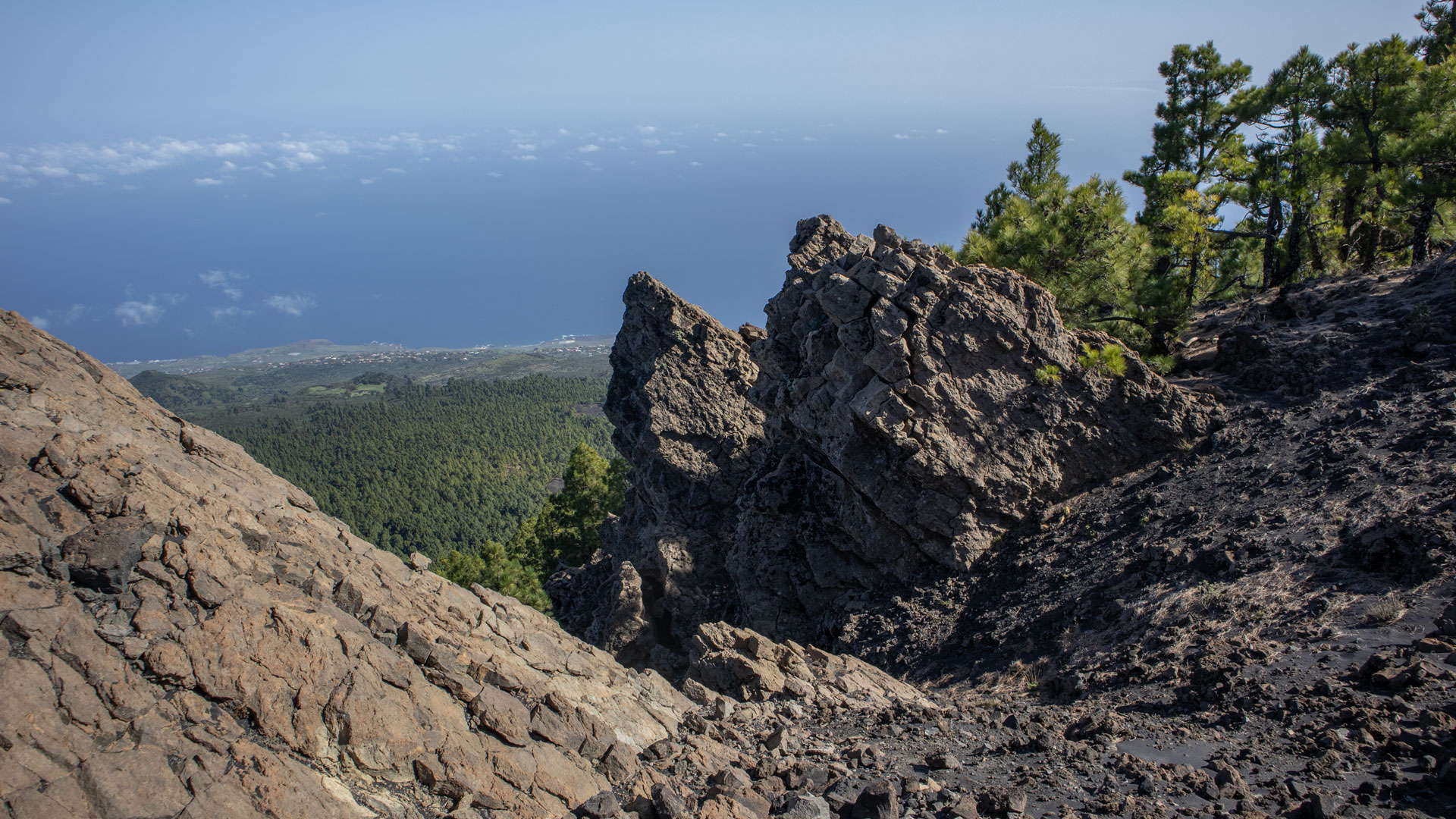
The deep lava shafts and degassing vents plunging into the heart of the mountain are another fascinating geological feature. These vents formed as the volcano cooled and contracted. The round vent with a diameter of one meter on the ascent path is one of them – a vertical tunnel deep into the volcano, dark and mysterious.
Best time to visit
| Season | Character | Note |
|---|---|---|
| Spring (March–May) | Excellent long-distance visibility; pine forest is fresh and green | Optimal conditions |
| Summer (June–Aug) | Lapilli sections hot | Early start; lots of water |
| Autumn (Sept-Nov) | Best panoramic light | Very quiet — you will often have the trail to yourself |
| Winter (Dec-Feb) | Cool and windy on the ridge | Wind protection mandatory |
Accommodation: El Paso — Clariso
The Refugio de las Moscas is located near El Paso. Holiday homes in El Paso on clariso.eu — Holiday homes El Paso. El Paso is the ideal base for all Cumbre Vieja tours.
Combinable tours
The Llano de las Moscas route connects seamlessly with the large Birigoyo-Nambroque circuit. If you want to get to know the Nambroque from a different side, combine both:
| Tour | Data | Character |
|---|---|---|
| Circular hike to Pico Birigoyo and Pico Nambroque | 15.8 km, difficult | Nambroque from the north via GR-131 |
| Circular hike to the Pico Birigoyo | 5.1 km, moderate | Short Cumbre Vieja circuit the following day |
| Ruta de los Volcanes | 18.7 km, difficult | The big volcano route from the same natural park |
GPS track and 3D route planner
The GPS track shows the junction at the cairn triangle and the shortcut on the way back via the forest path. The steep, slippery climb to the crater rim is particularly marked in the track. With the free 3D route planner, the route can be extended or combined with the Ruta de los Volcanes – directly in the browser, without an app.
To the route page on Sunhikes: Hike Llano de las Moscas to Pico Nambroque
3D route planner from Sunhikes – customize and combine routes
Practical Tips
Emergency call 112. Recommended for 4×4 travel. If you don’t have an off-road vehicle: park at the PR-LP-16 intersection (2.6 km from LP-301), reach the hut on foot in 1.4 km. Occupancy is low – you are often alone on this route. Bring enough water, no springs on the route.
Note: Nature Park
Completely within the Cumbre Vieja Natural Park. Road restrictions, garbage collection, fire ban.
Frequently asked questions
Do I really need a 4×4?
What are Phonolite domes?
The Llano de las Moscas plateau
The Llano de las Moscas (literally ‘Fly Plain’) is a high plateau covered with heather and cistus at an altitude of 1,500 meters in the Cumbre Vieja Natural Park. The unusual name refers to the many insects that swarm over the cistus flowers here in summer. The Refugio de las Moscas refuge lies on the edge of this plateau and, despite its remoteness, is an important junction: several hiking trails intersect here, including the PR-LP 16, which leads to the Refugio El Pilar.
The isolation of Llano de las Moscas is part of its appeal. No noise, no other hikers (occupancy rate: low), just the wind in the pine trees and the buzzing of insects. Anyone who arrives early in the morning will experience the plateau at first light – the rock roses glow white-pink, the heather trees form a dark counterpart. This is a picture you won’t forget.
The Hoyo Negro: Nambroque explosion crater
The Hoyo Negro on the western flank of Nambroque is botanically and geologically fascinating. The explosion crater is deep, dark and heavily shaped by erosion from wind and water. The rock layers in different shades of brown show the history of several eruption phases of the Nambroque. The view south from the edge of Hoyo Negro — over the Montaña del Fraile, the Duraznero to the peaks of Deseada — is one of the most complete views along the Cumbre Vieja volcanic chain.
If you know the Pico Nambroque from the other side – from the large Birigoyo-Nambroque circuit or the Ruta de los Volcanes – you will experience it from the Llano de las Moscas in a completely different perspective: from the south, deeper, with the Hoyo Negro as an intermediate step before you reach the summit. The route is quieter, shorter and, due to its isolation, a counterpoint to the well-frequented Ruta de los Volcanes. Low utilization – that’s a real quality advantage here.
A practical note: The Pista de Cabrito is even more difficult to drive after rain than usual. If you arrive in winter or after heavy rain, you should also park your 4×4 from the PR-LP-16 intersection. The upper section of the track is narrow and prone to minor landslides – don’t take any risks.
This article is based on the on-the-ground knowledge of the Gequo editorial team – publishers of the Reisezeit hiking guides and operators of Sunhikes.com. Last updated: May 2026


