Cumbre Nueva: The Ridge Connecting Two Worlds
The Cumbre Nueva often stands in the shadow of the better-known Caldera de Taburiente and the volcanically active Cumbre Vieja — yet geologically it ranks among La Palma’s key regions. This densely forested mountain ridge connects the massive rim zone of the Caldera de Taburiente in the north with the Cumbre Vieja in the south, forming the central transition between these two very different landscapes.
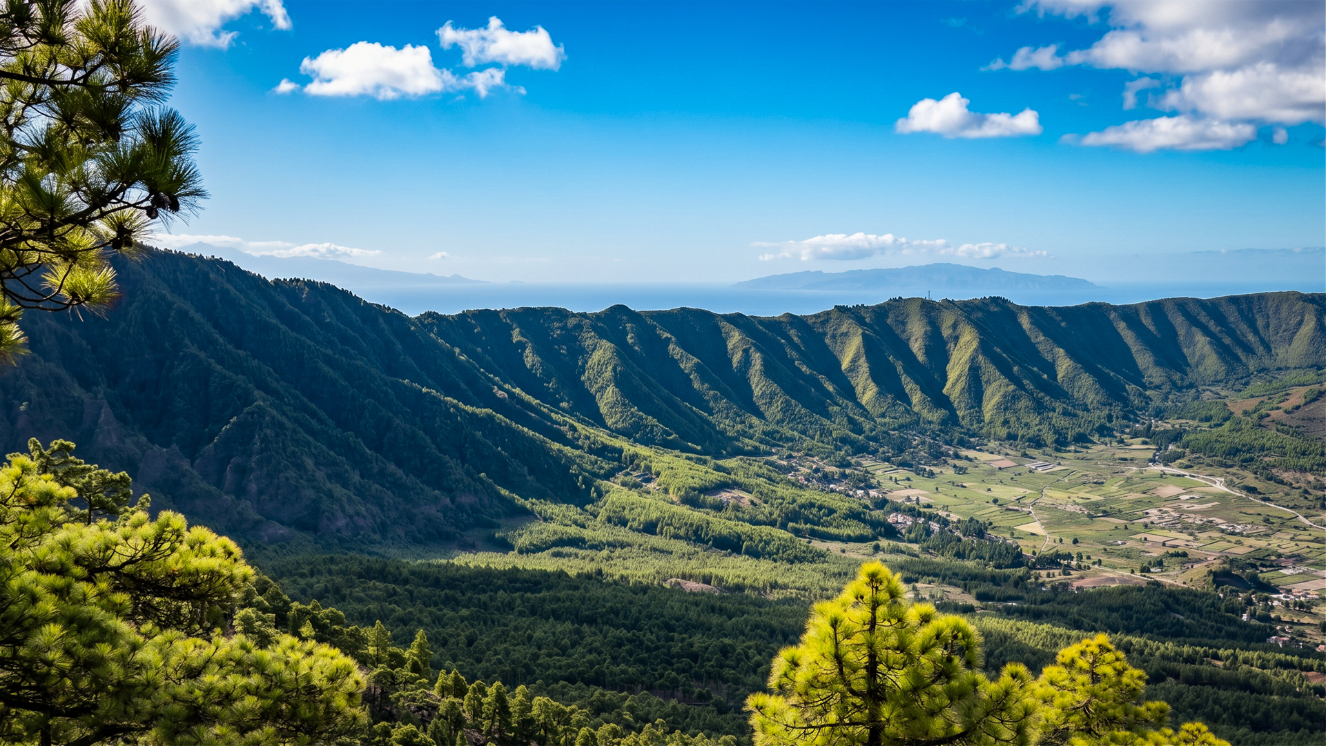
Geologically, its history stretches far back: around 560,000 years ago, a massive flank collapse occurred here in which large sections of the then-western slope slid into the sea. This event permanently shaped the development of the Aridane Valley. Today’s Cumbre Nueva forms the heavily eroded remnant of this former mountain chain and is thus one of the oldest preserved landscape forms at the centre of the island.
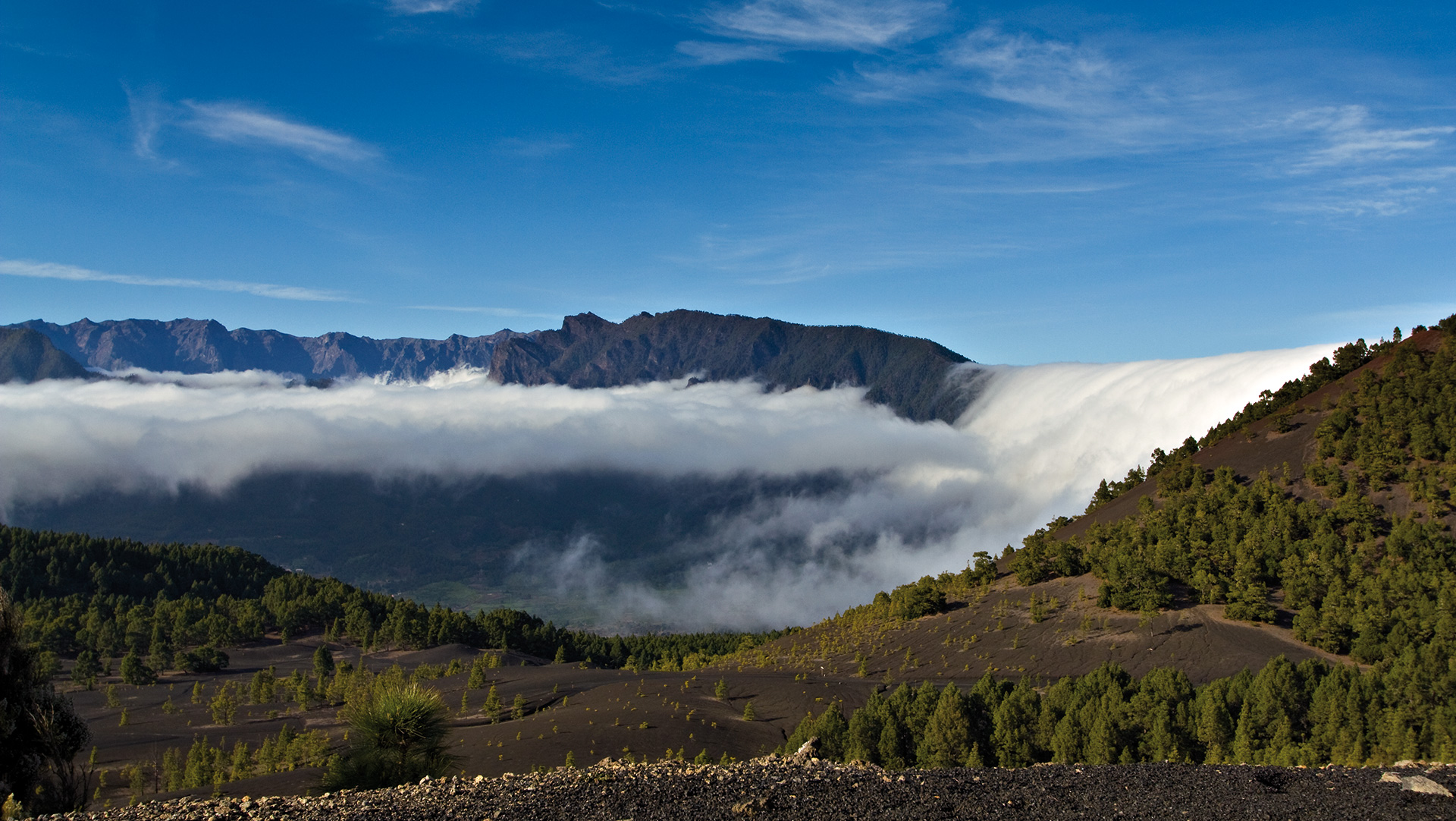
For visitors, the Cumbre Nueva is best known for the Cumbre Tunnel — the road tunnel connecting the east and west of La Palma, offering one of the island’s most striking weather demonstrations: the east (Santa Cruz de La Palma) is frequently under cloud, while the west (El Paso and Los Llanos de Aridane) enjoys sunshine over 90 percent of the time.
Pine Forests and Highland Landscape
The slopes of the Cumbre Nueva are covered by extensive pine forests. The Canarian pine (Pinus canariensis) appears here in its typical form: long needles, open crowns, and deeply furrowed trunks shape the landscape. Sunlight filters through the loose canopies, giving the forests an exceptionally bright atmosphere. At elevations between roughly 1,200 and 1,600 metres, the Cumbre Nueva is one of the finest forest hiking regions on La Palma — quiet, well-marked, and with views reaching through the trunks into the Caldera and across the west coast.
The Cumbre Tunnel
The LP-3 (Carretera de la Cumbre) connects Santa Cruz de La Palma with El Paso and Los Llanos de Aridane, passing through the Cumbre Nueva via two road tunnels. The drive through the newer, roughly 2.6-kilometer-long west tunnel often delivers a striking weather change: on the eastern side, trade wind clouds frequently dominate the landscape, while immediately after the tunnel on the western side, brilliant sunshine is common. This occurs as moist trade winds rise along the eastern slopes, cooling and condensing into clouds. On the western side, the air descends, warms, and the clouds dissolve.
Conclusion
The Cumbre Nueva is La Palma’s quiet climate divide. It connects not only two mountain ranges, but also two completely different landscape and climate zones. Its extensive pine forests, the spectacular trade wind cloud phenomenon, and its geological history make it one of the most fascinating natural areas on La Palma.
Frequently Asked Questions
What is the difference between Cumbre Nueva and Cumbre Vieja?
Where is the Cumbre Tunnel located?
Why do trade wind clouds form so frequently at the Cumbre Nueva?
Can you hike on the Cumbre Nueva?
How high is the Cumbre Nueva?
This article is based on the on-the-ground knowledge of the Gequo editorial team – publishers of the Reisezeit hiking guides and operators of Sunhikes.com. Last updated: May 2026