Playa de La Bombilla – Quiet Neighbour of Puerto Naos
Important Notice
La Bombilla is undergoing a controlled, phased reopening. After the 2021 Tajogaite eruption, the first residents are slowly returning — the place is coming back to life, but under strict conditions and with permanent CO₂ monitoring.
This does not mean it is open to tourists. The ground and buildings still emit elevated concentrations of carbon dioxide (CO₂) — invisible, odourless, dangerous. Entry is permitted only with authorisation and an approved CO₂ meter. Spontaneous visits for swimming are strictly prohibited.
La Bombilla is not a lost place — but not yet a visitor destination. For current status: Ayuntamiento de Tazacorte or Cabildo Insular de La Palma.
A Protected Cove? What La Bombilla Was
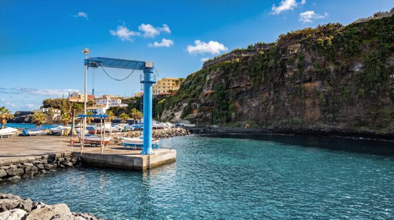
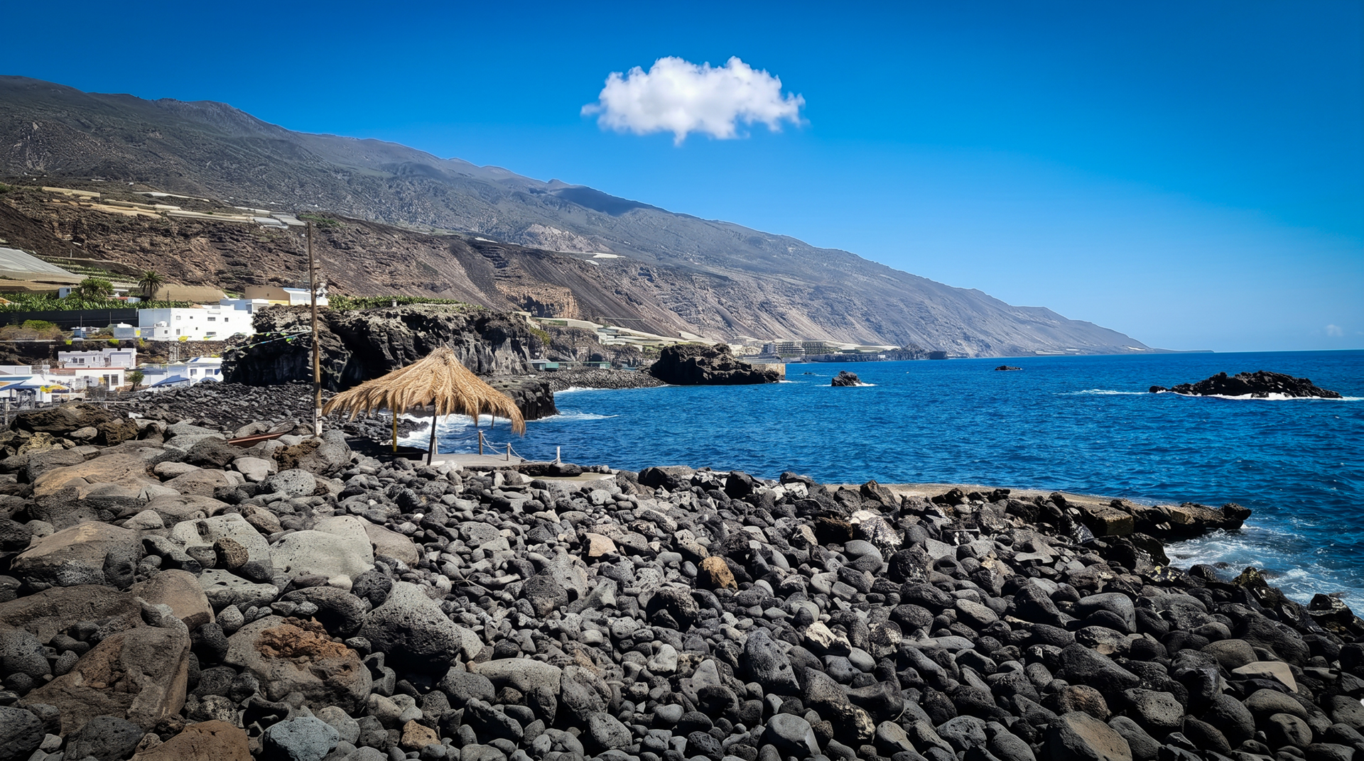
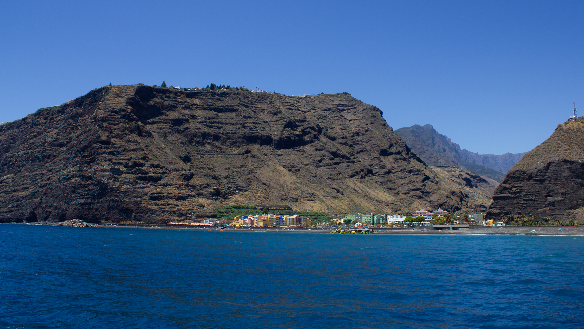
La Bombilla was a small fishing settlement on La Palma’s west coast, between Puerto Naos and the harbour of Tazacorte. No sandy beach in the classic sense — rather a rocky, sheltered cove of large round lava pebbles, with a concrete ramp where fishermen launched their boats. Colourful, partly informally built huts right at the water’s edge defined the character of this place.
There were no sun loungers, no beach flags, no lifeguard. La Bombilla was not a tourist beach — it was a working place for fishermen and a rugged, authentic spot for those who sought exactly that: lava rocks, clear water, silence.
The underwater world in front of the cove was genuinely remarkable. The lava rock formations provided habitat for Canarian coastal fish — parrotfish, moray eels, wrasse. The water on the west coast is clearer than on the east. For snorkellers willing to make the journey, La Bombilla was a quiet insider tip.
Swimming & Safety
West coast beaches often have undercurrents — even with a calm surface. But swimming here is currently not possible, and curiosity about the lava area should not lead anyone to visit.
Tajogaite 2021: La Bombilla and the Lava Field
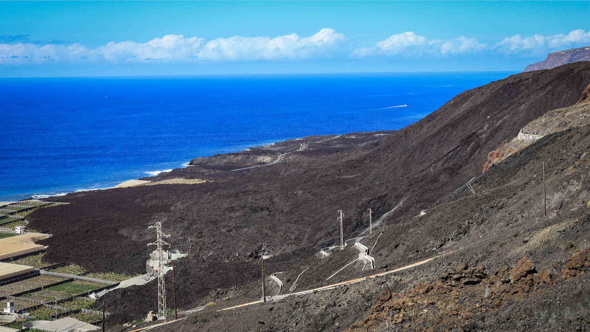
The eruption of Volcán Tajogaite in September 2021 fundamentally reshaped this stretch of coastline. The lava flowed directly north of La Bombilla and into the sea — creating the new lava delta (fajana) visible today from Tazacorte. The access road to La Bombilla was completely swallowed by lava. After the eruption the place was fully sealed off and remained a ghost zone for a long time.
The real problem was not the lava itself, but what comes from the ground: carbon dioxide. Volcanic soils emit CO₂ for years — sometimes decades — after an eruption. In La Bombilla concentrations are particularly high. The gas accumulates near ground level, in cellars, in buildings, in windless hollows. A person who unknowingly walks into a CO₂ cloud loses consciousness within seconds.
The neighbouring Puerto Naos was gradually reopened after extensive measurements, ventilation systems and permanent monitoring. La Bombilla, however, remained closed.
Why People Still Go There
The Tajogaite lava fields are a visually overwhelming phenomenon. New black land on the Atlantic, wisps of steam, the dramatic coastline — many travellers want to see this, and that is understandable. There are official viewpoints and accessible areas from which you can take in the lava fields safely.
What is strictly off-limits: Entering restricted zones independently under the false impression that a “quick look” is harmless. CO₂ gives no warning signal. Anyone entering an affected area without a gas detector will notice nothing — until it is too late.
What Is Accessible Today — And What Is Not
La Palma’s west coast is largely accessible and visitor-friendly despite the eruption. Puerto Naos is open again — with beach, promenade and dining. Puerto de Tazacorte functions normally: the fishing restaurants at the harbour, the boat tours to the Cueva Bonita, the Mirador del Time. The lava delta itself can be experienced from safe viewpoints.
La Bombilla is currently not a destination for day visitors. Whether and when that changes is decided not by travel descriptions, but by measuring instruments. Tazacorte lies a few kilometres to the north — the fishing harbour with its restaurants, the boat tours to the Cueva Bonita and the Mirador del Time up on the cliff. Instead of visiting La Bombilla, plan your afternoon around Puerto de Tazacorte: fresh fish, harbour views, or a dolphin and whale-watching boat excursion.
| Location | West coast of La Palma, between Puerto Naos and Tazacorte |
|---|---|
| Beach | No black sand beach |
| Surf | More moderate than exposed west coast beaches |
| Tajogaite | Check status before visiting |
| Infrastructure | none |
Book holiday rentals near Tazacorte via Clariso.
The Aridane Valley: La Palma’s Most Productive Corner
La Bombilla lies on the edge of the Aridane Valley — the most fertile and economically active part of the island. The terraced slopes are covered with banana plantations producing the Plátano Canario, La Palma’s best-known export fruit. Avocados, mangoes and tropical fruits thrive on the lower slopes. From the coast at La Bombilla you can see this landscape in its full abundance: green as far as the eye can see, until the Cumbre Vieja pushes the slopes upward.
The Cueva Bonita: By Boat from Tazacorte
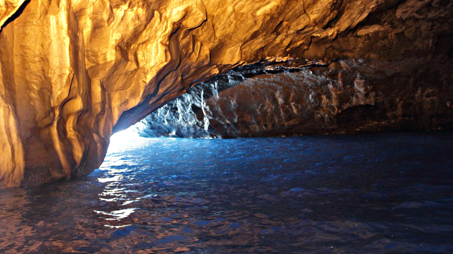
Tours to the Cueva Bonita depart from Puerto de Tazacorte — La Palma’s most beautiful sea cave, reachable only by boat. The play of light in the cave, the blue water and the silence beneath the rock ceiling make this one of the island’s most impressive experiences.
West Coast Year-Round — Practical Information
La Bombilla lies in the rain shadow of the Cumbre Vieja mountain range — the west coast receives around 300 sunny days per year and is usually clear and warm even in January and February. Water temperatures of 20 to 22 degrees allow swimming all year round. This year-round reliability makes the west coast La Palma’s most important tourism region, but not La Bombilla.
Puerto Naos — nearest accessible beach, a few kilometres away, black lava shingle, promenade, dining, lifeguard in season.
Puerto de Tazacorte — fishing harbour, restaurants, departure point for Cueva Bonita tours and whale-watching trips.
Cueva Bonita — sea cave, accessible only by boat from Puerto de Tazacorte. Light show in turquoise-blue water, one of La Palma’s most impressive natural experiences.
Mirador del Time — cliff viewpoint above Tazacorte, with views across the entire Aridane Valley and the west coast.
Current access information: Cabildo Insular de La Palma or Ayuntamiento de Tazacorte.
Current State After Tajogaite
The Tajogaite eruption in 2021 changed the coast between Puerto Naos and Tazacorte. La Bombilla lay on the edge of the lava zone — some coastal sections were altered, others left untouched. The current state of Playa de La Bombilla and its access road should be checked with local information points or current online reports before visiting.
Conclusion: Playa de La Bombilla
La Bombilla was a quiet, rugged place – a fishing settlement with a cobblestone cove and clear water, no sandy beach, no infrastructure, but an authentic piece of La Palma’s west coast. The Tajogaite eruption transformed this place and made it inaccessible for the time being.
Those who want to explore the west coast will find more than enough in Puerto Naos, Tazacorte and the surrounding excursion options. La Bombilla will return when the readings allow it – not before.
Frequently Asked Questions
How did La Bombilla get its name?
Did the Tajogaite eruption change Playa de La Bombilla?
How do you get to Playa de La Bombilla?
Are there restaurants nearby?
This article is based on the on-the-ground knowledge of the Gequo editorial team – publishers of the Reisezeit hiking guides and operators of Sunhikes.com. Last updated: May 2026