
Hike Barranco Fagundo and El Tablado
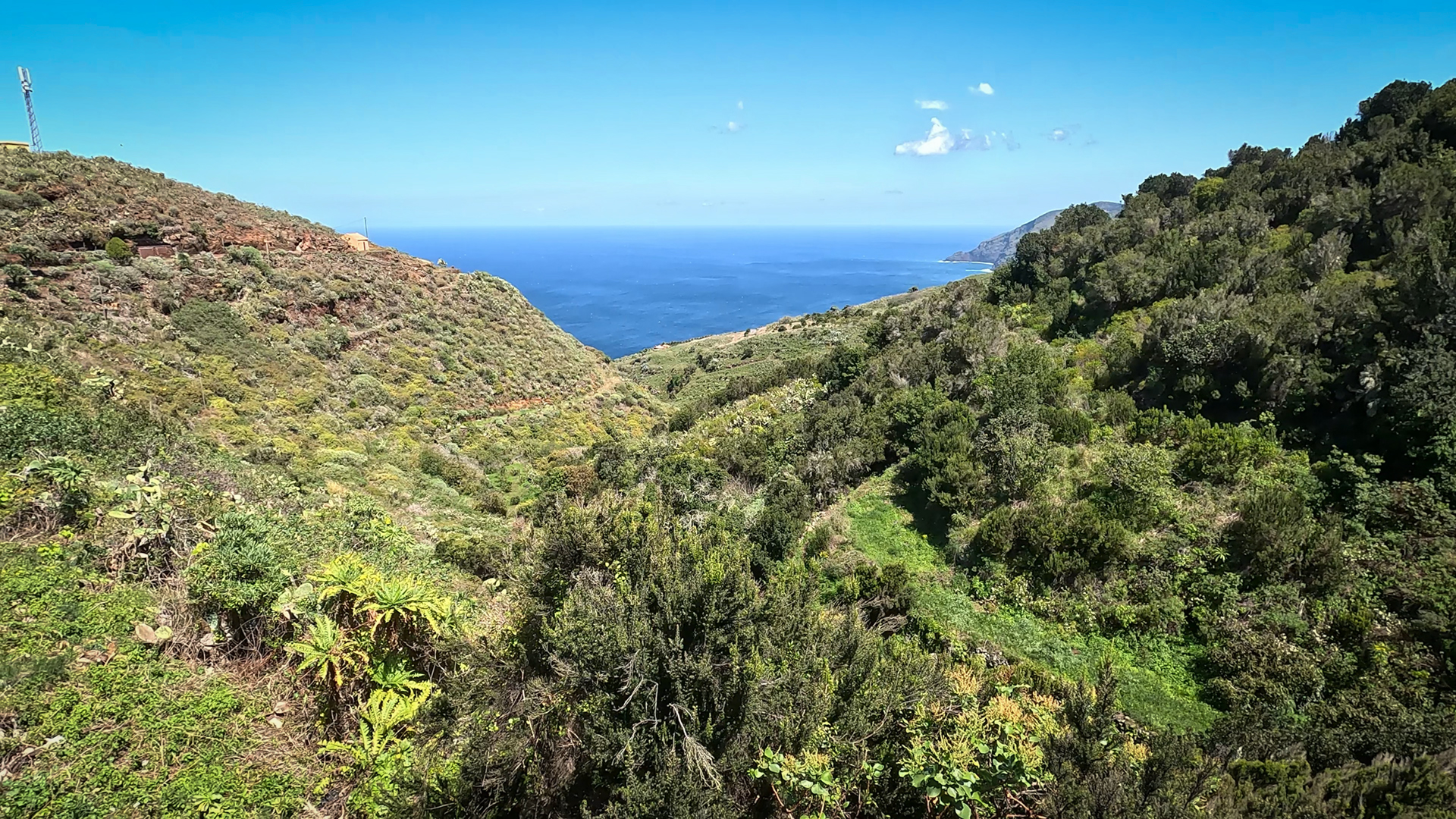
The Barranco Fagundo is one of the most impressive gorges in La Palma: deep ravines, sheer rock faces, erosion formations in various shades of brown and vegetation that alternates between spurge plants on the dry slopes and laurel forest vegetation in the moist gorge depths. El Tablado is right on the edge of this gorge and offers the ideal starting point.
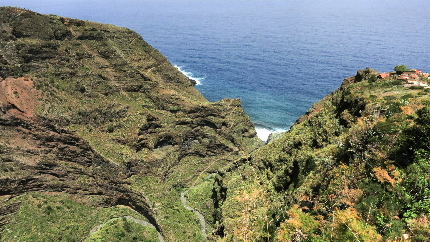
The Camino Real runs through El Tablado, which leads through the Barranco to Juan Adalid. A steep zigzag path leads down into the depths. A 45-minute hike from El Tablado leads to the bottom of the gorge. The hike is challenging, but the magnificent views of the coast make the effort well worth it.
The Barranco Fagundo gorge is part of the Guelguén Nature Reserve. Rare endemics can be found on the rocks of the gorge. The Barranco owes its inclusion in the protected area to the lushly growing laurel forest in the higher regions.
Route Facts at a Glance
| Route type | Out and back (El Tablado → canyon floor → return) |
|---|---|
| Distance | ca. 4–6 km |
| Elevation change | approx. 300–400 m descent and ascent |
| Duration | ca. 2:30–3:30 hours |
| Difficulty | Moderate to strenuous (a good head for heights is essential, steep sections) |
| Starting point | El Tablado, Mirador Barranco Fagundo (El Moral) |
| Trail marking | Camino Real (old trail, partially waymarked) |
| Protected area | Guelguén Nature Reserve |
| Equipment | Water, sturdy footwear, sun protection, rain protection |
Getting There
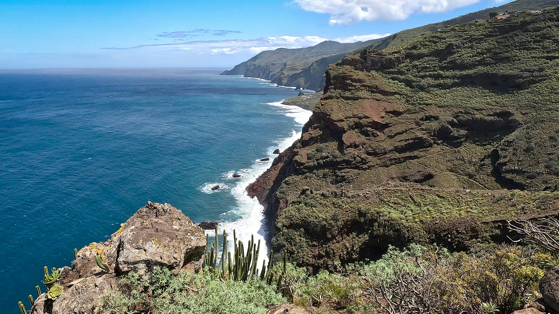
El Tablado is located on the LP-1, exit near Roque del Faro via a narrow asphalted cul-de-sac. Starting point: Mirador Barranco Fagundo (also El Moral), which marks the entrance to El Tablado on the western side. From here you have the first clear view into the depths of the gorge.
The Gorge in Detail
El Tablado to the gorge bottom
From El Tablado on the old Camino Real, which leads steeply in zigzag bends down into the gorge. The rock formations change from basalt to discoloured rock and back to basalt — a geological profile of La Palma’s volcanic history in layers. In the dry slope zones: spurge, red sorrel, various species of viper’s bugloss in shades of blue, pink and white.
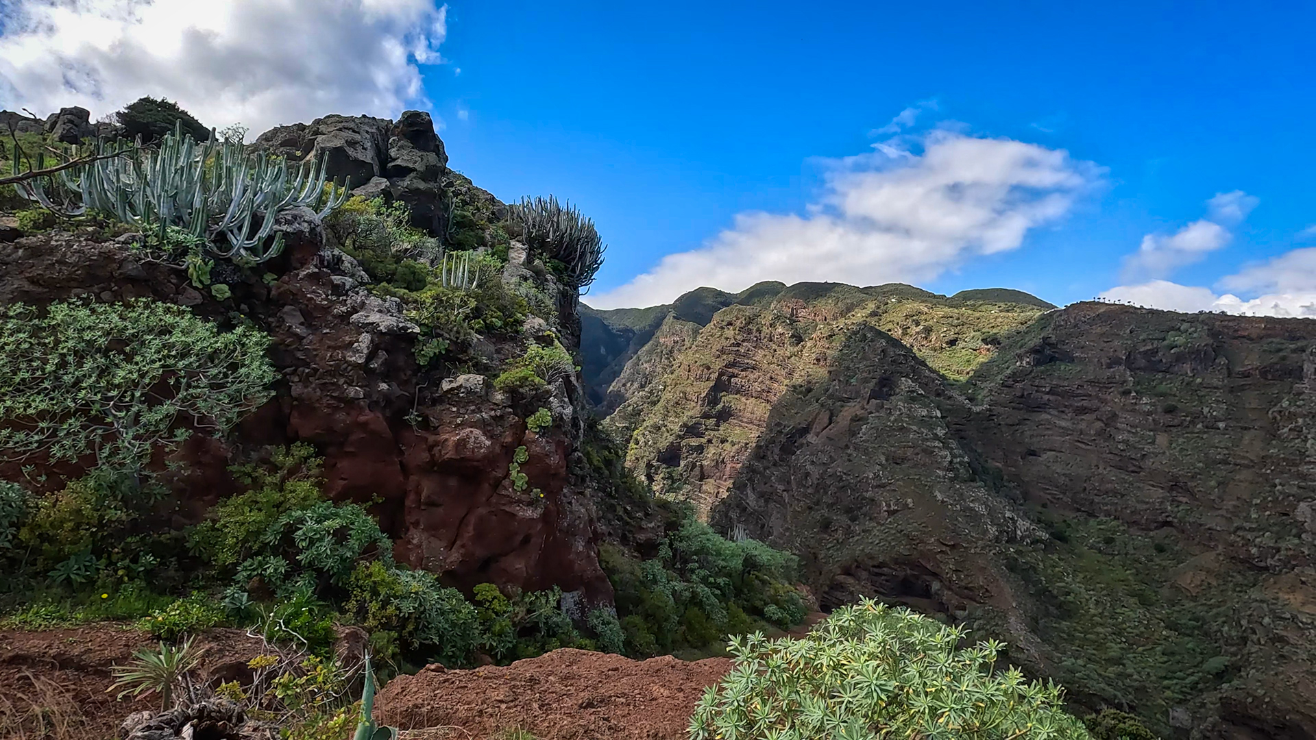
The path is demanding: steep sections, slippery ground after rain, exposed passages on the steep slopes. The compensation: With every metre you descend, a new picture opens up – the canyon walls on both sides, the sea on the horizon, the path that was visible from above on the other side.
The mouth of the gorge
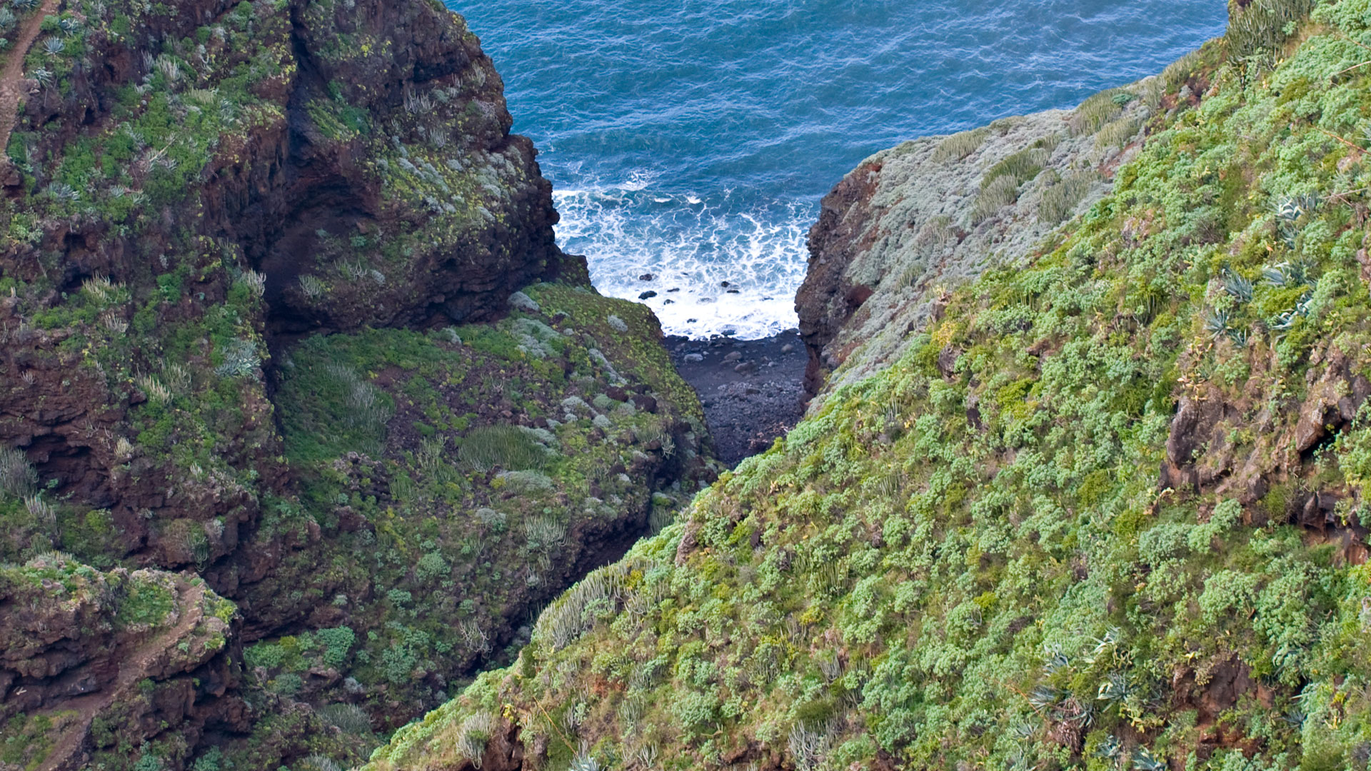
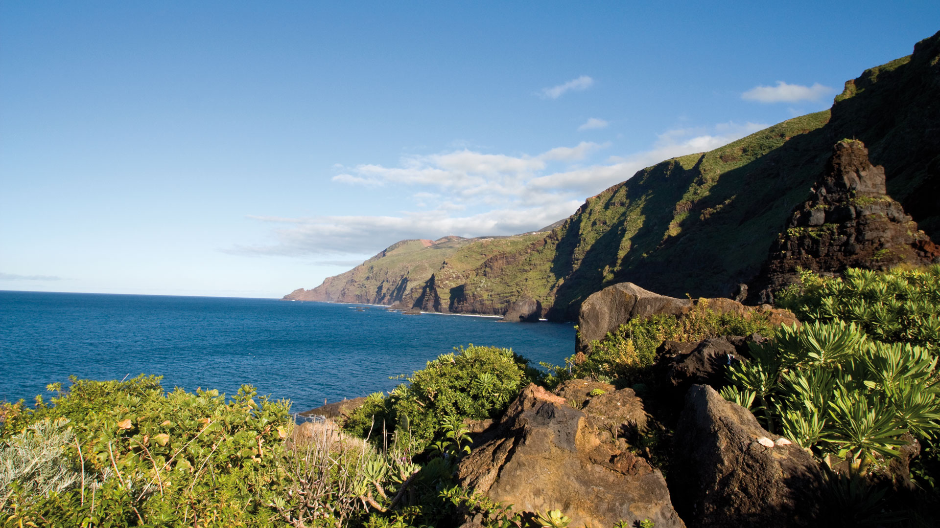
The Camino Real leads to the foot of the gorge, with the sea in sight. The mouth of the Barranco Fagundo is one of the most impressive geological points on the north coast: the gorge meets the cliffs, the rock faces fall into the sea. The path along the rock faces at the mouth is the most striking image of this route.
Vegetation of the Gorge: Endemics and Laurel Forest
The vegetation of the Barranco Fagundo ravine is exceptionally rich in species. Euphorbiaceae species dominate on the sunlit steep slopes: Tabaiba dulce, Cardón, various species of spurge. In the humid northern areas: tree heather (Erica arborea), Canarian laurel (Laurus novocanariensis), barbusano and ferns. Rare endemics grow on the rocky overhangs and only survive in these canyon habitats – protected from sun, frost and goats.
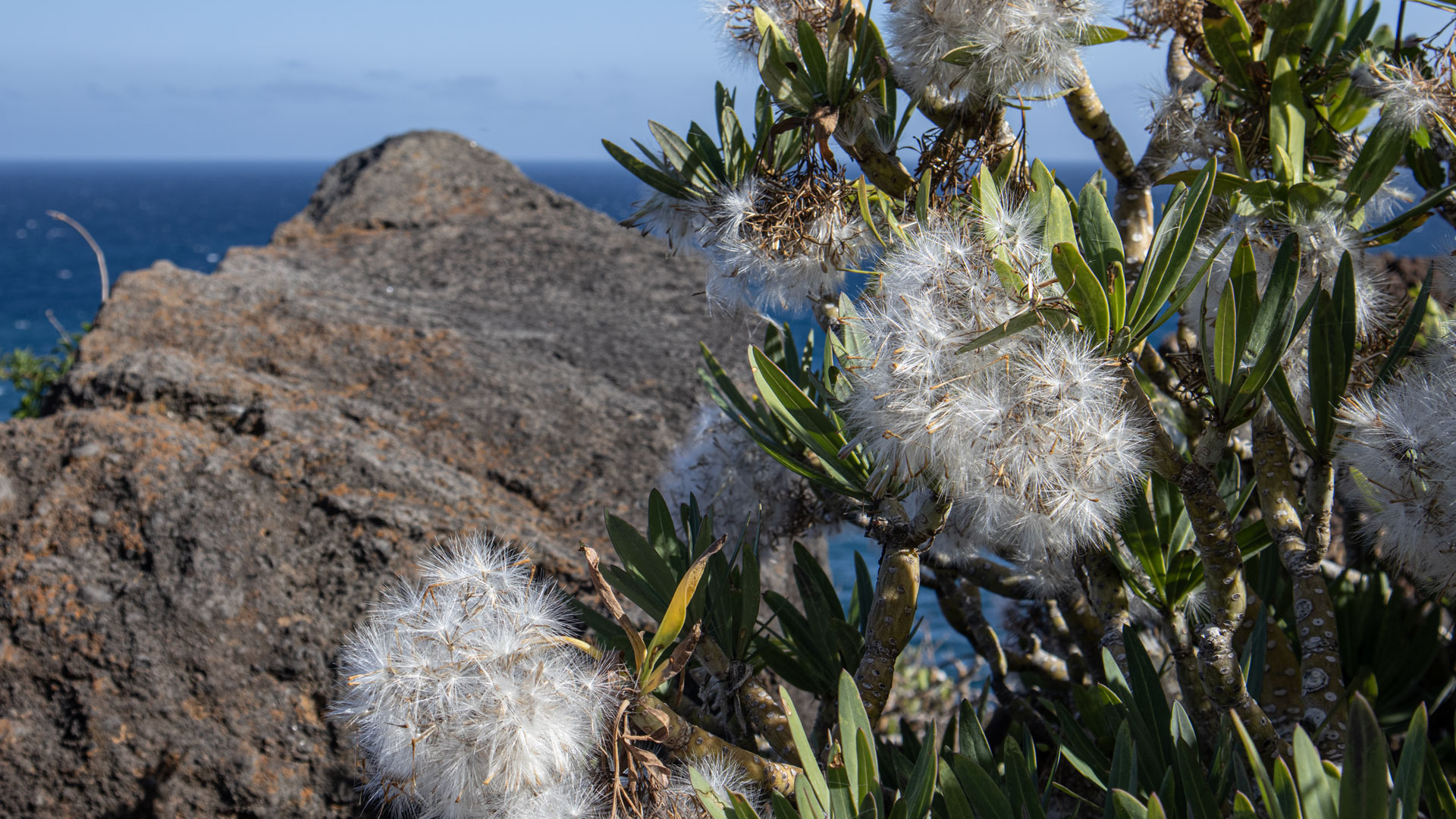
The laurel forest in the higher regions of the gorge is the reason for its inclusion in the Guelguén Nature Reserve. The Guelguén protected area is the most important laurel forest protected area on the north coast of La Palma – next to Los Tilos in the east of the island.
El Tablado: The Village on the Edge
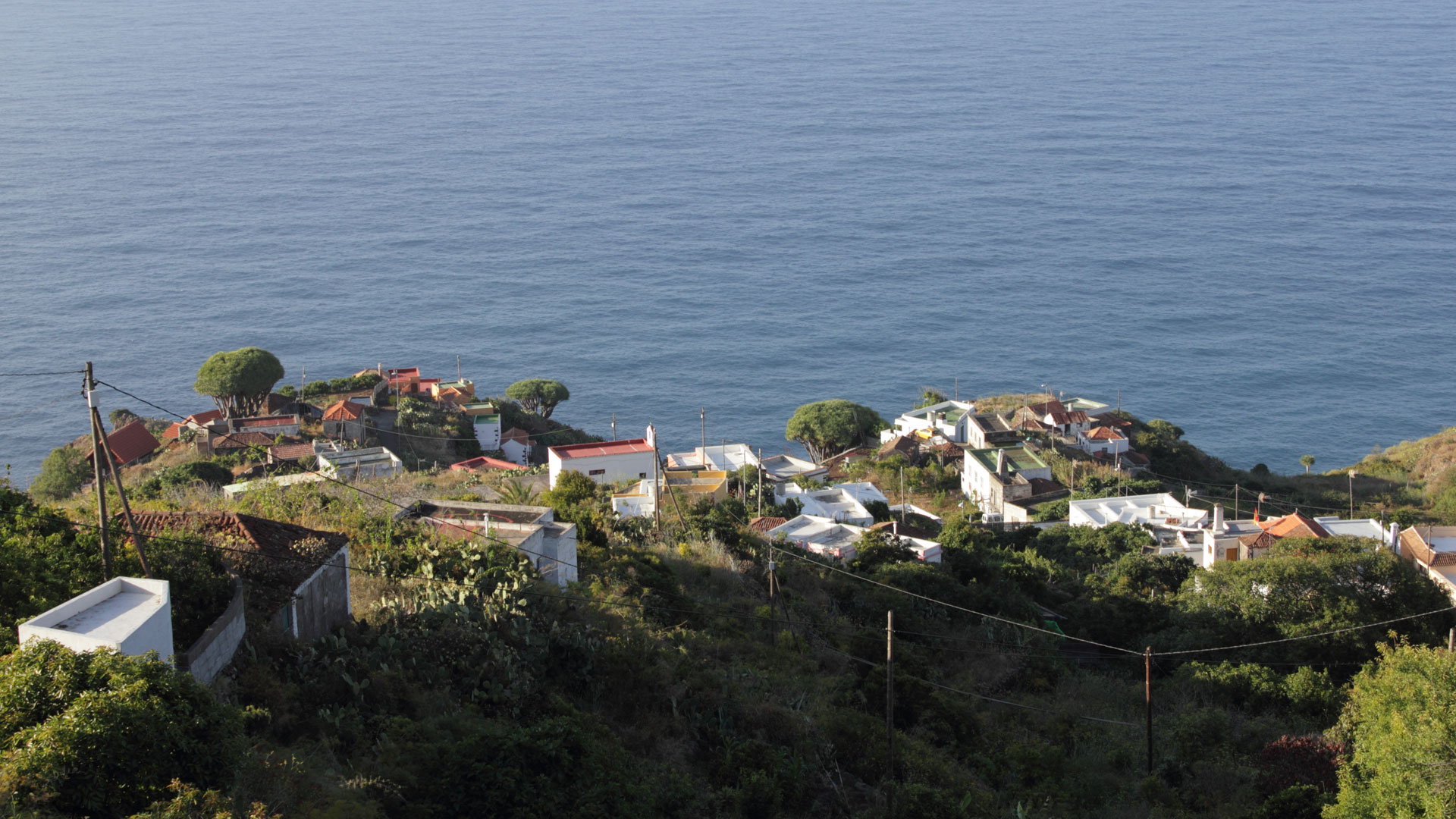
Seeing El Tablado on a ridge between Barranco Fagundo (left) and Barranco de los Hombres (right) is an unforgettable image. The village literally hangs between two abysses – the gorges drop hundreds of meters deep on both sides. The old dragon trees in the town, the houses made of lava stone, the wide views of the Atlantic: El Tablado is one of the most peculiar and impressive villages in La Palma.
Best Time to Visit
| Season | Character | Note |
|---|---|---|
| Spring (March–May) | Viper’s bugloss in bloom in blue and pink | Botanically best time |
| Summer (June–Aug) | Gorge cool and shady | Comfortable even in heat |
| Autumn (Sept–Nov) | Clear view of the coast | Best light for the estuary area |
| Winter (Dec–Feb) | Rain frequent; Paths slippery | Steep sections tricky after rain |
Accommodation in Garafía
El Tablado is located in the municipality of Garafía. Holiday homes on clariso.eu — Holiday homes Garafía. Casa Julia in Las Tricias is located right on the edge of the Barranco de Izcaqua.
Combinable Hikes
The Barranco Fagundo can be ideally combined with the GR-130 stages from El Tablado. Anyone who visits the gorge in the morning will can easily combine this with the following hikes in the afternoon:
| Tour | Data | Character |
|---|---|---|
| El Tablado to Gallegos (GR-130) | 9.4 km, difficult | Eastern GR-130 stage from El Tablado |
| El Tablado to Santo Domingo de Garafía | 13.2 km, difficult | Western GR-130 stage |
| Franceses – La Fajana – El Tablado | 6.5 km, difficult | Arrival in El Tablado |
GPS Track and 3D Route Planner
A GPS track is recommended for the descent through the gorge – the Camino Real is not always uniformly marked. With the free 3D route planner, the gorge descent with the GR-130 can be combined into a large north coast day tour – directly in the browser, without an app.
3D route planner from Sunhikes – customize and combine routes
Practical Tips
Emergency call 112. Sturdy shoes are mandatory – steep, slippery sections. There are no facilities or places to get refreshments in the gorge. El Tablado has no shops – bring provisions from home.
Note: Nature Conservation
Guelguén Nature Reserve. Directions, waste collection. No extraction of plants or minerals.
Frequently Asked Questions
What is Juan Adalid?
How deep is the Barranco Fagundo?
Viper's Bugloss in the Barranco Fagundo: Blooming in Spring
In spring, the Barranco Fagundo offers one of the most impressive floral displays on the north coast: various species of viper's bugloss (Echium) bloom in blue, pink and white on the steep slopes. The blue Echium simplex and the red Echium aculeatum are the most striking. The vegetation combines these colourful blooms with the green of red sorrel and the silver-grey spurge plants — a colour spectacle no garden can replicate.
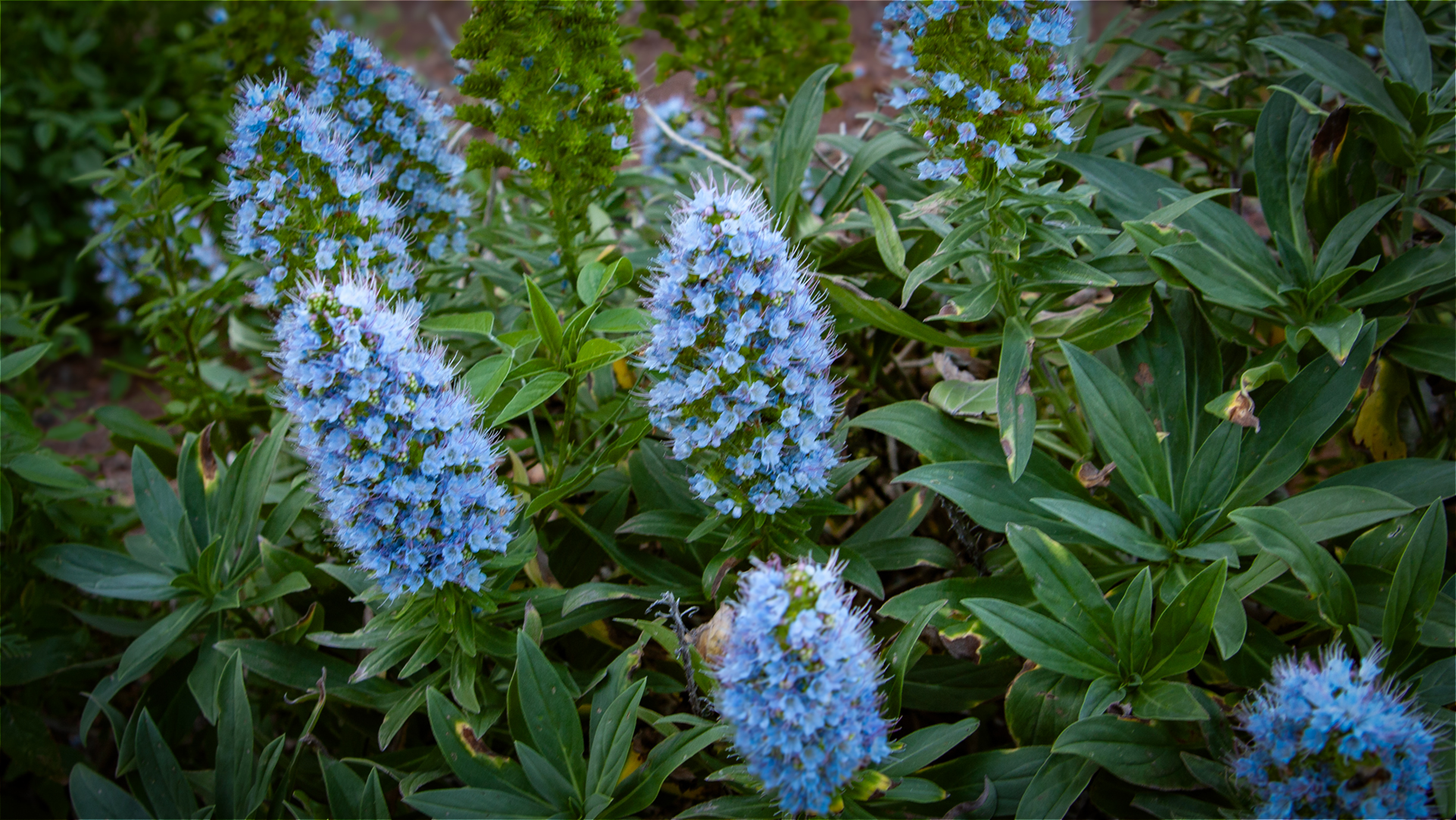
The rare Echium gentianoides, which also grows in the Pinar de Garafía nature reserve, thrives at particularly exposed rocky sites in this ravine. This species is endemic to La Palma — it occurs nowhere else in the world. The Barranco Fagundo is therefore not only geologically significant, but also floristically: a refuge for species that have disappeared elsewhere.
The Historical Connection: El Tablado – Juan Adalid
The Camino Real through the Barranco Fagundo to Juan Adalid is one of the oldest connecting routes on the north coast. In a time without roads, this connection was the only way for the residents of El Tablado to reach the coast. Goods were transported on mules and supplies arrived by boat at the coast. Juan Adalid was the landing point of this system — a small hamlet of great logistical importance for the municipality of Garafía.
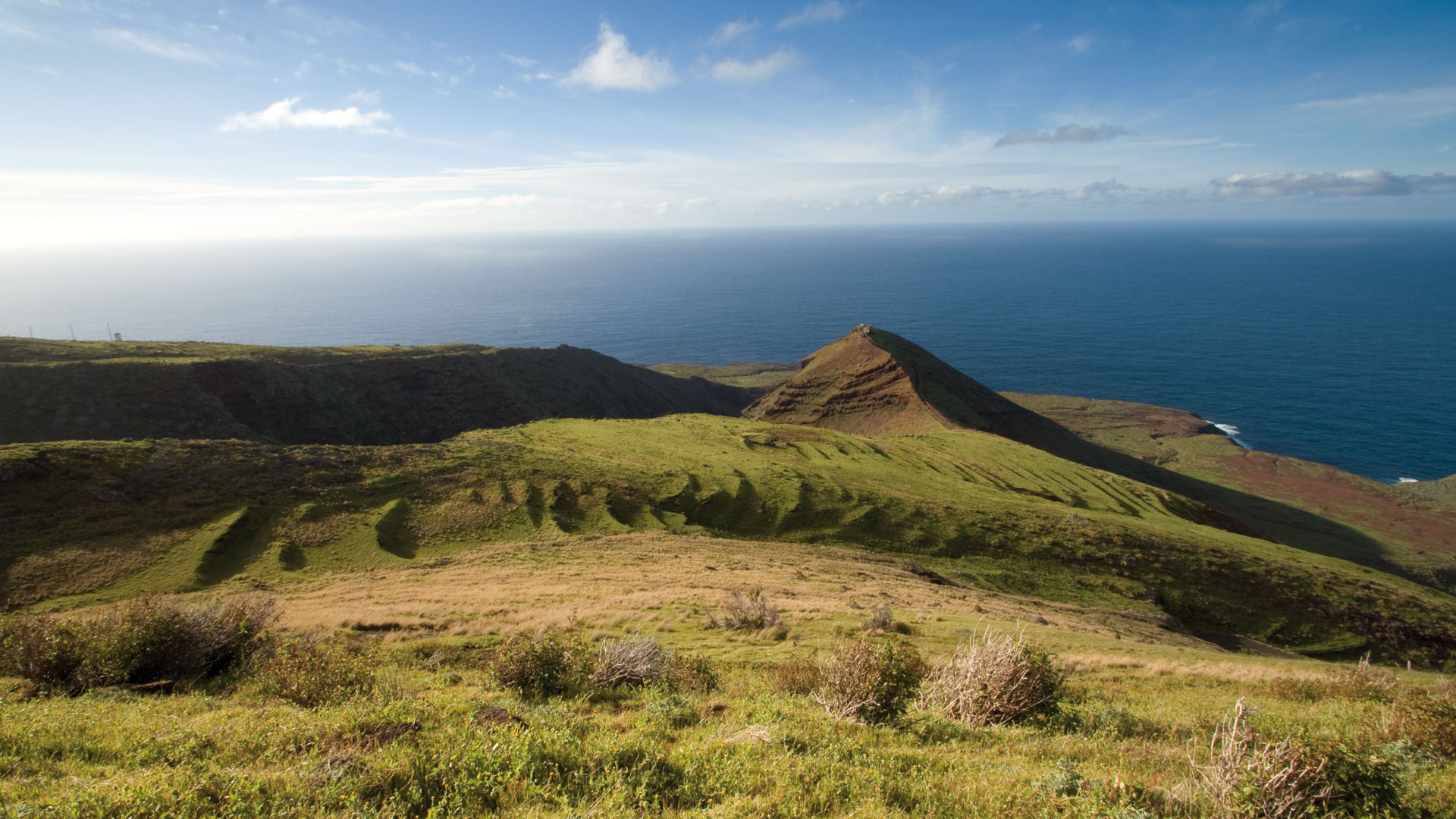
The hike to Barranco Fagundo is not a typical linear hike with a fixed endpoint in the tourist sense. It is an exploration: you go down as far as your fitness and time allow, and return the same way. The path to Juan Adalid is the complete version, but after just 300–400 metres of descent from the Mirador, the gorge opens up so completely that the goal is achieved: to have actually seen this barranco.
If you visit El Tablado by car and explore the gorge early in the morning, you can ideally combine this with one of the GR-130 stages on the same or the next day. The combination of the Fagundo gorge descent (morning) + El Tablado to Gallegos (afternoon) is a full and unforgettable hiking day for hikers with a good level of fitness.
Caves in the Canyon Rock: Dwellings and Stables
The caves and rock overhangs in Barranco Fagundo were used for centuries for livestock shelters and at times as dwellings. This practice — called abrigo — is typical of the north coast of La Palma: when there is no wood or stone for a house, the rock itself offers protection. Remains of walls that partially closed the cave openings are still visible in several places in the gorge. These traces of human use are no less important than the geological formations.
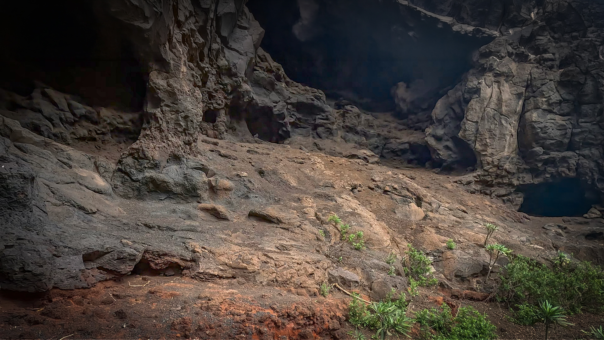
If you know the gorge from above – from the GR-130 on the El Tablado to Gallegos route – and then explore it from the inside, you will experience a completely different perception of space. From above: a cut in the plateau. From the inside: a space with its own microclimate and acoustics, its own fauna and flora. This double view of Barranco Fagundo is one of the most rewarding experiences the north coast of La Palma has to offer.
This article is based on the on-the-ground knowledge of the Gequo editorial team – publishers of the Reisezeit hiking guides and operators of Sunhikes.com. Last updated: May 2026


