La Palma Map: How to Find Your Way Around the Island
La Palma is small enough to get a feel for in a week — but complex enough to still get turned around. The island has two sides (east and west), a central mountain ridge, 14 municipalities, and a winding road network that can push Google Maps to its limits. A mental map of La Palma makes for better travel.
Geography at a Glance
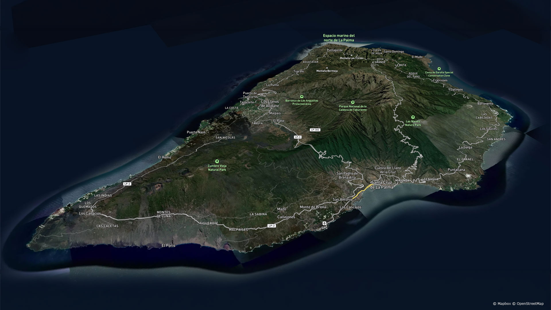
La Palma is around 45 kilometres long and up to 28 kilometres wide. A powerful mountain ridge runs from north to south. In the north rises the Caldera de Taburiente, with the Roque de los Muchachos (2,426 metres) — the island’s highest point. To the south lie the Cumbre Nueva and the volcanically active Cumbre Vieja.
The mountains act as a natural climate barrier: the east side is shaped by trade wind clouds and is particularly green, while the west side tends to be sunnier, drier, and warmer. The fastest link between the two halves runs through the Cumbre Tunnel on the LP-3.
The Key Roads
LP-3 — The Tunnel Road
The most important east-west link runs from Santa Cruz de La Palma through the Cumbre Tunnel to El Paso and Los Llanos de Aridane. For most visitors, it’s the fastest connection between the two sides of the island.
LP-1 — The Northern Route
The LP-1 connects Santa Cruz de La Palma with Puntallana, Barlovento, Garafía, Tijarafe, and finally Los Llanos de Aridane. One of the island’s most scenic panoramic roads — though very winding.
LP-2 — The Southern Route
The LP-2 runs from Santa Cruz de La Palma via Breña Alta, Mazo, and Fuencaliente to the west side of the island.
LP-4 — The Mountain Road
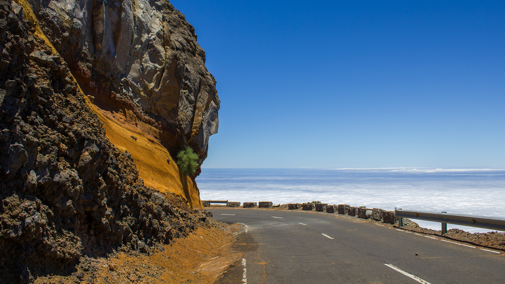
The spectacular LP-4 climbs to the Roque de los Muchachos and the world-famous observatories. In winter, the road can be temporarily closed due to snow, ice, or strong winds.
Map Apps for La Palma
Google Maps works well for navigating the island’s roads. Download the La Palma map for offline use before you travel — reception is unreliable in the mountains.
Maps.me offers detailed hiking trails based on OpenStreetMap and also works fully offline.
For hiking, GPX tracks are especially useful. Sunhikes.com provides detailed route descriptions, maps, and GPX files for many of La Palma’s trails — importable into any compatible hiking app for offline use.
Free road and hiking maps are also available from tourist offices at the airport, in Santa Cruz de La Palma, and at many other locations around the island.
Navigation Tips for Drivers
The simplest orientation trick: trade wind clouds hanging around the mountains usually mean you’re on the east side. Sunshine typically points to the west.
Don’t underestimate travel times. Distances look short on the map, but the many bends — especially in the north — result in significantly longer journeys. Allow extra time for journeys to Garafía, El Tablado, or Franceses.
Before driving on dirt tracks — for example to Los Brecitos — check your rental car terms. Not all insurance policies cover unpaved roads.
| Island Size | Around 45 km long · 28 km wide · approx. 708 sq km in area |
|---|---|
| Main Route | LP-3 via the Cumbre Tunnel links east and west in around 35–40 minutes |
| Navigation | Google Maps (download offline) · Maps.me for hiking trails · Sunhikes for GPX tracks and detailed route descriptions |
| Printed Maps | Free road and hiking maps available at the Oficinas de Turismo and at the airport |
Conclusion:
Understanding La Palma starts with the map: two sides, one tunnel, one mountain ridge. Download Google Maps offline before you go; use Maps.me or Sunhikes for hiking trails. Allow generous driving time for northern mountain routes.
Frequently Asked Questions
What is the best map app for La Palma?
How long does it take from Santa Cruz to Los Llanos?
Are there GPS outages on La Palma?
Is Google Maps enough for a holiday on La Palma?
Are there free road maps on La Palma?
This article is based on the on-the-ground knowledge of the Gequo editorial team – publishers of the Reisezeit hiking guides and operators of Sunhikes.com. Last updated: May 2026