
Hike Monte El Canal and Los Tilos: through the tunnel into the laurel forest
The hike from Monte El Canal through Los Tilos to Mirador Espigón Atravesado is one of the most beautiful easy tours in the northeast of La Palma: 5.1 km, 279 m, easy, child-friendly, 1:30–2:15 hours. The path begins on a closed forest road, leads through a 100-metre tunnel directly into the dense laurel forest and climbs gently uphill in the shade to the viewpoint.
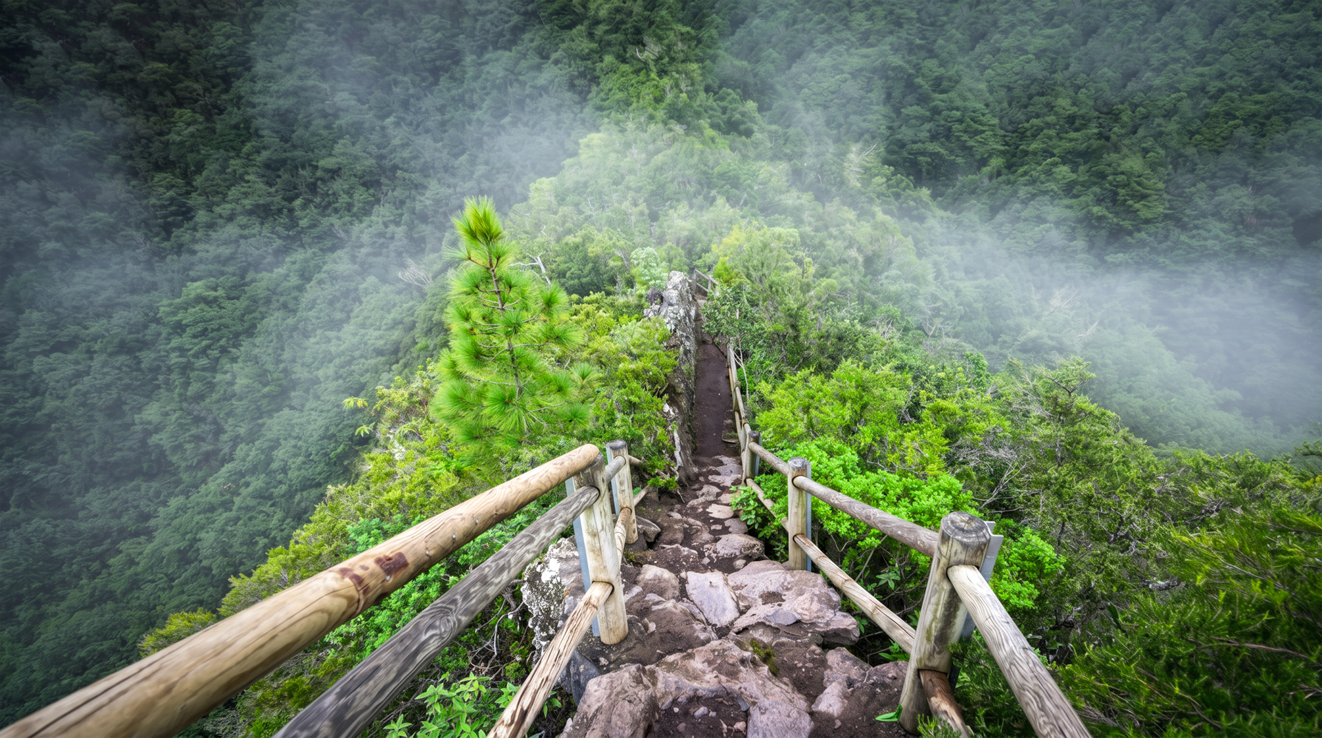
At Mirador Espigón Atravesado at an altitude of around 600 meters: an impressive view of the Barranco del Agua – the lush slopes, green, wild and deeply cut. Optionally, it’s worth taking a detour to the Los Tilos waterfall near the visitor centre. The starting point is the front car park of Los Tilos, where the closed forest road branches off. Bar-restaurant Los Tilos available.
Los Tilos is the most famous laurel forest reserve in La Palma and part of the island’s UNESCO biosphere reserve. The hike is one of the few routes where you don’t just see the forest at the edge, but go right through it — through the tunnel, under the canopy, with ferns, lianas and moss-covered trunks on all sides.
Route facts at a glance
| Route type | Out and back |
|---|---|
| Distance | 5.1 km |
| Elevation | 279 m ascent / 279 m descent |
| Highest point | 752 m |
| Lowest point | 479 m |
| Duration | 1:30–2:15 hours |
| Difficulty | easy (family-friendly, easy to follow) |
| Starting point | Main car park Los Tilos — junction of the closed forest road |
| End point | Mirador Espigón Atravesado (return via same path) |
| Waymarking | no official waymarking |
| Protected area | Las Nieves Nature Park / Los Tilos Biosphere Reserve |
| Equipment | Water, sturdy footwear |
The route in detail
Closed forest road and the tunnel
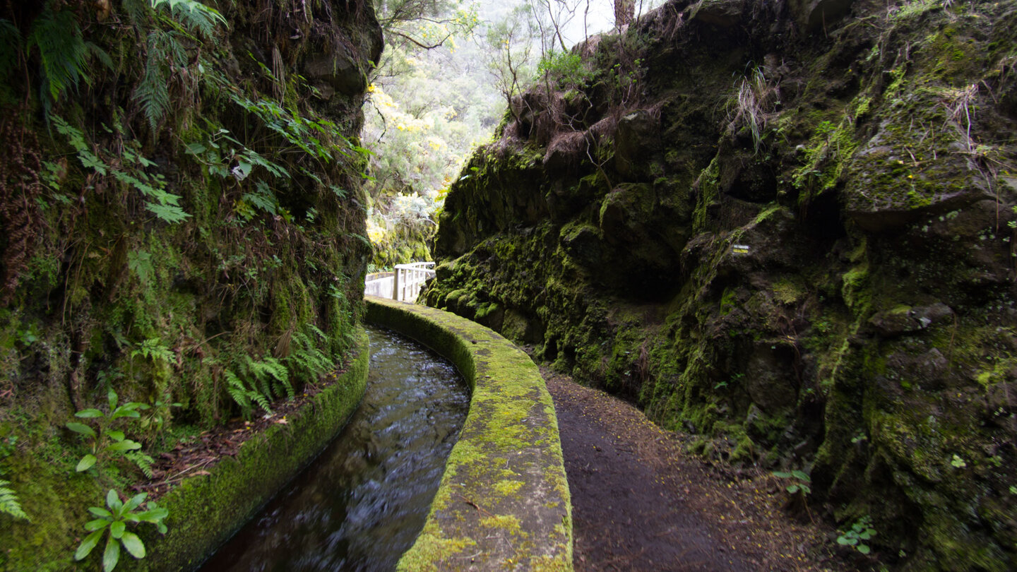
You start the hike where the road opens up and everyday life falls silent. The forest road, which is closed to traffic, branches off around five hundred meters from the famous biosphere reserve. The path climbs gently, quietly, almost imperceptibly. After a few minutes you disappear into a 100-metre tunnel – a transition into another world.
Behind it, the dense laurel forest of La Palma welcomes you. Ferns spread their fronds, lianas twine around mossy trunks, moist earth smells of life. The path is mostly in the shade, the light falls filtered through the green roof. Anyone who steps through this tunnel on a hot summer day experiences the immediate drop in temperature as a physical experience.
Gentle climb to the viewpoint
You follow the wide forest road and after about thirty minutes you pass a small stone house. The path now becomes a little steeper, but remains pleasant to walk. Step by step you gain altitude, accompanied by the gentle sound of the Barranco del Agua, which lies hidden deep beneath you.
After another thirty minutes you reach a fork in the road. Turn sharp left here and climb a staircase with a railing. Each step opens the view a little more. You step out of the dense forest onto the viewpoint.
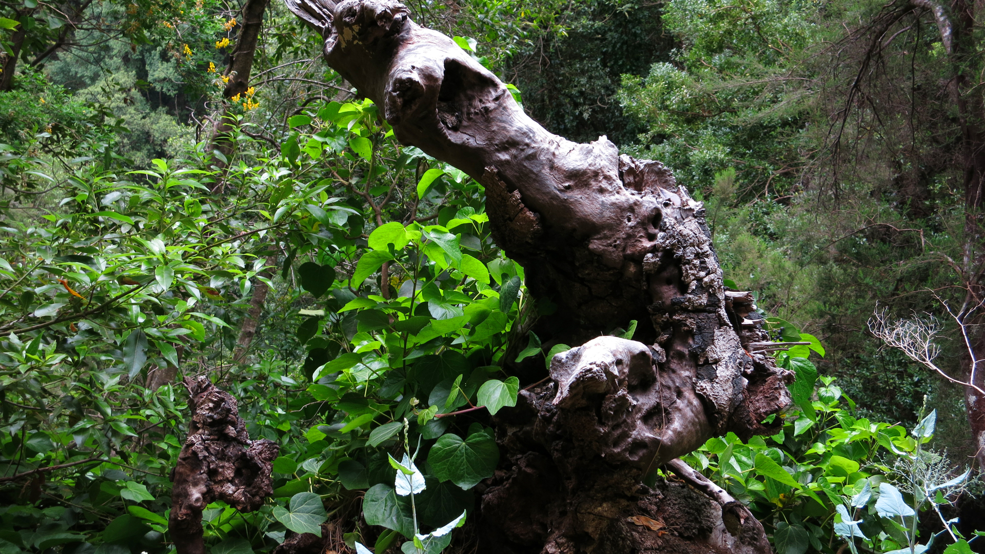
Mirador Espigón Atravesado
You stop at Mirador Espigón Atravesado at around 600 meters above sea level. The lush slopes of the Barranco del Agua spread out in front of you – green, wild and deeply cut. The deep view into the gorge is impressive: the same gorge through which the tunnel hike leads to the Marcos y Cordero springs, seen here from above.
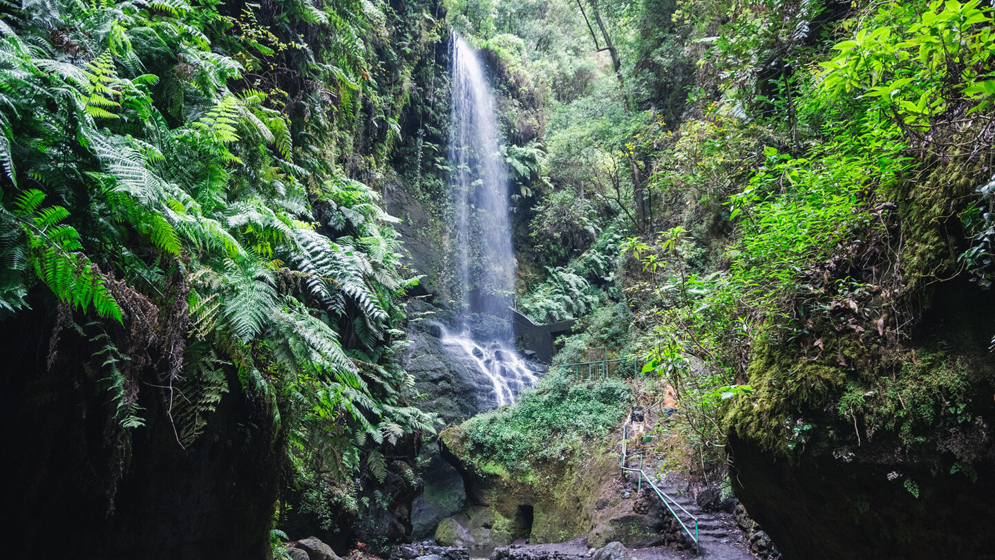
If you like, you can also plan a detour to the Los Tilos waterfall near the visitor centre – a popular photo opportunity and a refreshing break on warm days. You go back the same way.
The Los Tilos Biosphere Reserve
Los Tilos is the best-known and best-preserved laurel forest reserve in La Palma. It is part of the island’s UNESCO Biosphere Reserve and is part of the Las Nieves Natural Park. The Los Tilos laurel forest is a remnant of the Laurisilva — the Tertiary forest belt that once covered much of southern Europe and North Africa before the ice ages almost completely destroyed it. On the Canary Islands, the Laurisilva survived thanks to the stable, mild climate.
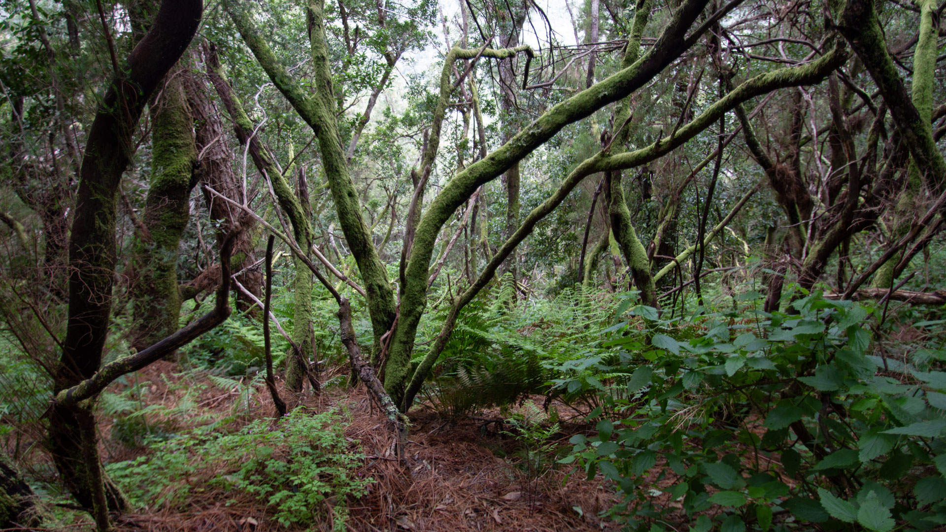
All of the Canary Islands’ major laurel tree species grow in the Los Tilos Forest: stink laurel (Til), Canary laurel, Barbusano and Indian Persea. In addition, Canarian holly, strawberry tree and heather. The visitor centre provides insight into the geology, hydrology and biodiversity of the area – a useful start before the hike.
The Canary Island Chaffinch from Los Tilos
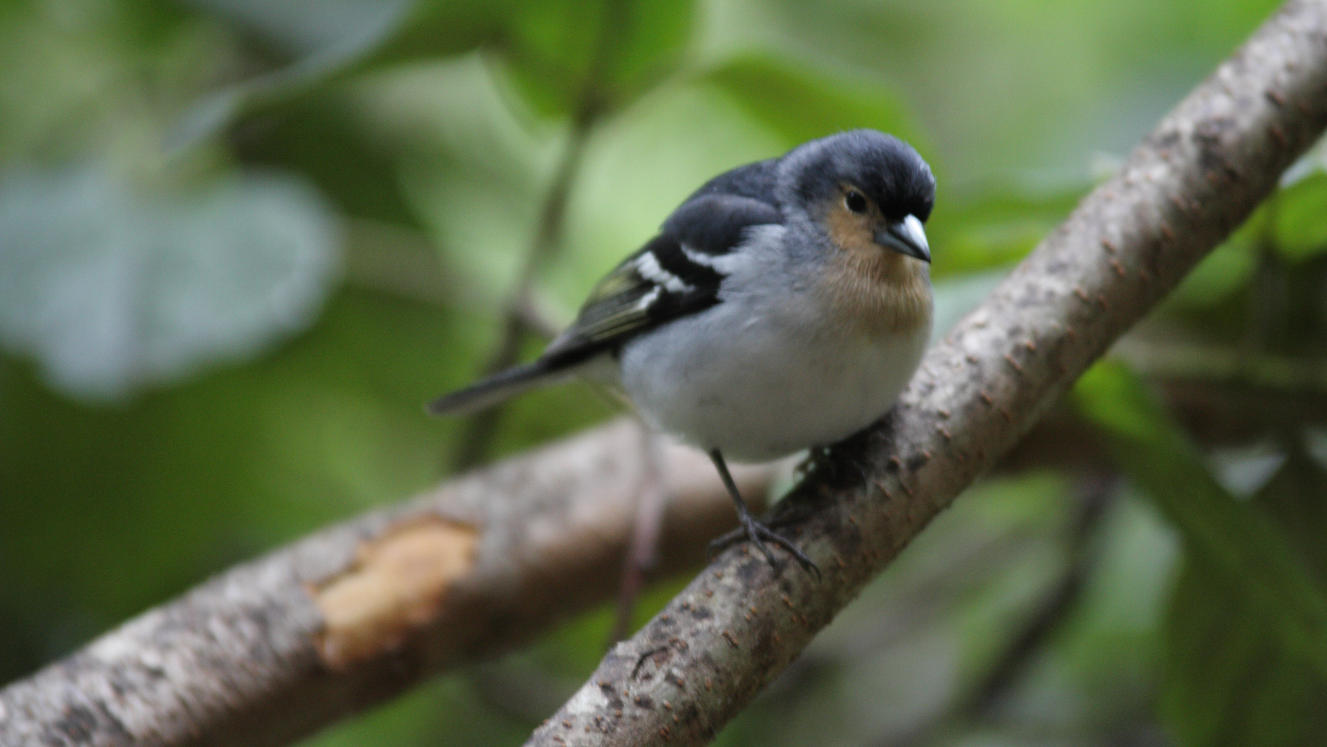
The highlight animal on this hike is the La Palma chaffinch (Fringilla coelebs palmae) – a subspecies of chaffinch with bluish plumage that is endemic to La Palma. It can often be seen and heard in the laurel forest of Los Tilos. If you walk quietly and wait, you will almost certainly meet him. Next to it: laurel dove, turqué dove and various warblers in the dense laurel forest.
Best travel time
| Season | Character | Note |
|---|---|---|
| Spring (March–May) | Forest lush green, full water supply | Optimal conditions |
| Summer (June–Aug) | Tunnel coolness as a contrast to the coastal heat | Ideal day goals in the heat |
| Autumn (Sept–Nov) | Cloud forest atmosphere | Rain protection always with you |
| Winter (Dec–Feb) | Highest Water flow | Waterfall most impressive |
Combinable tours
Los Tilos is the starting point of several laurel forest tours. If you have more time, combine the easy tour to Espigón Atravesado with the big tunnel hike the following day:
| Tour | Data | Character |
|---|---|---|
| Tunnel hike Marcos y Cordero → Los Tiles | 11.1 km, difficult | The big tunnel hike from Casa del Monte |
| PR-LP 7: Pico de la Cruz → Los Sauces | 14.4 km, difficult | Big descent in Los Sauces – neighboring region |
| PR-LP 8: Pico de la Cruz → Barlovento | 11.9 km, difficult | Descent with Laguna de Barlovento |
GPS track and 3D route planner
The route has no official waymarking. The GPS track on the Sunhikes route page shows the turnoff to the stairs at the Mirador and the optional waterfall detour – both are clearly marked in the track.
To the route page on Sunhikes: Monte El Canal & Los Tilos – to Mirador Espigón Atravesado
3D route planner from Sunhikes
Practical Tips
Emergency call 112. Bar-restaurant Los Tilos at the visitor centre for refreshments before or after the tour. The route has no official waymarking – take a GPS track with you. Child-friendly from approx. 4 years.
Note: Biosphere Reserve
Las Nieves Natural Park and Los Tilos Biosphere Reserve. Directions, waste collection. Follow the marked paths – no leaving the paths.
Frequently asked questions
Getting There
Los Tilos is in the northeast of La Palma, in the municipality of San Andrés y Sauces. Access via the LP-109 from Los Sauces. The car park at the visitor centre is signposted. The trailhead is at the front car park, around 500 metres before the visitor centre — this is where the closed forest road branches off.
For families with children, the Los Tilos hike is one of the most reliable recommendations on La Palma: The path is wide and easy to see, the tunnel is a child-friendly highlight, the gradient is moderate and the destination – the viewpoint with a deep view of the gorge – is also impressive for children. The bar-restaurant at the car park allows you to stop off at the end. Child-friendly from around 4 years old according to Sunhikes.
If you want to combine Los Tilos with the Caldera de Taburiente National Park and the Cubo de la Galga laurel forest, you have three of the most beautiful laurel forest tours in La Palma on three consecutive days in the northeast and northwest: Day 1 Cubo de la Galga (8.4 km), Day 2 Los Tilos to Espigón Atravesado (5.1 km, half day), Day 3 Marcos y Cordero tunnel hike (11.1 km, difficult). Three different Laurel Forest characters, three completely different experiences.
A practical note: The car park at the front entrance to Los Tilos is significantly closer to the hike start than the car park at the visitor centre. From there, the beginning of the closed forest road is immediately visible. Signage available. Arrive early on weekends — Los Tilos is popular with day-trippers from Santa Cruz and Los Sauces.
San Andrés y Sauces: La Palma’s Greenest Municipality
Los Tilos is located in the municipality of San Andrés y Sauces in the northeast of La Palma — the dampest and greenest municipality on the island. The trade winds gather against the northern slopes of Las Nieves Nature Park, supplying the laurel forests with a constant flow of water.
The Los Tilos Biosphere Reserve visitor centre is at the end of the access road and free to enter. Exhibitions on the geology, hydrology, flora and fauna of the area make it a worthwhile stop before the hike. The adjacent Bar-Restaurant Los Tilos is one of the few places to eat in this remote area, known for simple Canarian cuisine.
Laurel Forest Types in Los Tilos
All four major laurel tree species of the Canary Islands grow side by side in the Los Tilos laurel forest: Stinkwood (Til, Ocotea foetens) on the upper slopes; Canary Laurel (Laurus novocanariensis) through the middle elevations; Barbusano (Apollonias barbujana) and Indian Persea (Persea indica) in the damper valley floors. This complete species spectrum in such a small area is exceptional even by Canarian laurel forest standards.

The Los Tilos hike is one of the most reliable family recommendations on La Palma: the trail is wide and clearly marked, the tunnel is a child-friendly highlight, the gradient is moderate and the destination — the viewpoint with a dramatic view into the gorge — is impressive for children too. The Bar-Restaurant at the car park allows for a stop at the end. Suitable for children from around age 4, according to Sunhikes.
Those wanting to combine Los Tilos with Caldera de Taburiente National Park and the Cubo de la Galga laurel forest can cover three of La Palma’s finest laurel forest hikes over three consecutive days: Day 1 Cubo de la Galga (8.4 km), Day 2 Los Tilos to Espigón Atravesado (5.1 km, half day), Day 3 Marcos y Cordero tunnel hike (11.1 km, challenging). Three different laurel forest characters, three completely different experiences.
This article is based on the on-site knowledge of the Gequo editorial team – publisher of the Reisezeit hiking guides and operator of Sunhikes.com. As of: May 2026


