
SL-FU 111: Hiking trail from Volcán Martín to Fuente del Tión
The SL-FU 111 is a short, local hiking trail in the Cumbre Vieja Natural Park: 1.6 km, 338 m descent, easy, 0:20–0:40 h downhill (return uphill approx. 1 hour). The path runs as a linear trail from the foot of Volcán Martín downhill to the junction with the SL-FU 110 at Fuente del Tión.
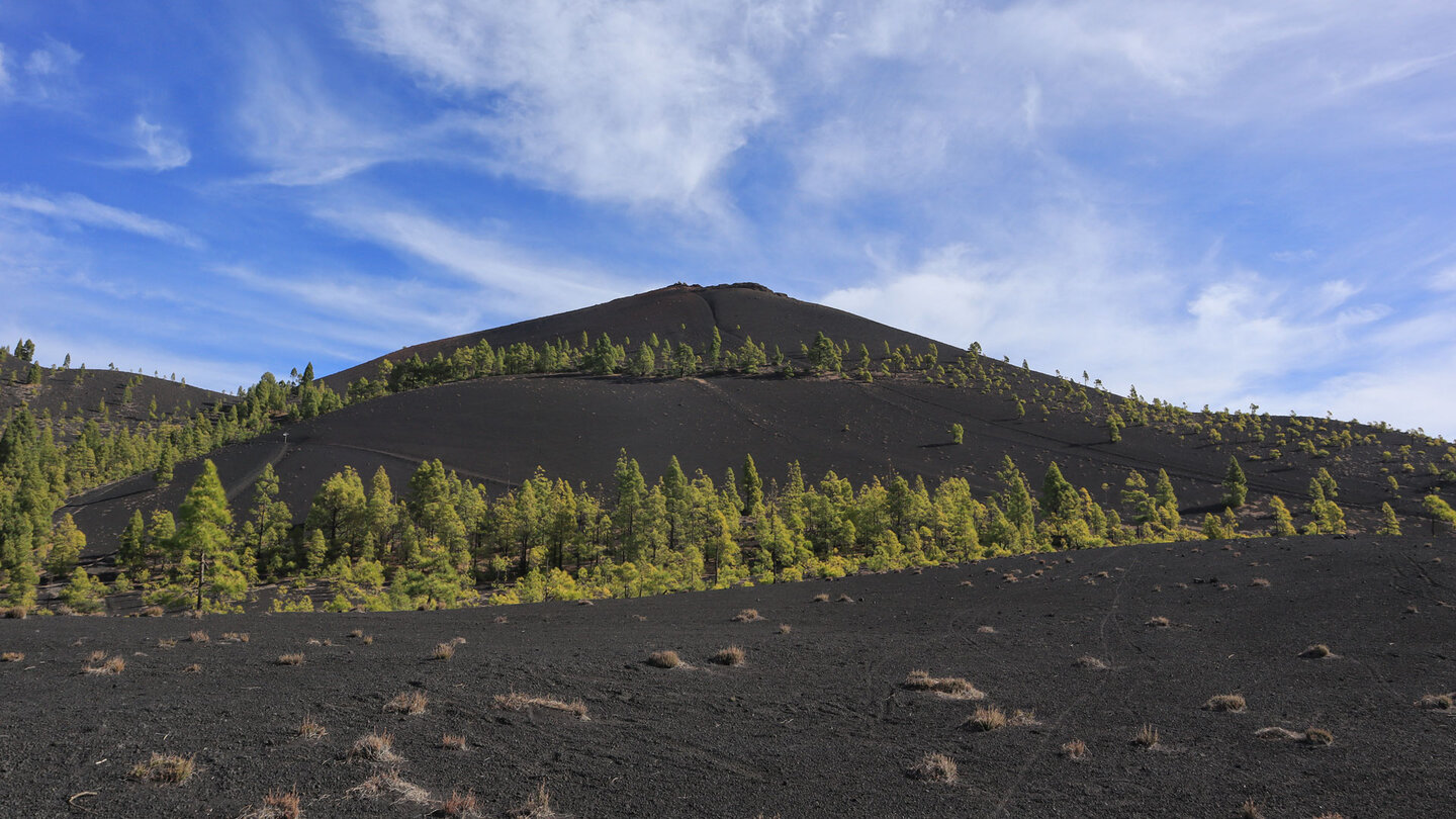
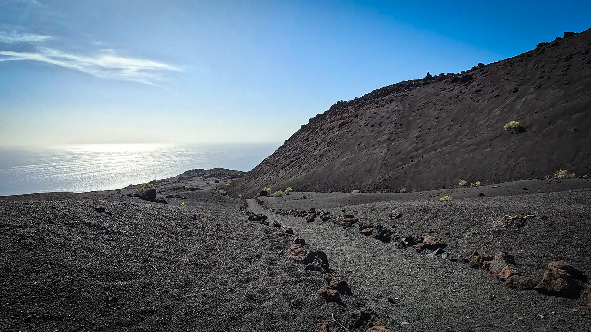
This short route is ideal as a complement to the Fuente de los Roques – Volcán Martín circular hike or as an independent exploration of the Cumbre Vieja for hikers with little time. It offers breathtaking views of Volcán Martín and shows the connection between the Ruta de los Volcanes (GR-131) and the deeper pine forests.
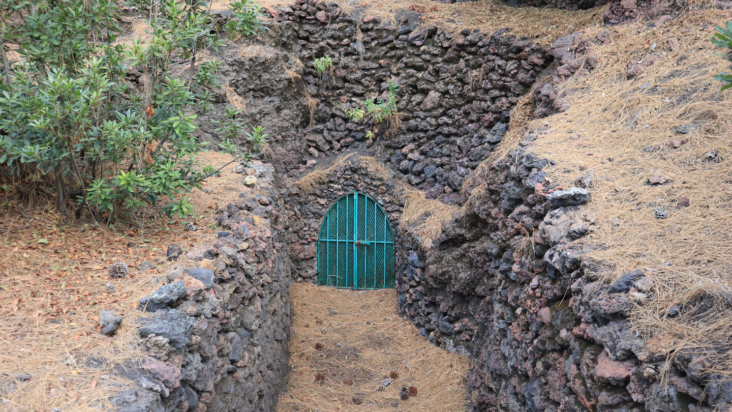
Sunhikes describes this hiking trail: It rewards with a breathtaking landscape and an unforgettable experience. The Fuente del Tión is the destination – a closed water tunnel that was once used as a livestock trough.
Trail facts at a glance
| Route type | One-way / out and back |
|---|---|
| Distance | 1.6 km (one way) |
| Elevation profile | 0 m ascent / 338 m descent (downhill) |
| Highest point | 1,526 m (starting point at Volcán Martín) |
| Lowest point | 1,188 m (Fuente del Tión) |
| Duration | 0:20–0:40 h downhill / approx. 1:00 h return leg uphill |
| Difficulty | easy (downhill, mostly single-track trails) |
| Starting point | foot of Volcán Martín, Cumbre Vieja Nature Park |
| Trail marking | SL-FU 111 (green-white) |
| Protected area | Cumbre Vieja Nature Park |
| Equipment | water, sturdy footwear, sun protection |
Getting there
Starting point: Base of Volcán Martín, accessible from the LP-301 or via the Ruta de los Volcanes (GR-131) from Fuente de los Roques. If you are adding this section to as a supplement to the Volcán Martín circular hike will find the starting point directly on the circuit.
The route in detail
Starting point to intersection SL-FU 110 / Fuente del Tión
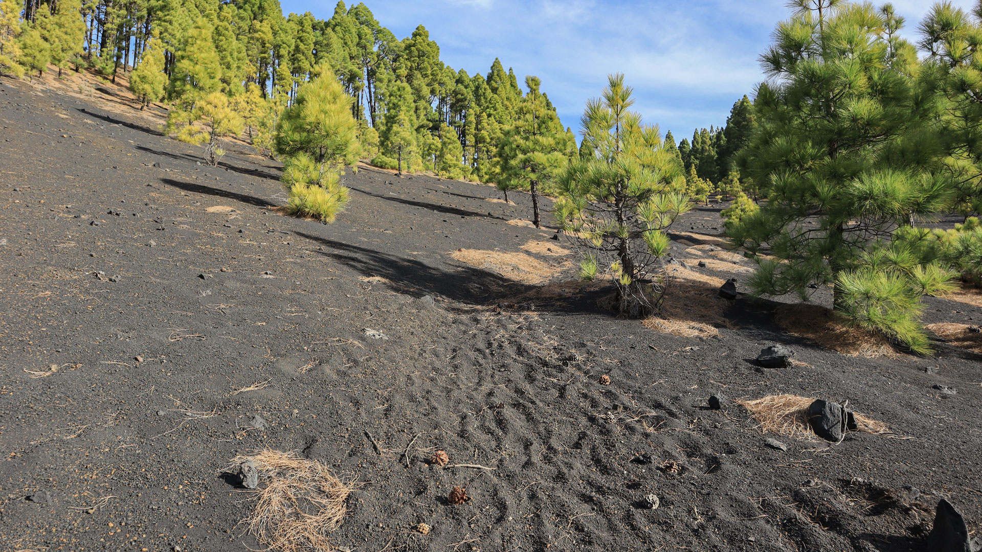
The SL-FU 111 begins at the foot of Volcán Martín at 1,526 m. It runs continuously downhill through the pine forest of the Cumbre Vieja Natural Park. The route is well marked and mainly on paths, easy to follow. After 1.6 km you reach the intersection with the SL-FU 110 at Fuente del Tión.
The Fuente del Tión is a closed water tunnel – historical infrastructure for pastoral farming on the Cumbre Vieja. The water does not come to the surface here; it is a bricked-up access tunnel. It served as a cattle trough in times when herds of sheep and goats populated the Cumbre Vieja.
The Volcán Martín de Tigalate in context
The Volcán Martín de Tigalate is the first real peak of the Ruta de los Volcanes from the south. Its red cone shines like a flame from the black lapilli fields. Date of eruption: 1646. At the summit there is a volcanic cave containing the Fuente del Fuego — a spring that only flows after long periods of rain. The SL-FU 111 does not lead to the summit, but from the summit area down into the pine forest.
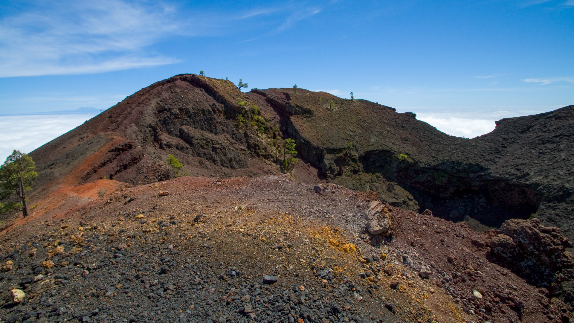
The relationship between Volcán Martín and the Cumbre Vieja hiking trails is complex: the GR-131 passes the crater rim, the SL-FU 111 leads from the base into the forest, and the SL-LP 111 climbs directly to the summit. Anyone who knows all three paths has experienced Volcán Martín from all perspectives – from above, from the side and from below.
Short routes in the Cumbre Vieja
The SL-FU 111 is one of several short local hiking trails (SL = Sendero Local) in the Fuencaliente/Cumbre Vieja area. These short paths complement the long routes (GR-131, SL-LP) and make the area accessible to hikers who cannot or do not want to do a full-day tour. The network of SL trails makes it possible to explore the Cumbre Vieja in stages, with flexible starting and ending points.
If you want to explore the Cumbre Vieja intensively, combine: Circular hike Fuente de los Roques → Volcán Martín (10.2 km, moderate) in the morning and staying overnight in El Paso. The next day: Hike from Llano de las Moscas to Pico Nambroque (9 km, moderate). This is a complete Cumbre Vieja weekend.
Best travel time
| Season | Character | Note |
|---|---|---|
| Spring (April-June) | Tajinaste blooms above; Fresh pine forest | Best time |
| Summer (July–Aug) | Pine forest provides shade | Comfortable even in the heat |
| Autumn (Sept–Nov) | Clear, long-range views of Volcán Martín | Good light for Photos |
| Winter (Dec-Feb) | Cool; sometimes fog in the pine forest | Pleasant for a short tour |
Accommodation in El Paso
The Cumbre Vieja Natural Park is located near El Paso. Holiday homes in El Paso on clariso.eu — Holiday homes El Paso. Best base for all Cumbre Vieja tours.
Combinable tours
| Tour | Data | Character |
|---|---|---|
| Circular hike Fuente de los Roques → Volcán Martín | 10.2 km, moderate | This loop logically includes the SL-FU 111 |
| Hike Llano de las Moscas → Pico Nambroque | 9 km, moderate | Neighboring tour in the same natural park |
| GR-131 Stage 3: El Pilar – Faro de Fuencaliente | 22.8 km, difficult | The main volcano route through the park |
GPS track and 3D route planner
For 1.6 km with clear directions, GPS is optional — the SL-FU 111 is well marked. With the free 3D route planner, the route can be combined with the large Volcán Martín circuit – directly in the browser, without an app.
To the route page on Sunhikes: SL-FU 111 Volcán Martín – Fuente del Tión
3D route planner from Sunhikes – customize and combine routes
Practical Tips
Emergency call 112. The uphill return takes significantly longer (around 1 hour). No supplies on the way. There is no drinking water at Fuente del Tión.
Frequently asked questions
What is the Fuente del Tión?
Can you combine the SL-FU 111 with the Volcán Martín circuit?
The network of SL trails in the Cumbre Vieja
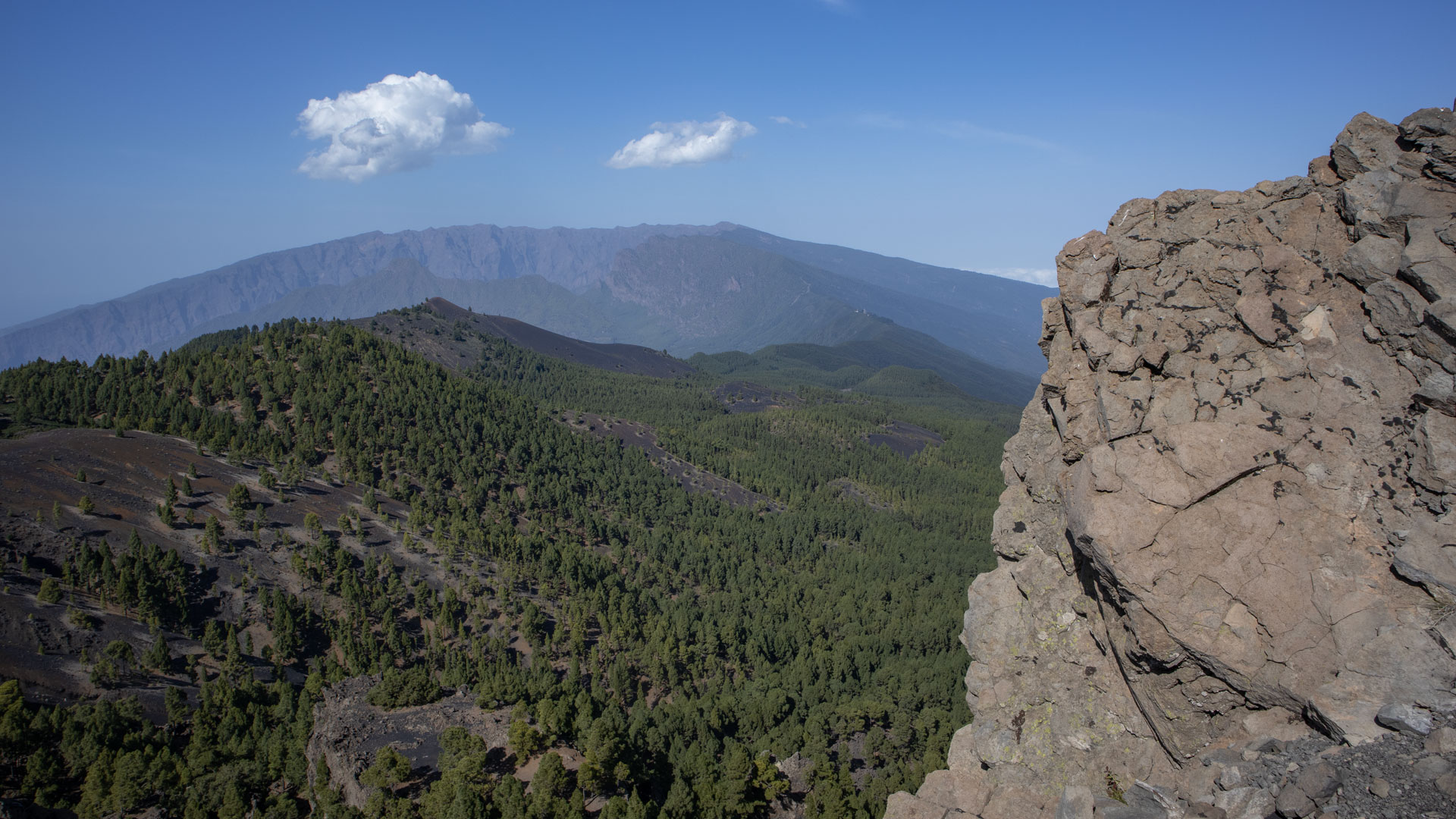
The Cumbre Vieja is criss-crossed by a network of local hiking trails (SL = Sendero Local), which connect the major long-distance hiking trails (GR-131, PR-LP) with access roads, springs and rest areas. The SL-FU 111 is one of these connecting routes – little-known outside the island, but important for the local infrastructure. It connects the high zone of Volcán Martín (Ruta de los Volcanes) with the lower pine forest plains where the Fuente del Tión is located.
For hikers who want to systematically explore the Cumbre Vieja, the SL trails form shortcuts and connections that significantly expand the touring area. The SL-FU 110 (Vereda de las Cabras – Fuente del Tión) crosses at the end point of the SL-FU 111 and in turn connects other paths. Together, these paths open up the inner highlands of the Cumbre Vieja beyond the known main routes.
The Fuente del Tión: water supply on the Cumbre
The Fuente del Tión is a closed water tunnel – built to collect the groundwater of the Cumbre Vieja and to channel it towards the villages and fields in the surrounding area. These tunnel systems are the backbone of La Palma’s water supply: on an island without rivers and with irregular rainfall, the rainwater that seeps into the volcanic rock had to be collected and diverted. The Fuente del Tión is one of hundreds of such tunnels on La Palma.
Today the tunnel is closed and no water flows to the outside – the system has been modernized and converted to pipes. But the entrance with the old stone surrounds is a monument to the Canary Islands’ water management. If you are looking for a piece of historic engineering on La Palma, you will find it here: in a stone tunnel deep in the pine forest.
For hikers who explore the Cumbre Vieja over several days: The SL-FU 111 is particularly suitable as an afternoon tour if the main Volcán Martín loop (10.2 km) was completed in the morning. You then already know Volcán Martín from above and the SL-FU 111 rounds off the experience from the northern side. Start at the foot of the Martín, descend through the pine forest, short break at the Fuente del Tión, return uphill. Total time approx. 2 hours for both directions.
An atmospheric tip: Hiking the SL-FU 111 in the morning mist is a truly magical experience. The pine forest on the north side of Volcán Martín is often covered in trade wind fog that rolls over the ridge edge. The lichens and mosses on the pine trunks, the wet silence of the forest, the contrast to the black lava on the opposite side: this is the Cumbre Vieja in a completely different light.
This article is based on the on-the-ground knowledge of the Gequo editorial team – publishers of the Reisezeit hiking guides and operators of Sunhikes.com. Last updated: May 2026


