
PR-LP 13: Hike from Los Brecitos through the Caldera de Taburiente
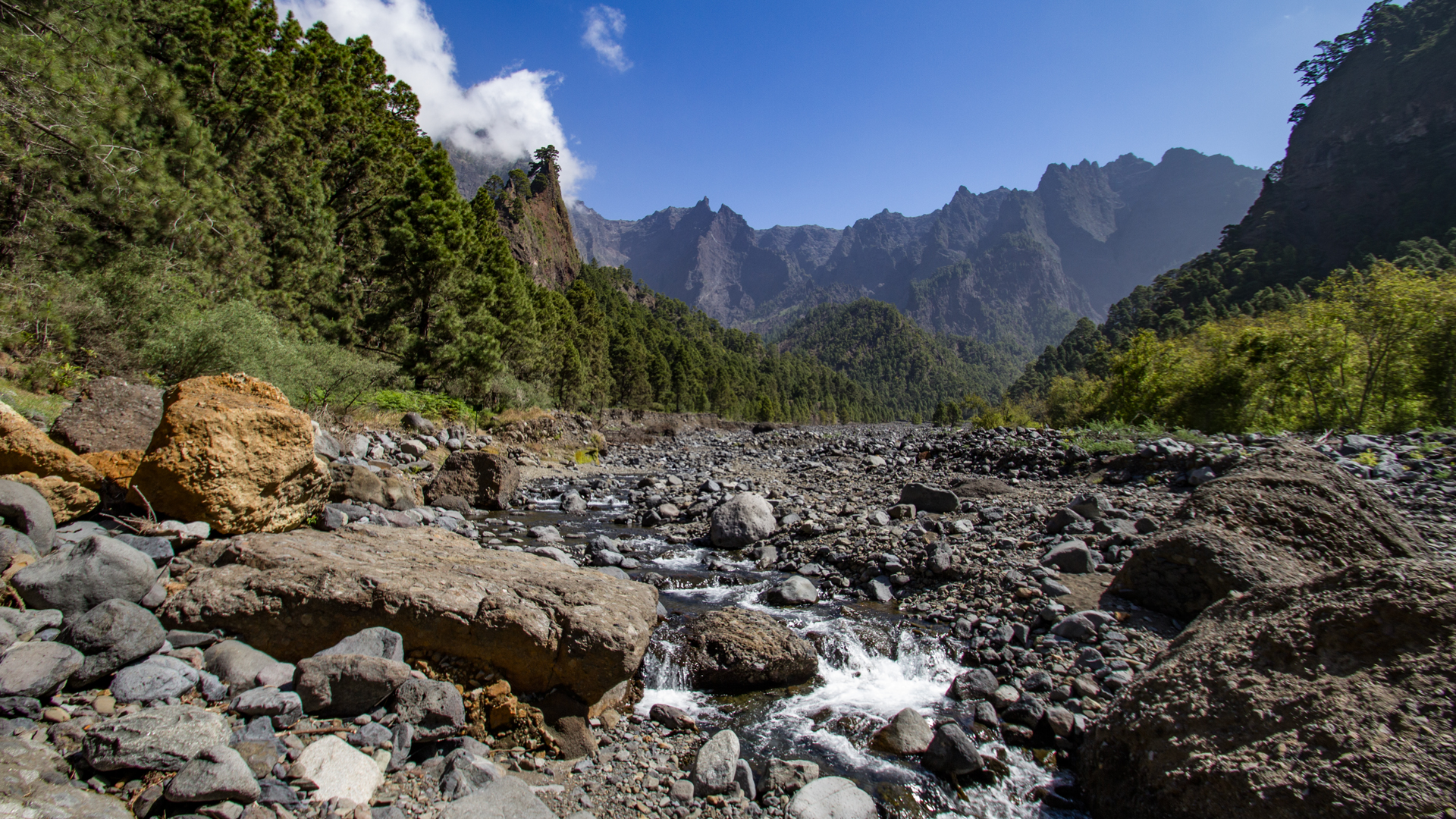
The hike from Los Brecitos through the Caldera de Taburiente is one of the most impressive routes on La Palma. 13.9 km · 381m ascent · 1,156m descent · Strenuous. The path leads from the Mirador de Los Brecitos on the PR-LP 13 through the heart of the national park: over gorge passages with wooden bridges, past the rock pinnacles of Los Agujeritos and the Roque Idafe, to the Playa de Taburiente, through the steep section of El Reventón (literally “the lung-burster”), along the Cascada de Colores and finally through the Barranco de las Angustias to the hiking car park in the Barranco.
>
The start at Mirador de Los Brecitos is only accessible via a taxi shuttle service (approx. €15 per person) that departs from the car park at Barranco de las Angustias — the same car park where the route ends. This is important for planning: no second car necessary, but take the shuttle start in the morning into account.
The route should not be attempted during or after rainfall. The Barranco de las Angustias is often closed after heavy rainfall. Sure-footedness, good basic fitness and resistance to dizziness are a prerequisite.
Route facts at a glance
| Route type | One-way (shuttle up, walk down) |
|---|---|
| Distance | 13.9 km |
| Elevation | 381 m ascent / 1,156 m descent |
| Highest point | 1,079 m (Mirador de Los Brecitos) |
| Lowest point | 240 m (Barranco de las Angustias car park) |
| Duration | 5.5 to 7 hours |
| Difficulty | Strenuous |
| Start | Mirador de Los Brecitos — reach by taxi shuttle (~€15/person) from Barranco de las Angustias car park |
| End | Barranco de las Angustias car park |
| Trail markings | PR-LP 13 (yellow-white) |
| Protected area | Caldera de Taburiente National Park (since 1954) |
| Equipment | Water, food, sturdy footwear, sun protection, waterproofs |
Directions and starting point
The hike begins at the Mirador de Los Brecitos at an altitude of 1,079 meters. You can only get there by taxi shuttle service, which leaves from the car park in Barranco de las Angustias. Driving on the slopes with a normal rental car is not permitted. The car park in Barranco de las Angustias is also the end point of the hike – so the car is exactly where you arrive after 13.9 km.
Practical shuttle details
In the high season (autumn and spring) the car park and the shuttle are very busy. Those who start early will have the best light and temperature conditions and will reach their destination safely before dusk.
Check for trail closures
Check the current status of the hiking trail before starting. The national park administration closes the Barranco de las Angustias after heavy rain. Contact: Parks Department or El Paso Visitor Centre.
The route in detail
The PR-LP 13 is not merely a steady descent, but a series of distinct sections – each with its own terrain, atmosphere, and views.
Section 1: Mirador de Los Brecitos to Playa de Taburiente
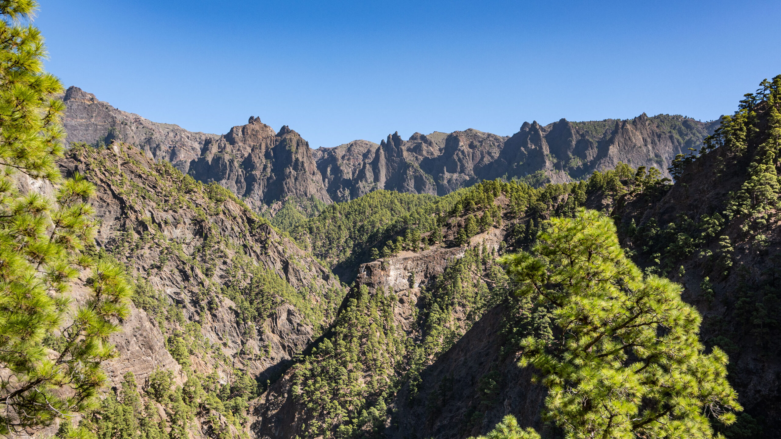
From the Mirador de Los Brecitos, the PR-LP 13 (yellow-white marking) follows the mountainside through open pine forest. The path is well signposted and winds gently up and down the slope. You cross several ravines and watercourses, some of which you cross on small wooden bridges.
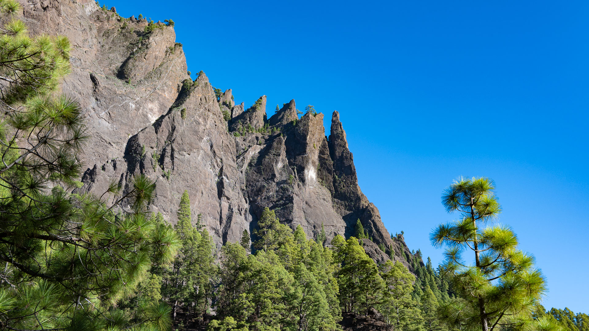
There are several viewpoints along the way. The Mirador del Lomo de Tagasaste offers the best view of the Roque Idafe – the finger-shaped monolith that rises 100 meters from the calderade floor and was a sacred site for the indigenous people of La Palma, the Benahoritas. Above the path, the needle-like rock formations of Los Agujeritos rise up in front of the steep walls of the caldera, which are up to 800 meters high. Opposite rises the Pico Bejenado.
You pass the spring Fuente de la Mula and the Barranco del Risco Liso, which only fills up when it rains, but has water underground all year round. Approximately 50 meters behind, the detour to the rock carving site branches off to the left (approx. 1.6 km / 75 m extra): old stone walls and two fenced-in yellow rocks with rock carvings of the Benahoritas.
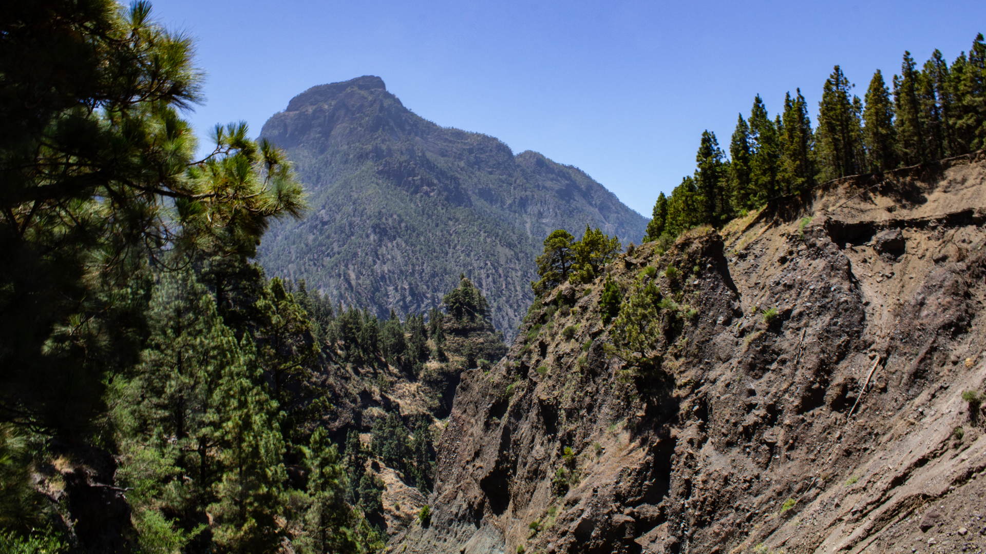
The path continues through the heavily eroded gorge Barranco de Bombas de Agua. In a wide left bend, below the old Casas de Taburiente (stone houses), you go down to Playa de Taburiente.
Section 2: Playa de Taburiente and Zona de Acampada
The Playa de Taburiente is the wide stone and gravel bed of the Rio de Taburiente – not a sandy beach, but a wide sedimentary area in the heart of the national park. Canary willow trees grow in the woods on the banks. The cool mountain stream invites you to refresh yourself. From the stream bed you can see the steep walls of the caldera and the Roque Huso in the north.
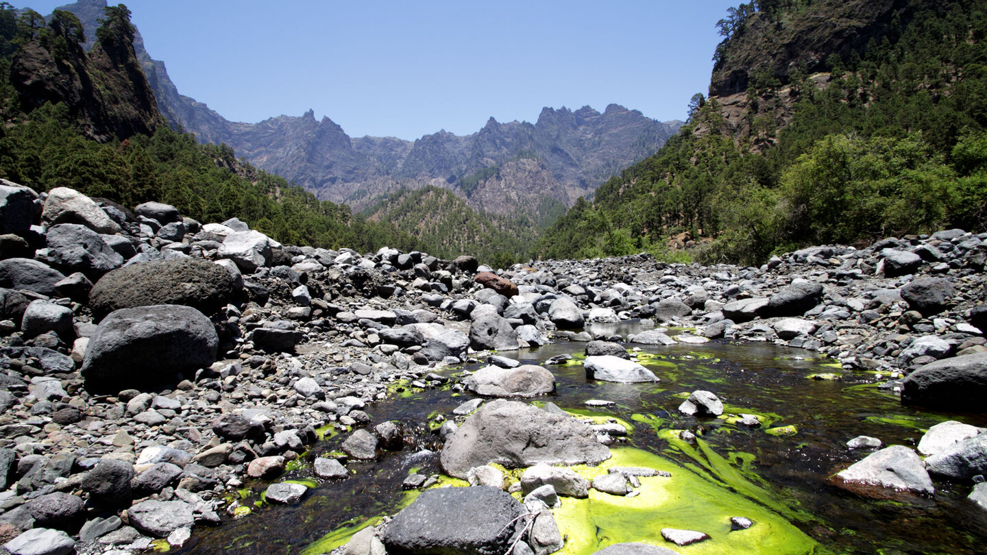
Before the playa, the path splits: on the left begins the steep climb to the Mirador Cascada de la Fondada viewpoint and on to the Hoyo Verde springs (only if you start early and are in good condition). If you walk straight ahead, you will reach the Zona de Acampada via the riverbed of the Rio Taburiente – the campsite with a first aid station, toilets and running water. Overnight stay by reservation only: reservasparquesnacionales.es.
Section 3: El Reventón — the crusher
From the campsite, the PR-LP 13 continues slightly uphill through sparse pine forest. You leave the gorge of the Rio Taburiente and reach the steep valley of the Rio Almendro Amargo. Now begins El Reventón – a long, very steep section whose name means “the grinder”. Along it there are impressive views of the Pico Bejenado, the Barranco Almendro Amargo and the Roque Idafe.
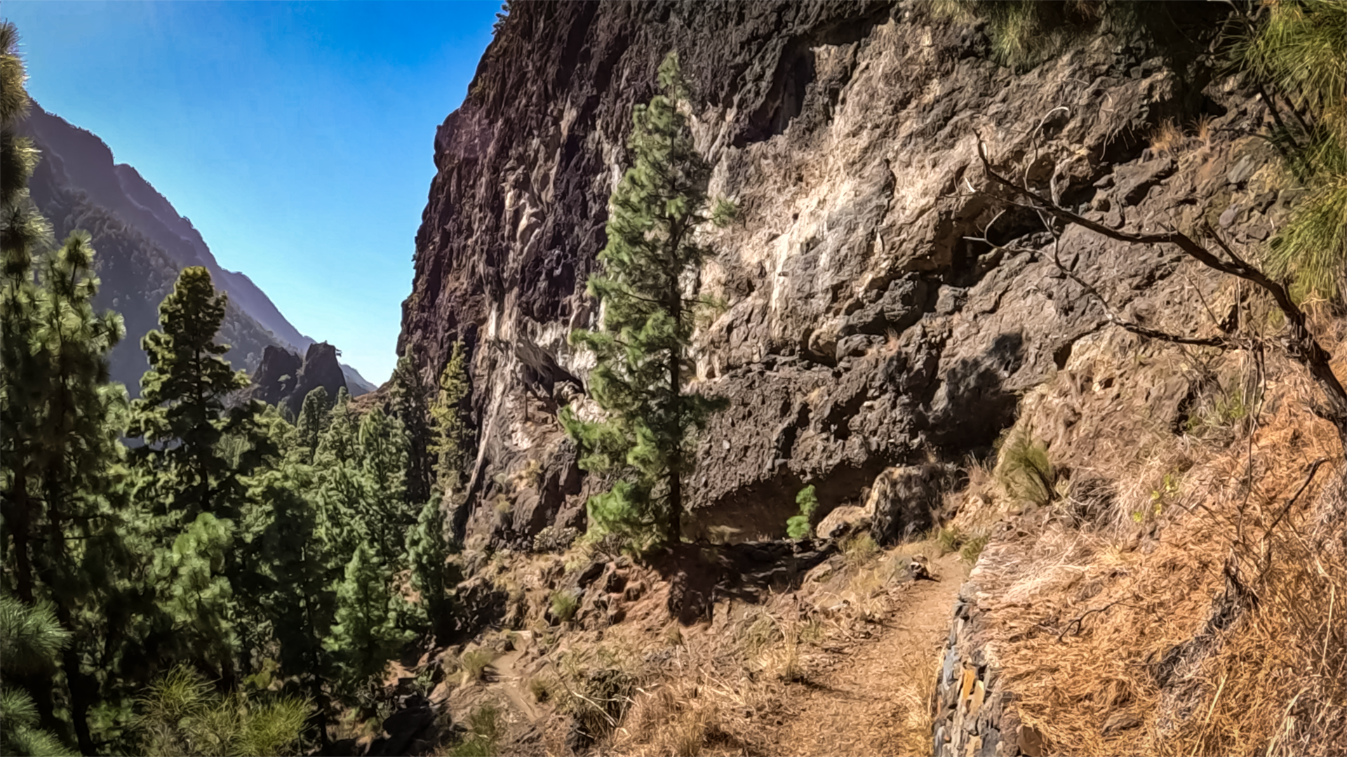
At the next fork in the road there are two options: an easier path and a more challenging path. The latter runs narrow, steep and exposed above the gorge of the Rio Almendro Amargo – only for sure-footed people who are not afraid of heights. Both paths meet again after a short time at the bottom of the Barranco Almendro Amargo.
Section 4: Cascada de Colores and Dos Aguas
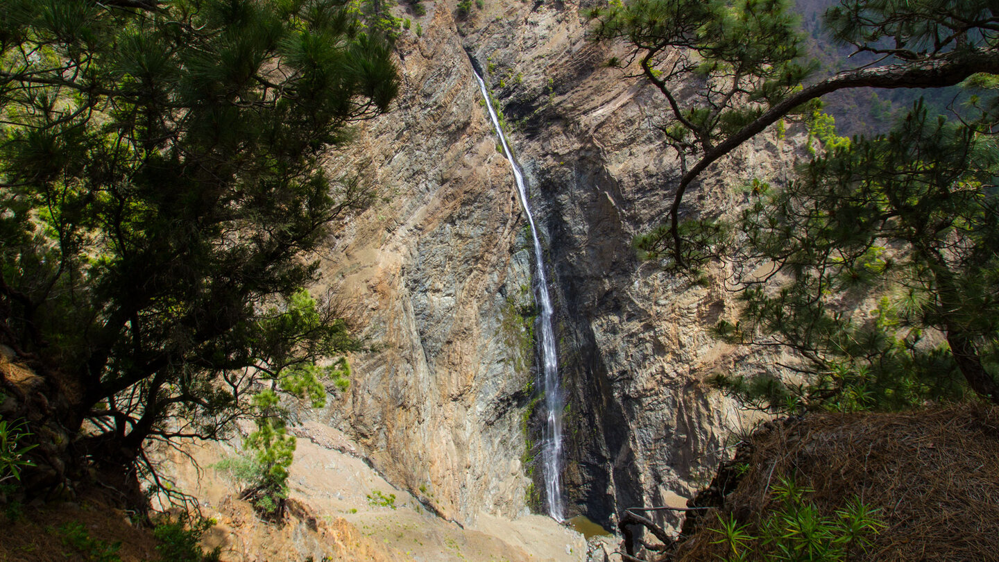
A little later you reach the confluence of the Rio Almendro Amargo and the Rio Rivanceras (also Limonero). The stream bed of the Rio Rivanceras shows a colorful spectacle of red, yellow and ocher due to its ferrous deposits. About a 15-minute walk upstream is the Cascada de Colores – the waterfall of colours. The last few meters lead directly through the slippery stream bed. Shortly before the waterfall the gorge narrows sharply.
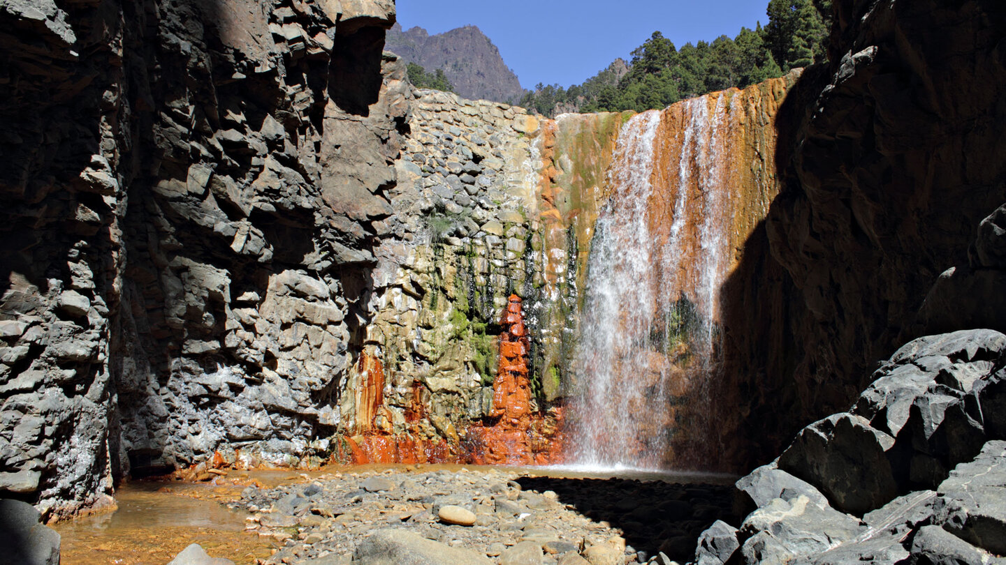
The path then continues along the Rio Almendro Amargo to Dos Aguas (two waters), where the Rio Taburiente and the Rio Almendro Amargo flow together. The river is crossed here – depending on the water level you have to wade through the water.
Section 5: Barranco de las Angustias to the car park
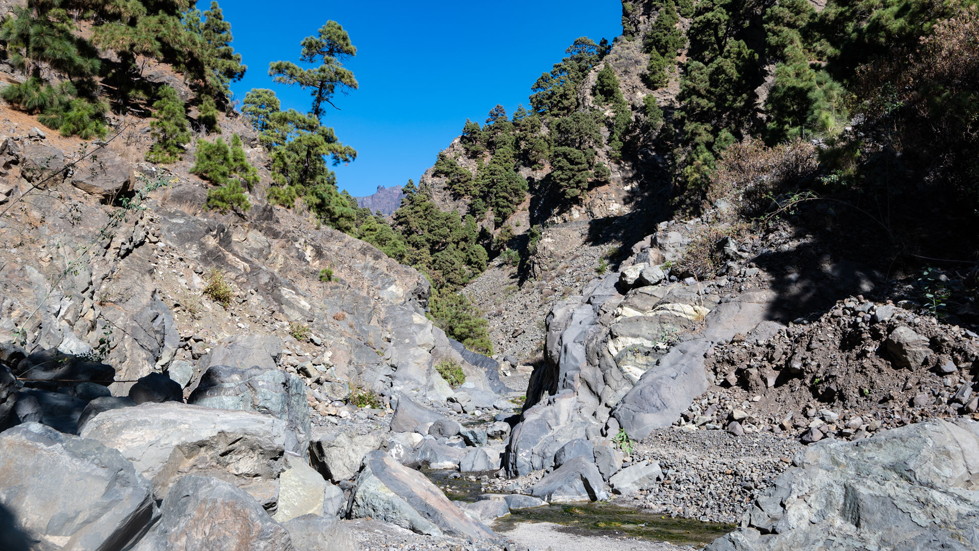
In the Barranco de las Angustias there is a constant change between stream bed passages and high-level paths along the steep banks. The side of the stream has to be changed again and again. Stepping stones usually ensure that feet stay dry. Yellow-white markings and cairns indicate where sections of the route run above the gorge.
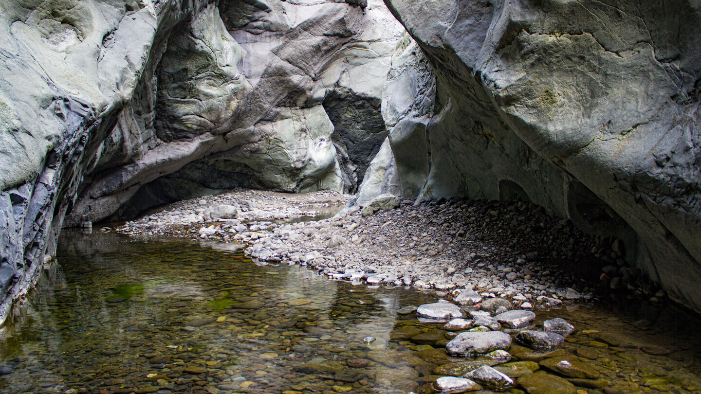
Along the stream bed you pass numerous pools and small waterfalls. The intense green colour of the stream bed is caused by algae. Beautiful submarine pillow lavas can be seen in the riverbed – rocks that were formed during underwater eruptions and only lie on the surface here and on Fuerteventura in the Canary Islands. The vegetation changes in the latter part from pines to bushes and milkweeds. Shortly before the end, the stream bed widens and you reach the hiking car park in the Barranco de las Angustias – the starting point of the shuttle.
Geology: Pillow lava and volcanic history
The Barranco de las Angustias is geologically unique in the Canary Islands. In the lower gorge area, the bedrock of La Palma is exposed: submarine pillow lava, recognizable by its honeycomb structure and greenish-brown colour. These rocks were formed during underwater eruptions in the early phase of island formation – before La Palma broke through the sea surface. In the Canary Islands you can only find them in Fuerteventura.
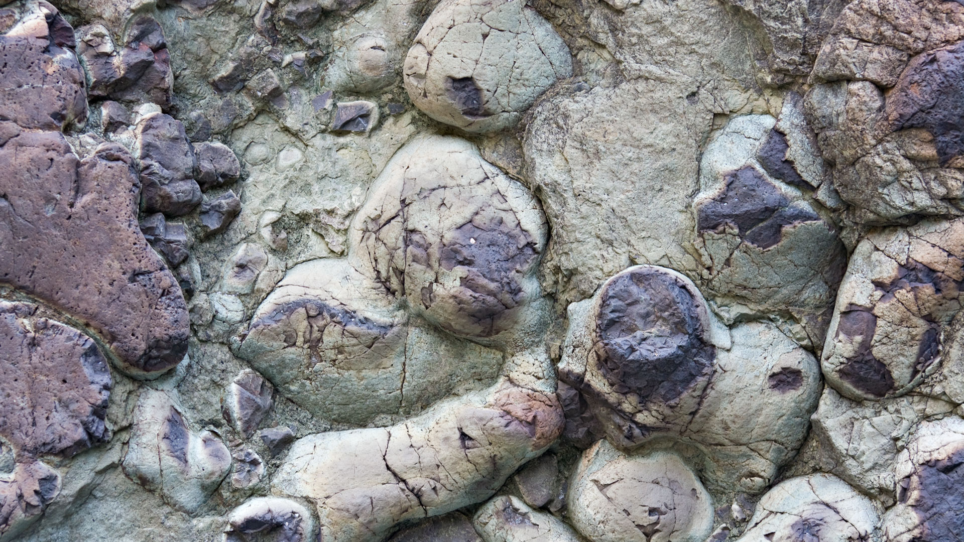
The steep walls of the Caldera de Taburiente – up to 800 meters high – show the different lava phases of the island’s history in their layer sequences. The caldera itself is not a volcanic crater, but the result of a huge landslide and millions of years of erosion. The national park has been protecting this geological evidence since 1954.
The Roque Idafe — sacred rock of Benahoritas
The Roque Idafe is the most striking monolith of the Caldera de Taburiente: a 100-meter-tall finger of basalt that rises from the calderade floor and can be seen from several sections of PR-LP 13. It was formed when harder rock resisted the forces of erosion that eroded everything around it.
For the Benahoritas, the natives of La Palma, the Roque Idafe was sacred land. They believed that if the rock fell, the island would sink into the sea. Sacrifices were regularly made to ensure its stability. The Roque can be seen from different angles from the Mirador del Lomo de Tagasaste on the way to Playa de Taburiente and again on the long descent along the Rio Almendro Amargo – different every time.
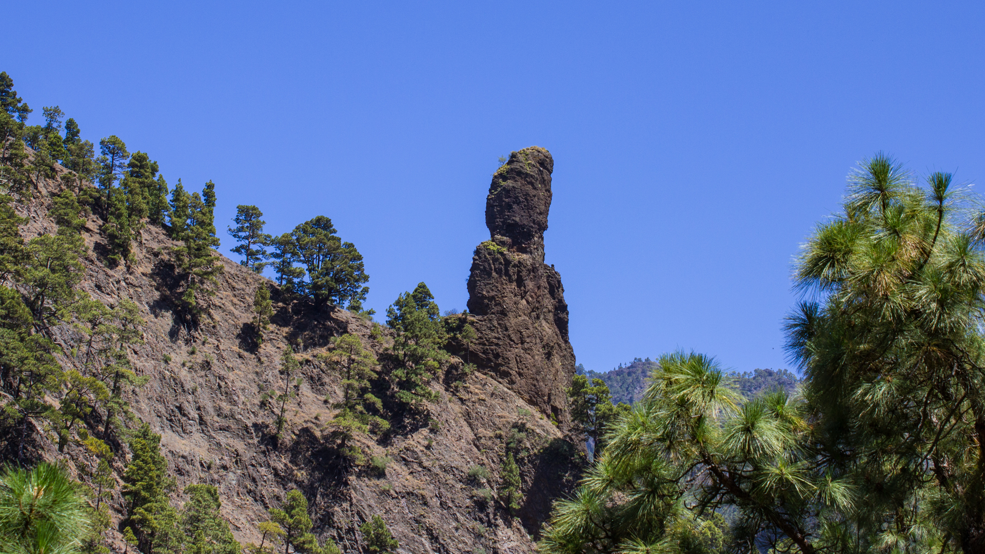
Directly from the ridge on which the PR-LP 13 runs after the campsite, between the El Reventón section and the confluence of the streams, there is the most complete view of the monolith: in the depths of the gorge, framed by the 800 meter high cliffs, it appears almost miniature – until you realise that it measures 100 meters.
The Zona de Acampada halfway is not just an optional campsite – it is the natural rest point on the route. Anyone who takes a longer break there will feel how the caldera looks different in the silence of midday than it does in the early morning: the steep walls shine differently, the water of the Rio Taburiente sounds louder, and the view of the Roque Huso in the north changes with the position of the sun. If you’re lucky enough to go on a weekday, you’ll often have the place to yourself.
The route is very busy according to Sunhikes – especially in the high season. The early shuttle start at 7:30 a.m. not only brings better temperatures and light, but also more silence on the first section through the pine forest before the majority of hikers also start.
Best travel time
| Season | Character | Note |
|---|---|---|
| Spring (March-May) | Mild, full water in stream beds | Cascada de Colores at peak; Petroglyph detour is worth it |
| Summer (June–Aug) | Hot in the lower gorge section | Early start 7:30 a.m.; enough water; Swimming break at the Playa |
| Autumn (Sept–Nov) | Best light, clear view | Best travel time; Highly frequented route – start early |
| Winter (Dec-Feb) | Risk of rain; Closure possible | Check weather conditions the day before; Under no circumstances go when it rains |
Equipment
| Footwear | Sturdy, waterproof hiking boots – stream bed crossings and wet stepping stones |
|---|---|
| Water | Bring enough for 5:30–7:00 h; refill available at the Zona de Acampada |
| Food | Full meal + snacks |
| Rain protection | For unexpected showers – the gorge cools quickly |
| Sun protection | Open sections above the caldera are fully exposed |
Combinable detours
| Detour | Data | Character |
|---|---|---|
| Petroglyph site | +1.6 km / 75 m | Approx. 50 m after Barranco del Risco Liso turn left; Rock carvings of the Benahoritas |
| Mirador Cascada de la Fondada | +3 km / 319 m | Turn off before the playa; only with an early start |
| Hoyo Verde springs | +5.6 km / 633 m | Challenging detour; only with a very early start and good fitness |
| Cascada de Colores | +approx. 30 min | From the confluence of the Rio Almendro Amargo / Rio Rivanceras upstream |
GPS track and 3D route planner
All data for the PR-LP 13 – distance, elevation profile, waypoints and GPX track – on the route page of the Sunhikes hiking portal.
To the route page on Sunhikes: Hike from Los Brecitos through the Caldera de Taburiente
Plan your own route with the 3D route planner from Sunhikes
Practical Tips
Emergency services: 112 – logs into the strongest available network. No mobile reception inside the caldera and in the Barranco de las Angustias. Communicate location before start.
Take the shuttle service early in the morning. During peak season, on busy days, other hikers wait for the same shuttle. If you start late, you could walk the last section of the Barranco at dusk.
To overnight at the campsite in the Caldera, you must register in advance at reservasparquesnacionales.es. An overnight stay allows you to visit Cascada de la Fondada and Hoyo Verde without any time pressure.
Note: National Park and Nature Conservation
The route lies entirely in the Caldera de Taburiente National Park – the oldest national park in the Canary Islands, protected since 1954. There are trail restrictions, garbage collection, fire ban and no wild camping outside the Zona de Acampada.
Frequently asked questions
How do you get to Los Brecitos?
When is the route closed?
What is the Cascada de Colores?
Can you camp in the caldera?
How difficult is the Barranco de las Angustias?
This article is based on the on-the-ground knowledge of the Gequo editorial team – publishers of the Reisezeit hiking guides and operators of Sunhikes.com. Last updated: May 2026


