
Hike from El Tablado to Gallegos on the GR-130
The hike from El Tablado to Gallegos on the GR-130 leads through the wildest gorge area on the north coast of La Palma: 9.4 km, 897 m ascent, 933 m descent, difficult, approx. 4:00-5:00 hours. The route crosses four gorges – including the mighty Barranco de los Hombres – passes the hamlet of Franceses and ends in Gallegos with the opportunity to stop for a break at the bar Víveres Gallegos.
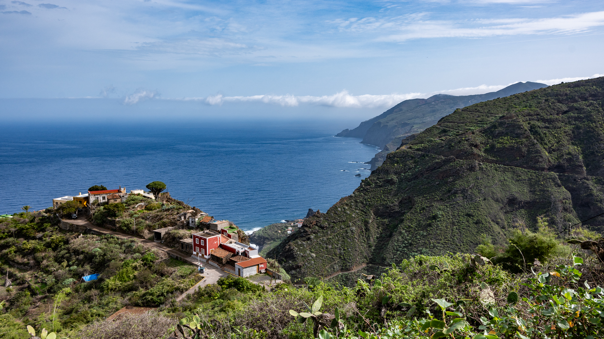
El Tablado is picturesquely located between two gorges on a mountain ridge: on the right the Barranco de los Hombres, on the left the Barranco Fagundo. It is one of the most remote inhabited hamlets in La Palma. The hike to Gallegos follows the GR-130 Camino Real de la Costa — the historic coastal path that circles La Palma in eight stages.
Highlight: A curve below the Mirador Cueva del Canga viewpoint lies a fallen boulder with a petroglyph from the indigenous people of Benahorita – in a slightly exposed location, only visible if you leave the path briefly to the right. Return: Taxi from Gallegos to El Tablado (Barlovento municipality).
Route facts at a glance
| Route type | Distance (El Tablado → Gallegos) |
|---|---|
| Distance | 9.4 km |
| Elevation | 897 m ascent / 933 m descent |
| Highest point | 488 m |
| Lowest point | 65 m (Barranco Franceses gorge floor) |
| Duration | 4:00-5:00 hours |
| Difficulty | difficult (requires a good head for heights, sure-footedness, and good stamina for steep climbs and descents) |
| Starting point | El Tablado – LP-1 departure near Roque del Faro |
| End point | Gallegos – LP-1 departure from bus stop La Cancela |
| Path marking | PR-LP 9.1 (yellow-white) |. GR-130 (red-white) |
| Protected area | Guelguén Natural Park |
| Equipment | Water, provisions, sturdy shoes, sun protection, rain protection, wind protection |
Directions and logistics
El Tablado is located on the LP-1, exit near Roque del Faro via a narrow tarmac dead-end road. Gallegos is also on the LP-1, leaving at the La Cancela bus stop. Return: Taxi recommended from Gallegos to El Tablado — Gallegos is in the municipality of Barlovento. No refreshment stops on the route (except Víveres Gallegos at the destination).
The route in detail
El Tablado to Mirador Cueva del Canga
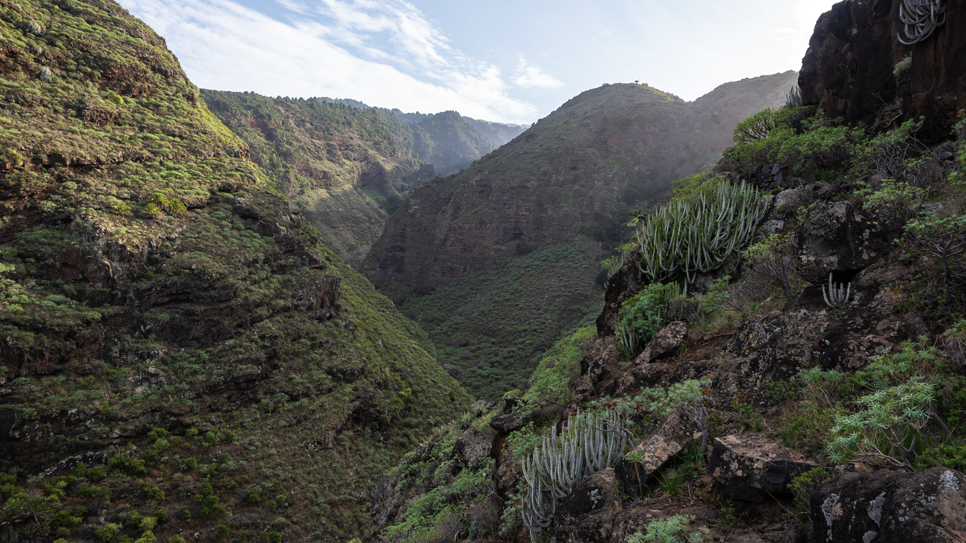
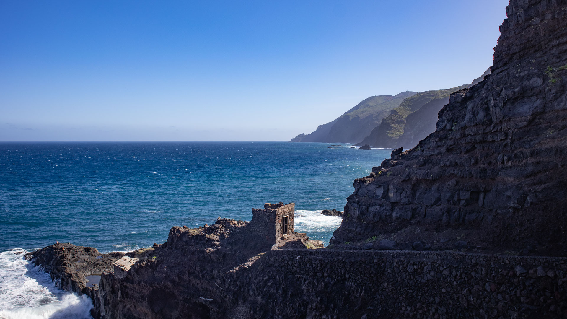
From the town entrance in El Tablado, follow the PR-LP 9.1 (yellow-white) downhill through the town until you meet the GR-130. Turn right here and soon reach the steep edge of the deep gorge Barranco de los Hombres. Viewpoint Mirador Cueva del Canga: impressive view of the coast, gorge and the small settlement of La Fajana. Nearby: a massive basalt wall in which erosion has created a natural window.
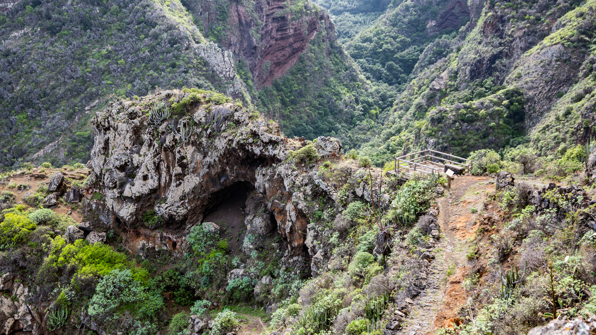
A curve below the Mirador: If you leave the path briefly to the right, you will find a petroglyph of Benahoritas on a large fallen boulder – in a slightly exposed place. This stone carving by the natives of La Palma is one of the few petroglyph finds directly on a hiking route. Short, slightly exposed, worthwhile.
Descent Barranco de los Hombres and climb to Franceses
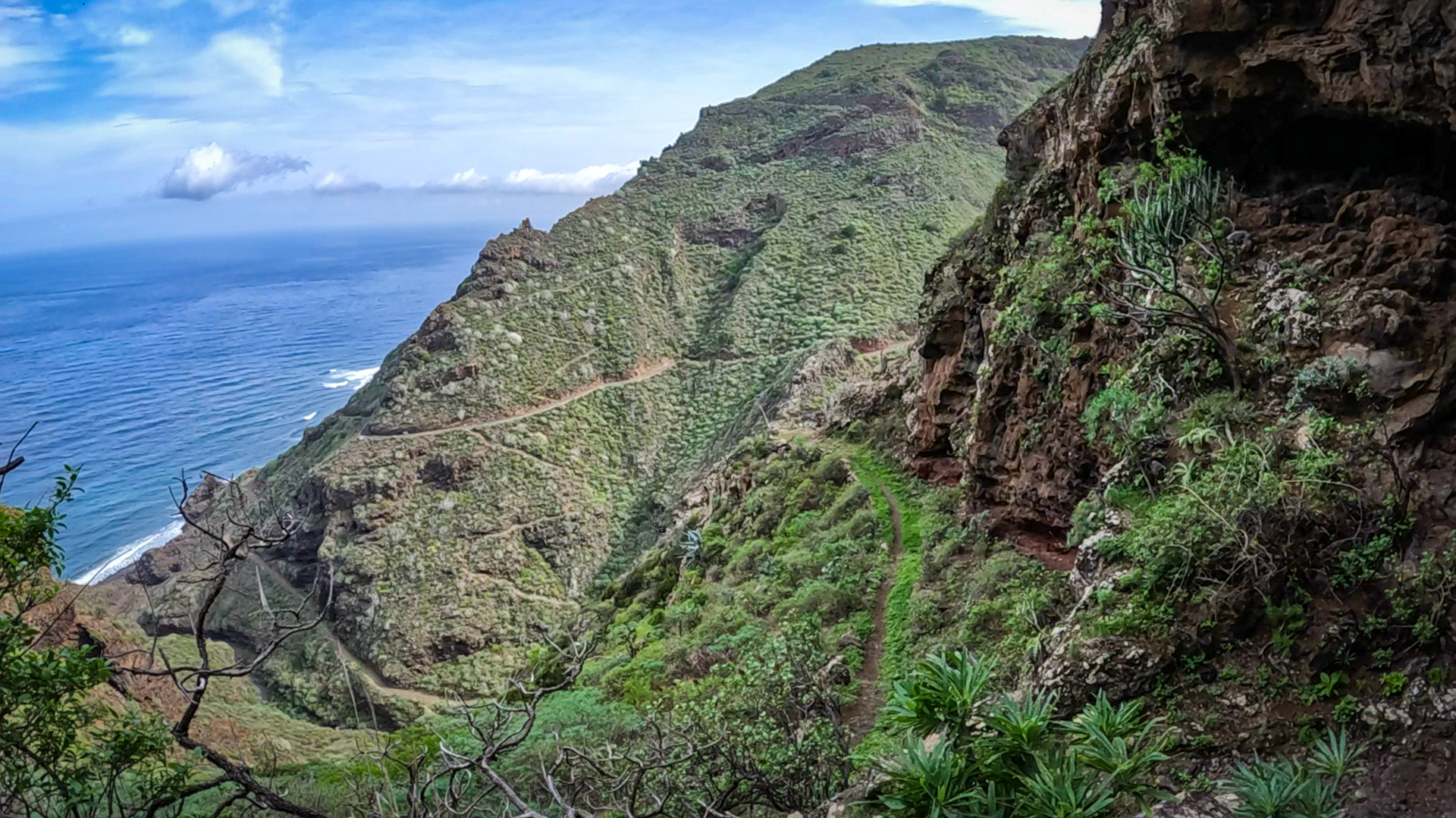
The path winds down approximately 180 metres via numerous switchbacks into the Barranco de los Hombres. Opposite you can already see the path up to Franceses. At the bottom of the gorge, briefly towards the coast, then climb to Franceses. Cross La Fajana Street, turn left, then switchbacks up the partly paved path with spectacular views. Aeonium, lavender, agave and spurge plants characterize the vegetation. After 100 m: first houses of Franceses, Las Tierras district.
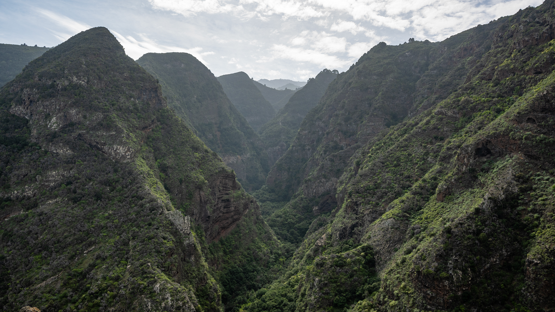
Franceses, Mirador de Franceses and gorges towards Gallegos
Through the rural cultural landscape of Franceses to the LP-110 (small supermarket). Follow LP-110 for about 1 km, then GR-130 to the left. Through the Los Castros district downhill to the Mirador de Franceses – sensational views over the cliffs of the north coast. Then descend into the Barranco Franceses: in serpentines up to 65 m above sea level past an overhanging boulder. Immediately afterwards: crossing the Barranco de Melchor Pérez. Last climb in a zigzag to Gallegos. Mirador de Gallegos: View over green coastal landscape. Through terraces with yam cultivation to the centre of Gallegos.
El Tablado: the village between two gorges
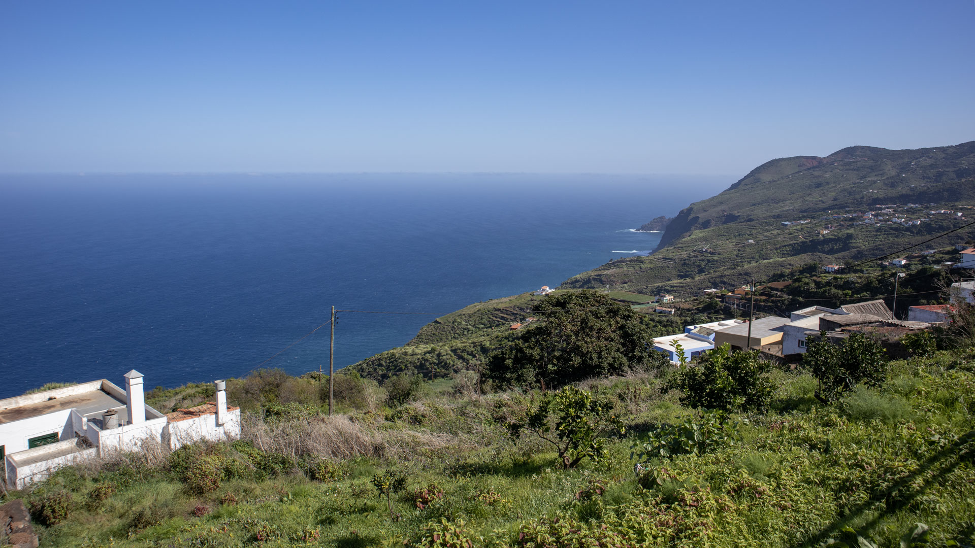
El Tablado lies on a narrow ridge – to the left the Barranco Fagundo, to the right the Barranco de los Hombres. This extreme location between the two deepest canyons on the north coast once made El Tablado an isolated, difficult-to-reach place. Today there is a dead end road leading there, but the village has retained its character: a few houses, old dragon trees, wide views of the Atlantic.
The Barranco Fagundo north of El Tablado is one of the deepest gorges in La Palma. The Barranco de los Hombres, south of the town, is the gorge through which this route leads. Anyone who visits El Tablado for the first time will immediately understand why it was historically one of the most remote hamlets on the island – and why it still seems that way today.
Yam in Gallegos
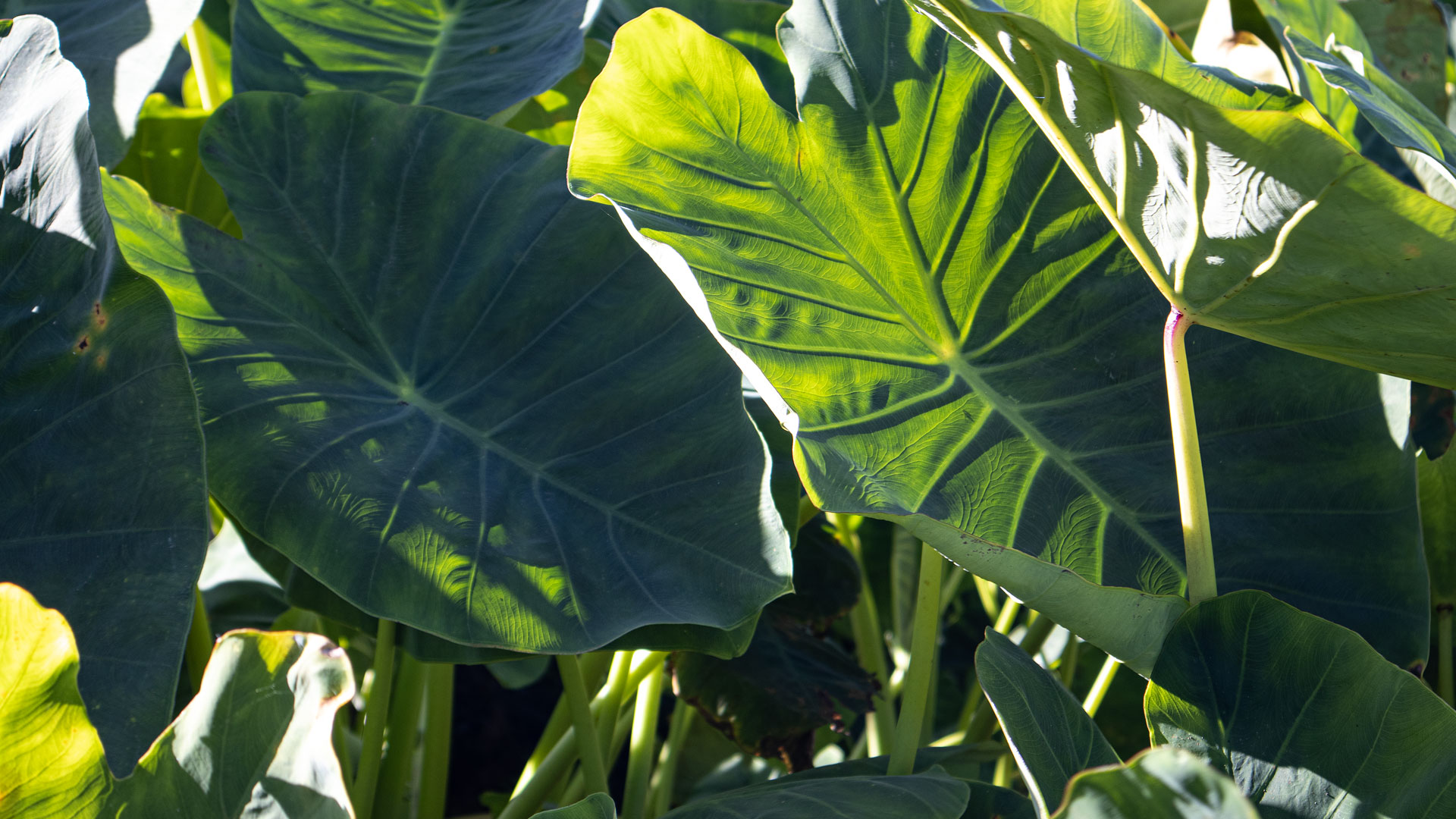
Yam grows on the terraces just before Gallegos – one of the most unusual cultures on the north coast of La Palma. The yam root (Dioscorea) originally comes from West Africa and came to the island through La Palma’s historical contact with the African and American trade routes. It is used as a potato substitute in local cuisine and thrives particularly well on the moist northern slope terraces.
Best travel time
| Season | Character | Note |
|---|---|---|
| Spring (March-May) | Vegetation in full force; Canyons green | Optimal conditions |
| Summer (June-Aug) | Cool in canyon bottoms; Mountain ridges hot | Early start mandatory |
| Autumn (Sept-Nov) | Clear north coast views | Most popular season |
| Winter (Dec-Feb) | Rain possible; Paths slippery | Gorge descents challenging after rain |
Accommodation: Garafía — Clariso
El Tablado is located in the municipality of Garafía. Holiday homes in Garafía on clariso.eu — Holiday homes Garafía. Casa Julia in Las Tricias and Casa Micaela in Santo Domingo offer excellent locations for north coast tours.
Combinable tours
El Tablado is the starting point for several GR-130 sections in both directions as well as the PR-LP 9.1 towards the coast. This route is ideal as part of a multi-day north coast crossing:
| Tour | Data | Character |
|---|---|---|
| Franceses – La Fajana – El Tablado | 12-15 km, difficult | Previous GR-130 stage west |
| El Tablado – Santo Domingo de Garafía | 13.2 km, difficult | Continuation to the west (Mirador de la Tosca → Gallegos) |
| Hike Mirador de la Tosca – Gallegos | 9.8 km, moderate | Eastern alternative from Barlovento |
GPS track and 3D route planner
With the free 3D route planner, the route can be combined with the continuation to Gallegos or the previous stage – directly in the browser, without an app.
To the route page on Sunhikes: Hike El Tablado to Gallegos
3D route planner from Sunhikes – customize and combine routes
Practical Tips
Emergency call 112. Coordinate the return trip from Gallegos in advance (taxi in the municipality of Barlovento). Plan to stop at Bar Víveres Gallegos at your destination. Petroglyph at Mirador Cueva del Canga: program GPS waypoint – the detour is short but slightly exposed.
Note: Guelguén Natural Park
Parts of the route in the Guelguén Natural Park. Follow local park regulations: stick to marked paths and carry out all litter.
Frequently asked questions
What can be seen at the Mirador Cueva del Canga?
How do you get back to El Tablado from Gallegos?
The historic Camino Real on the north coast
The GR-130 Camino Real de la Costa y Medianías follows ancient trade routes that have connected north coast villages since Spanish colonization in the 16th century. In the region between El Tablado and Gallegos, these paths lead through one of the least changed landscapes in La Palma: no road, hardly any buildings between the villages, just the paths that lead up and down the gorge.
The mixed crops on the terraces along the path show the broad spectrum of north coast agriculture: bananas at low altitudes, vines at mid-elevation, avocados and yams higher up. This vertical farming is adapted to the climates of the steep slopes — a system that has worked for centuries and is still active today.
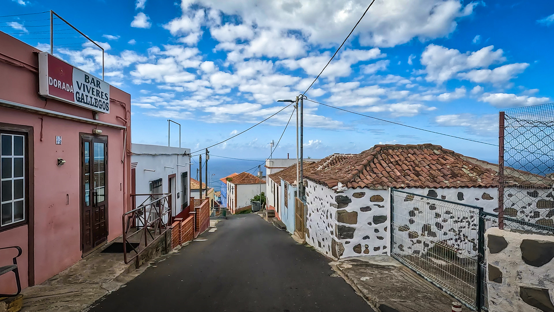
Gallegos: Bar Víveres and Canarian character
The bar Víveres Gallegos at the destination is more than just a place to stop for a break: it is a typical Palmerian meeting place. No tourist menu, no decorations from the catalog — real drinks, local snacks, locals. Anyone who arrives here after 4-5 hours through four gorges will experience La Palma from its most authentic side. Stopping for a coffee here is a memorable local experience in its own right.
For planning the return journey: Gallegos is located in the municipality of Barlovento. The nearest taxi location is in Barlovento itself, about 3 km east of Gallegos on the LP-1. If you arrive early and still have energy, you can continue on the GR-130 to Barlovento (approx. 45 minutes) and take a taxi or bus from there. The combination with the following day Mirador de la Tosca – Gallegos (from Gallegos west) enables a multi-day north coast route without logistical problems.
El Tablado has no supply infrastructure – no supermarket, no café. Anyone starting the hike should arrive fully equipped. This applies to water and provisions for the entire tour, as there is no place to stop for refreshments on the route to Gallegos. The only exception: in Franceses there is a small supermarket on the LP-110, about halfway there.
This article is based on the on-the-ground knowledge of the Gequo editorial team – publishers of the Reisezeit hiking guides and operators of Sunhikes.com. Last updated: May 2026


